Cof Cymru: National Historic Assets of Wales · Wales
Servant's quarters or secondary house, Bodlasan Fawr
Llanfachraeth, Isle of Anglesey, Wales
A Grade II listed building in Llanfachraeth, Holyhead, Isle of Anglesey, designated on 19 December 2000.
The record
- Designation
- Listed building, Grade II
- Broad class
- Agriculture and Subsistence
- Date of designation
- 19 December 2000
- Locality
- Llanfachraeth
- Town
- Holyhead
- Community
- Llanfachraeth
- Unitary authority
- Isle of Anglesey
- Country
- Wales
- Coordinates
- 53.31456, -4.55491
- Cadw reference
- 24474
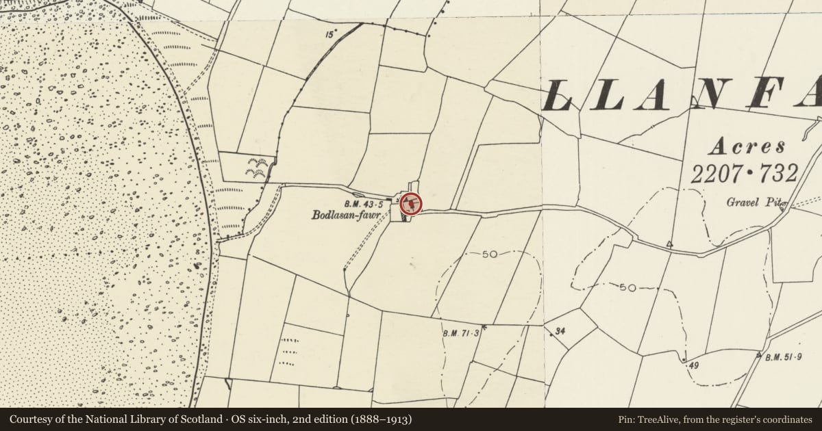
Slide toward Today to fade the historical sheet and see the modern map underneath.
David Rumsey Map Collection, Stanford LibrariesDavid Rumsey Map Collection, Stanford LibrariesDavid Rumsey Map Collection, Stanford LibrariesDavid Rumsey Map Collection, Stanford LibrariesDavid Rumsey Map Collection, Stanford Libraries
5 historical maps cover this location, the earliest the 1799 map "Ireland." (David Rumsey Map Collection, Stanford Libraries).
Historical maps covering this location
- 1799 · Ireland. (David Rumsey Map Collection, Stanford Libraries)
- 1883 · Watershed map England, Wales 3. (David Rumsey Map Collection, Stanford Libraries)
- 1899 · 93 Holyhead (Hills) (David Rumsey Map Collection, Stanford Libraries)
- 1901 · Sheet 9 and 10. (David Rumsey Map Collection, Stanford Libraries)
- 1919 · Sheet 41. Anglesey. (David Rumsey Map Collection, Stanford Libraries)
Cadw's description
Location
In an isolated rural location at the end of a single track road c 1.5km W of the village of Llanfachraeth. The servant's quarters lie directly SE of the house at Bodlasan Fawr.
History
C18 with later alterations. Although the building was clearly originally domestic, its precise purpose is unclear: it may have been a secondary dwelling or possibly accommodation of farm servants.
Exterior
Two-storey house with single storey wing to L (N) and single-pitched addition at N end. Built of local rubble masonry; roof of small, old slates, stone copings and gable stacks. The R (S) stack is a tall rectangular stack with capping, the L (N) stack a shorter, squarer stack projecting from the N gable, with capping and raised by brick. The entrance elevation faces the yard and farm buildings to the W, the doorway under a gabled porch to the L (N). There is a ground floor window, a horizontally sliding sash, to the R (S) and a first floor window, with margin panes, set directly under the eaves; a similarly detailed first floor window to the rear. To the L (N) is a single storey gabled wing, probably a boiling house; with external access via a door to the rear. A single pitched addition built against the L (N) end; a single doorway to the front.
Interior
The interior was not inspected at the time of the survey.
Reason for designation
Included as an integral part of the farm complex at Bodlasan Fawr, which retains a strong vernacular character.
Nearby in the register
- Bodlasan FawrDomesticunder 1 mi
- Agricultural range, Bodlasan FawrAgriculture and Subsistenceunder 1 mi
- Church of St MwrogReligious, Ritual and Funeraryunder 1 mi
- Churchyard walls and outbuilding, Church of St MwrogReligious, Ritual and Funeraryunder 1 mi
Other entries of the same register within about three miles of this one, by straight line.