Cof Cymru: National Historic Assets of Wales · Wales
Cross Keys
Llanfachraeth, Isle of Anglesey, Wales
A Grade II listed building in Llanfachraeth, Holyhead, Isle of Anglesey, designated on 19 December 2000.
The record
- Designation
- Listed building, Grade II
- Broad class
- Domestic
- Date of designation
- 19 December 2000
- Locality
- Llanfachraeth
- Town
- Holyhead
- Community
- Llanfachraeth
- Unitary authority
- Isle of Anglesey
- Country
- Wales
- Coordinates
- 53.31449, -4.53230
- Cadw reference
- 24471
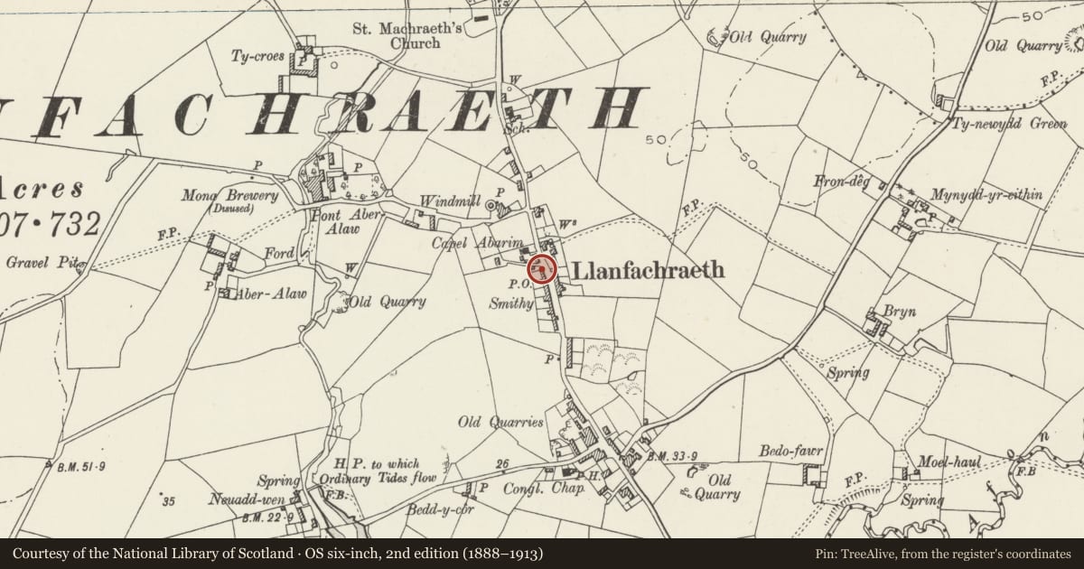
Slide toward Today to fade the historical sheet and see the modern map underneath.
David Rumsey Map Collection, Stanford LibrariesDavid Rumsey Map Collection, Stanford LibrariesDavid Rumsey Map Collection, Stanford LibrariesDavid Rumsey Map Collection, Stanford LibrariesDavid Rumsey Map Collection, Stanford Libraries
5 historical maps cover this location, the earliest the 1799 map "Ireland." (David Rumsey Map Collection, Stanford Libraries).
Historical maps covering this location
- 1799 · Ireland. (David Rumsey Map Collection, Stanford Libraries)
- 1883 · Watershed map England, Wales 3. (David Rumsey Map Collection, Stanford Libraries)
- 1899 · 93 Holyhead (Hills) (David Rumsey Map Collection, Stanford Libraries)
- 1901 · Sheet 9 and 10. (David Rumsey Map Collection, Stanford Libraries)
- 1919 · Sheet 41. Anglesey. (David Rumsey Map Collection, Stanford Libraries)
Cadw's description
Location
Located at the W side of the A5025 towards the N end of the village of Llanfachraeth. At the N end of a terrace of houses directly to the S of Capel Abarim.
History
C19 village house.
Exterior
Small 2-storey, 2-unit house; a 2-window range built at the end of a taller terrace to the L (S). Pebbledash rendered over rubble. Roof of small old slates with rectangular, rendered, gable stack at R (N) end with dripstones. Entrance elevation faces the road to the E; a 2-window range, widely spaced windows with doorway between. The door is boarded and the windows are narrow 4-pane horned sashes, first floor windows set directly under the eaves.
Interior
The interior was not inspected at the time of the survey.
Reason for designation
Listed as a traditional C19 village house retaining vernacular character.
Nearby in the register
- Wall, railings and gates, Capel AbarimReligious, Ritual and Funeraryunder 1 mi
- Chapel house and outbuilding, Capel AbarimReligious, Ritual and Funeraryunder 1 mi
- Capel AbarimReligious, Ritual and Funeraryunder 1 mi
- Bryn GlasDomesticunder 1 mi
Other entries of the same register within about three miles of this one, by straight line.