Cof Cymru: National Historic Assets of Wales · Wales
Pilot beacon (N)
Cylch-y-Garn, Isle of Anglesey, Wales
A Grade II listed building in Carmel Head, Cylch-y-Garn, Isle of Anglesey, designated on 27 November 2000.
The record
- Designation
- Listed building, Grade II
- Broad class
- Maritime
- Date of designation
- 27 November 2000
- Locality
- Carmel Head
- Community
- Cylch-y-Garn
- Unitary authority
- Isle of Anglesey
- Country
- Wales
- Coordinates
- 53.40482, -4.56174
- Cadw reference
- 24435
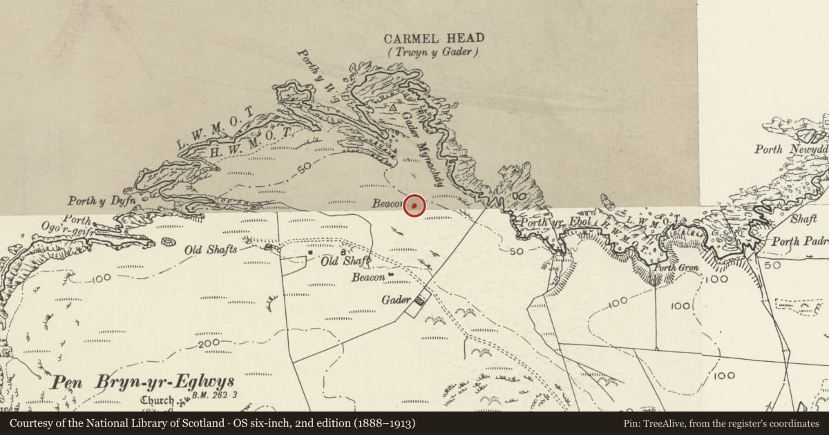
Slide toward Today to fade the historical sheet and see the modern map underneath.
David Rumsey Map Collection, Stanford LibrariesDavid Rumsey Map Collection, Stanford LibrariesDavid Rumsey Map Collection, Stanford LibrariesDavid Rumsey Map Collection, Stanford LibrariesDavid Rumsey Map Collection, Stanford Libraries
5 historical maps cover this location, the earliest the 1799 map "Ireland." (David Rumsey Map Collection, Stanford Libraries).
Historical maps covering this location
- 1799 · Ireland. (David Rumsey Map Collection, Stanford Libraries)
- 1883 · Watershed map England, Wales 3. (David Rumsey Map Collection, Stanford Libraries)
- 1899 · 93 Holyhead (Hills) (David Rumsey Map Collection, Stanford Libraries)
- 1901 · Sheet 9 and 10. (David Rumsey Map Collection, Stanford Libraries)
- 1919 · Sheet 41. Anglesey. (David Rumsey Map Collection, Stanford Libraries)
Cadw's description
Location
In an isolated rural location overlooking the coast at Carmel Head. The N beacon is sited c220m NE of the other land based beacon and the 2 are aligned with the 3rd beacon, located on the islet of West Mouse (Maen y Bugael).
History
Early C19 pilot beacon, erected by Trinity House in the 1830s. One of a pair erected at Carmel Head, used in conjunction with a beacon on West Mouse (Maen y Bugael) and the lighthouse at the Skerries as an aid to navigation into the harbour at Holyhead.
Exterior
Tall navigation marker, c10m high and 5.5m wide; built of rubble masonry, mortared, the front 'face' once heavily limewashed. Comprises raking slab angled slightly to the rear against a raking buttress. The raking buttress has a rounded head and front face has stone capping; the front face of the raking slab is set in alignment with the other 2 beacons.
Reason for designation
Listed as a well-preserved early C19 pilot beacon or navigation marker, part of a navigational system including the lighthouse at The Skerries and other pilot beacons along the north Anglesey coast at Carmel Head.
Nearby in the register
- Pilot beacon (S)Maritimeunder 1 mi
- Cornbarn-cowhouse range at MynachdyAgriculture and Subsistenceunder 1 mi
- MynachdyDomesticunder 1 mi
- Stable-cartshed range at MynachdyAgriculture and Subsistenceunder 1 mi
Other entries of the same register within about three miles of this one, by straight line.