Cof Cymru: National Historic Assets of Wales · Wales
10 Merthyr Road
Tongwynlais, Cardiff, Wales
A Grade II listed building in Tongwynlais, Cardiff, designated on 6 October 1977.
The record
- Designation
- Listed building, Grade II
- Broad class
- Domestic
- Date of designation
- 6 October 1977
- Locality
- Tongwynlais
- Town
- Cardiff
- Community
- Tongwynlais
- Unitary authority
- Cardiff
- Country
- Wales
- Coordinates
- 51.53242, -3.25241
- Cadw reference
- 24402
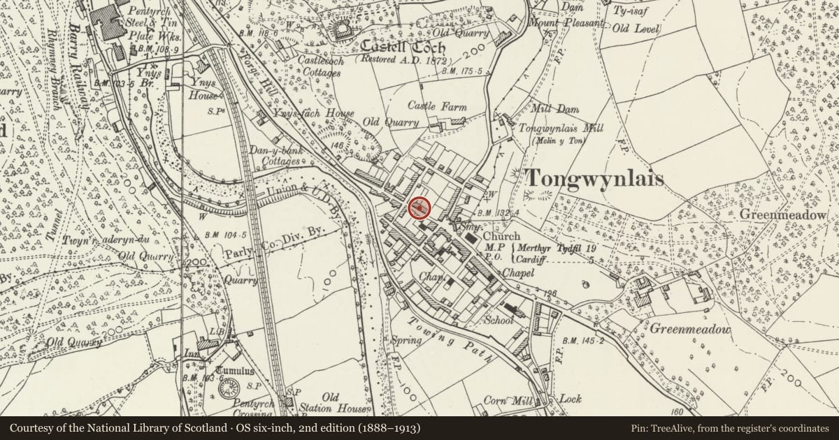
Slide toward Today to fade the historical sheet and see the modern map underneath.
David Rumsey Map Collection, Stanford LibrariesNational Library of ScotlandDavid Rumsey Map Collection, Stanford LibrariesDavid Rumsey Map Collection, Stanford LibrariesDavid Rumsey Map Collection, Stanford Libraries
5 historical maps cover this location, the earliest the 1636 map "Cornubia : Devonia, Somersetus, Dorcestria, Wiltonia, Glocestria ..." (David Rumsey Map Collection, Stanford Libraries).
Historical maps covering this location
- 1636 · Cornubia : Devonia, Somersetus, Dorcestria, Wiltonia, Glocestria ... (David Rumsey Map Collection, Stanford Libraries)
- 1637 · The fourth table of England. Cornub. Devonia, Somerset etc. (David Rumsey Map Collection, Stanford Libraries)
- 1865 · England and Wales. England No. 6. (David Rumsey Map Collection, Stanford Libraries)
- 1895 · Sheet 11. Ordnance Survey of England and Wales. (David Rumsey Map Collection, Stanford Libraries)
- 1963 · Map No. 1 - Local Government Commission for Wales : [Definitive maps showing proposed… (National Library of Scotland)
Cadw's description
Location
Towards the N end of the village fronting the main thoroughfare.
History
Tongwynlais had an important position on the Merthyr to Cardiff highway constructed 1767 which linked the Merthyr ironworks with Cardiff, the village being sited in the narrow entrance to the Taff Vale between the mountains of Fforest Fawr and Garth Wood. It was further developed to serve the important nearby Melingriffith and Pentyrch works producing iron, tinplate, bricks and quarried stone. The grid lay-out of the central village is intact on the first edition Ordnance Survey Map surveyed 1875, with Ainon Baptist chapel nearby built 1827, enlarged 1851, the Glamorgan Canal constructed 1794, and the Taff Vale Railway in1840. Masonry of this terrace is of higher quality and probably a little earlier than that in Wyndham Street adjacent.
Interior
Originally staircases rose beside front room fireplace (except for central staircase in no.14), some retained; some stone flagged floors and slabs from former pantries; ground floor ceiling joists of thin scantling, some exposed.
Reason for designation
Listed primarily for historic interest as a mid C19 row of workers' cottages.
Nearby in the register
- 8 Merthyr RoadDomesticunder 1 mi
- 12 Merthyr RoadDomesticunder 1 mi
- 6 Merthyr RoadDomesticunder 1 mi
- 14 Merthyr RoadDomesticunder 1 mi
Other entries of the same register within about three miles of this one, by straight line.