Cof Cymru: National Historic Assets of Wales · Wales
Boundary stone at Garn Turne
Ambleston, Pembrokeshire, Wales
A Grade II listed building in Garn Turne, Haverfordwest, Ambleston, Pembrokeshire, designated on 21 November 2000.
The record
- Designation
- Listed building, Grade II
- Broad class
- Civil
- Date of designation
- 21 November 2000
- Locality
- Garn Turne
- Town
- Haverfordwest
- Community
- Ambleston
- Unitary authority
- Pembrokeshire
- Country
- Wales
- Coordinates
- 51.90635, -4.93751
- Cadw reference
- 24397
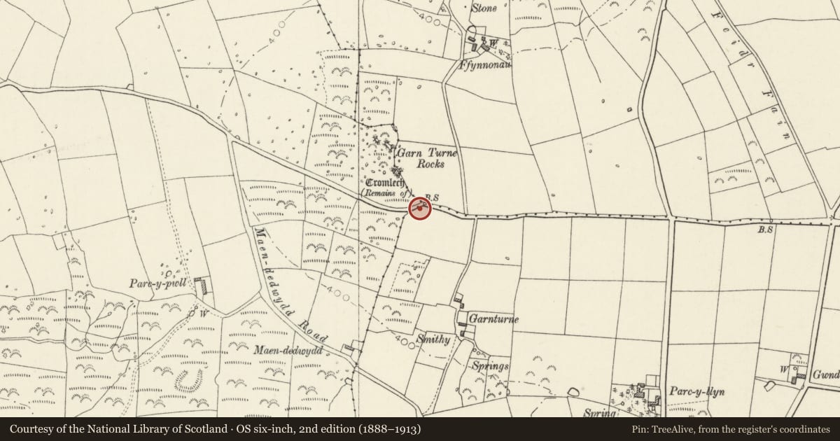
Slide toward Today to fade the historical sheet and see the modern map underneath.
David Rumsey Map Collection, Stanford LibrariesDavid Rumsey Map Collection, Stanford LibrariesDavid Rumsey Map Collection, Stanford LibrariesDavid Rumsey Map Collection, Stanford LibrariesDavid Rumsey Map Collection, Stanford Libraries
5 historical maps cover this location, the earliest the 1636 map "Cornubia : Devonia, Somersetus, Dorcestria, Wiltonia, Glocestria ..." (David Rumsey Map Collection, Stanford Libraries).
Historical maps covering this location
- 1636 · Cornubia : Devonia, Somersetus, Dorcestria, Wiltonia, Glocestria ... (David Rumsey Map Collection, Stanford Libraries)
- 1891 · Sheet 10. Ordnance Survey of England and Wales. . (David Rumsey Map Collection, Stanford Libraries)
- 1898 · 210 Cardigan (Hills) (David Rumsey Map Collection, Stanford Libraries)
- 1898 · 210 Cardigan (Outline) (David Rumsey Map Collection, Stanford Libraries)
- 1901 · Sheet 13. (David Rumsey Map Collection, Stanford Libraries)
Cadw's description
Location
Situated on S side of road to Sealyham, by drive to Garnturne Farm.
History
Boundary stone between parishes and also between the three Hundreds of Cemaes, Daugleddau and Dewisland, probably early C19. Four boundary stones are recorded in the parish, the one W of Henne Lodge is broken in half, there was one near Longstone on the road to Clarbeston Road, now gone, and another on the N side of the main Haverfordwest road near North Court Farm, not found.
Exterior
Boundary stone, slate with broken top right part. Divided by vertical line: the left half reads 'Bou.. St Dogwells Parish' and then below a line 'The Hundreds Meet Kemes Dungleddy Dewsland'. The right side much more eroded reads ?'..ewca.. parish' and then below a line 'To be repaired by Ambleston parish'.
Reason for designation
Included for its historic interest, as a scarce parish boundary marker.
Nearby in the register
- Garn Turne Burial ChamberChambered Tombunder 1 mi
- Parc-y-Llyn Burial ChamberChambered Tombunder 1 mi
- Colston Burial ChamberChambered Tombunder 1 mi
- Saint Dogwells FarmDomesticunder 1 mi
Other entries of the same register within about three miles of this one, by straight line.