Cof Cymru: National Historic Assets of Wales · Wales
Bridge over Cwm Trafle S of Prest-dabuan barn
Llanwrthwl, Powys, Wales
A Grade II listed building in Cwm Trafle, Llanwrthwl, Powys, designated on 14 November 2000.
The record
- Designation
- Listed building, Grade II
- Broad class
- Transport
- Date of designation
- 14 November 2000
- Locality
- Cwm Trafle
- Community
- Llanwrthwl
- Unitary authority
- Powys
- Country
- Wales
- Coordinates
- 52.23389, -3.46630
- Cadw reference
- 24382
Slide toward Today to fade the historical sheet and see the modern map underneath.
David Rumsey Map Collection, Stanford LibrariesDavid Rumsey Map Collection, Stanford LibrariesDavid Rumsey Map Collection, Stanford LibrariesDavid Rumsey Map Collection, Stanford LibrariesDavid Rumsey Map Collection, Stanford Libraries
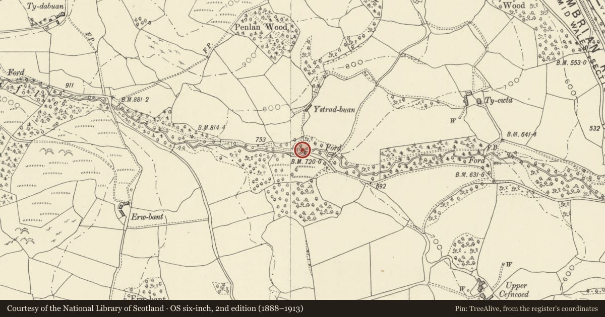
5 historical maps cover this location, the earliest the 1608 map "(13) Cambriae Typus." (David Rumsey Map Collection, Stanford Libraries).
Historical maps covering this location
- 1608 · (13) Cambriae Typus. (David Rumsey Map Collection, Stanford Libraries)
- 1637 · Particular description of Wales. Cambria seu Wallia (David Rumsey Map Collection, Stanford Libraries)
- 1883 · Watershed map England, Wales 3. (David Rumsey Map Collection, Stanford Libraries)
- 1898 · 179 Rhyader (Hills) (David Rumsey Map Collection, Stanford Libraries)
- 1901 · Sheet 14. (David Rumsey Map Collection, Stanford Libraries)
Cadw's description
Location
Approximately 0.5km WSW of Tycwtta Farm and reached by a track S of Prest-dabuan barn.
History
Built in 1839 by Thomas Price of Llangammarch, for the country estate of James Watt of Soho, Birmingham, the son of the famous inventor (the details are recorded on a tablet on the parapet). One of 3 surviving estate bridges built by Price in 1839.
Exterior
A single-carriageway bridge of rubble stone. A single segmental stone arch has hammer-dressed voussoirs which is set back from the face of the bridge behind dressed quoins. The parapets, now partly missing, curve outwards and terminate with simple square piers, now partly fallen. A dated tablet is set into the parapet on the upstream side.
Reason for designation
Listed as one of a series of 3 early C19 estate bridges built across Cwm Trafle.
Nearby in the register
- Prest-dabuan barn with attached cow houseAgriculture and Subsistenceunder 1 mi
- Bridge over Cwm Trafle SE of Ty DabuanTransportunder 1 mi
- Road bridge over Cwm Trafle SE of Tycwtta FarmTransportunder 1 mi
- The HolmesNo class recordedunder 1 mi
Other entries of the same register within about three miles of this one, by straight line.