Cof Cymru: National Historic Assets of Wales · Wales
Granary and Brewhouse at Great Tre-Rhew
Skenfrith, Monmouthshire, Wales
A Grade II listed building in Llanvetherine, Abergavenny, Skenfrith, Monmouthshire, designated on 27 October 2000.
The record
- Designation
- Listed building, Grade II
- Broad class
- No class recorded
- Date of designation
- 27 October 2000
- Locality
- Llanvetherine
- Town
- Abergavenny
- Community
- Skenfrith
- Unitary authority
- Monmouthshire
- Country
- Wales
- Coordinates
- 51.85484, -2.90549
- Cadw reference
- 24303
Slide toward Today to fade the historical sheet and see the modern map underneath.
David Rumsey Map Collection, Stanford LibrariesDavid Rumsey Map Collection, Stanford LibrariesDavid Rumsey Map Collection, Stanford LibrariesDavid Rumsey Map Collection, Stanford LibrariesDavid Rumsey Map Collection, Stanford Libraries
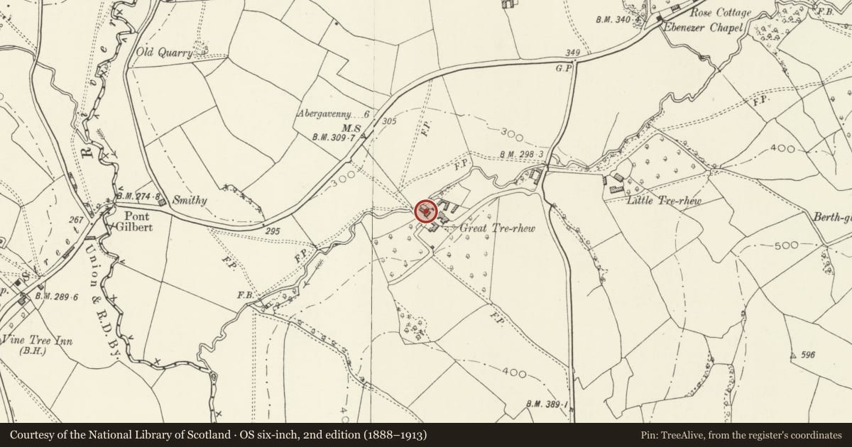
5 historical maps cover this location, the earliest the 1608 map "(13) Cambriae Typus." (David Rumsey Map Collection, Stanford Libraries).
Historical maps covering this location
- 1608 · (13) Cambriae Typus. (David Rumsey Map Collection, Stanford Libraries)
- 1636 · Cornubia : Devonia, Somersetus, Dorcestria, Wiltonia, Glocestria ... (David Rumsey Map Collection, Stanford Libraries)
- 1830 · V.3:11-15:XV.Britisches Reich. A. Kon: England. a. England ab sich: Shire:15-17, 33 (David Rumsey Map Collection, Stanford Libraries)
- 1895 · Sheet 11. Ordnance Survey of England and Wales. (David Rumsey Map Collection, Stanford Libraries)
- 1901 · Sheet 14. (David Rumsey Map Collection, Stanford Libraries)
Cadw's description
Location
Located immediately N of the farmhouse.
History
C17 in origin, altered in C19 when attached brewhouse was added.
Exterior
Granary and brewhouse in L-plan range. Rubble stone with corrugated metal roof. SE gable of granary has straight flight of stone steps rising to upper doorway. First floor (right) has a 2-light window with centre mullion and internal shutters. On ground floor (to right of steps) is cartshed with broad entry spanned by deep oak lintel. On each side of the building are single-storey outshuts. To left is lean-to with vertical plank wall and boarded door; to right stone wall of lean-to has been heightened. Set back to right, two-storey gabled wing has blocked 2-light window on first floor. Attached to end-gable (far right), single-storey brewhouse with stone end-stack has plank and batten door (left) and C20 6-pane metal window (right).
Interior
Cartshed has two C17 chamfered beams with scroll stops.
Reason for designation
C19 granary and brewhouse included for group value as part of the historic farm group at Great Tre-rhew.
Nearby in the register
- Shelter Shed at Great Tre-RhewNo class recordedunder 1 mi
- Corn Barn with attached Stable and Lofted Cider House at Great Tre-RhewNo class recordedunder 1 mi
- Great Tre-Rhew FarmhouseNo class recordedunder 1 mi
- Barn at Croft FarmAgriculture and Subsistenceunder 1 mi
Other entries of the same register within about three miles of this one, by straight line.