Cof Cymru: National Historic Assets of Wales · Wales
House, including attached railings
Abergavenny, Monmouthshire, Wales
A Grade II listed building in Abergavenny, Monmouthshire, designated on 6 September 1973.
The record
- Designation
- Listed building, Grade II
- Broad class
- Domestic
- Date of designation
- 6 September 1973
- Locality
- Abergavenny
- Town
- Abergavenny
- Community
- Abergavenny
- Unitary authority
- Monmouthshire
- Country
- Wales
- Coordinates
- 51.82459, -3.02313
- Cadw reference
- 2430
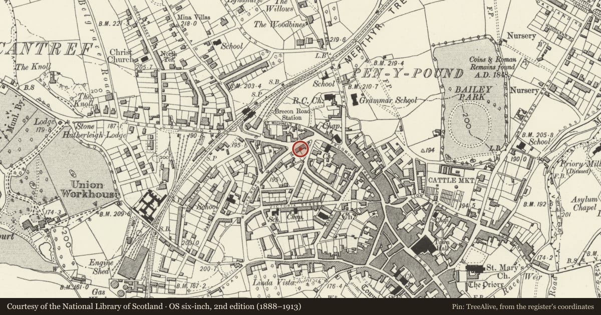
Slide toward Today to fade the historical sheet and see the modern map underneath.
David Rumsey Map Collection, Stanford LibrariesDavid Rumsey Map Collection, Stanford LibrariesDavid Rumsey Map Collection, Stanford LibrariesDavid Rumsey Map Collection, Stanford LibrariesDavid Rumsey Map Collection, Stanford Libraries
5 historical maps cover this location, the earliest the 1636 map "Cornubia : Devonia, Somersetus, Dorcestria, Wiltonia, Glocestria ..." (David Rumsey Map Collection, Stanford Libraries).
Historical maps covering this location
- 1636 · Cornubia : Devonia, Somersetus, Dorcestria, Wiltonia, Glocestria ... (David Rumsey Map Collection, Stanford Libraries)
- 1856 · 42. Brecon. (David Rumsey Map Collection, Stanford Libraries)
- 1898 · 232 Abergavenny (Hills) (David Rumsey Map Collection, Stanford Libraries)
- 1898 · 232 Abergavenny (Outline) (David Rumsey Map Collection, Stanford Libraries)
- 1901 · Sheet 14. (David Rumsey Map Collection, Stanford Libraries)
Cadw's description
Location
In the middle of the terraced row to S of the junction with Brecon Road.
History
Early/mid C19, probably c1830 and in the urban style of T H Wyatt. It is shown on Wood's map of 1834.
Exterior
Roughcast rendered in pebbledash, probably over brick, with a natural slate roof and brick stacks. Double depth central entry plan. Two storeys, three windows, the centre bay projects with pediment over. Porch with flat entablature supported on slim iron columns, 4-panel door with transom light over. All windows are 6 over 6 pane sashes. Plain low pitch roof with gable stacks. There is additional walling on the outside of either chimney wall attaching the house to the adjoining ones, one extra door on the left side. Probably retains original low spiked railing and gate.
Rear elevation not inspected.
Interior
Interior not inspected at resurvey.
Reason for designation
Included for its special interest as part of a well-preserved group of substantial early C19 terraced housing close to the junction with Brecon Road.
Nearby in the register
- House, including attached railingsNo class recordedunder 1 mi
- House, including attached railingsDomesticunder 1 mi
- House, including attached railingsNo class recordedunder 1 mi
- House, including attached railingsNo class recordedunder 1 mi
Other entries of the same register within about three miles of this one, by straight line.