Cof Cymru: National Historic Assets of Wales · Wales
Barn and Stable Range at Great Goytre
Grosmont, Monmouthshire, Wales
A Grade II listed building in Pandy, Abergavenny, Grosmont, Monmouthshire, designated on 19 October 2000.
The record
- Designation
- Listed building, Grade II
- Broad class
- Agriculture and Subsistence
- Date of designation
- 19 October 2000
- Locality
- Pandy
- Town
- Abergavenny
- Community
- Grosmont
- Unitary authority
- Monmouthshire
- Country
- Wales
- Coordinates
- 51.91372, -2.93385
- Cadw reference
- 24164
Slide toward Today to fade the historical sheet and see the modern map underneath.
David Rumsey Map Collection, Stanford LibrariesDavid Rumsey Map Collection, Stanford LibrariesDavid Rumsey Map Collection, Stanford LibrariesDavid Rumsey Map Collection, Stanford LibrariesDavid Rumsey Map Collection, Stanford Libraries
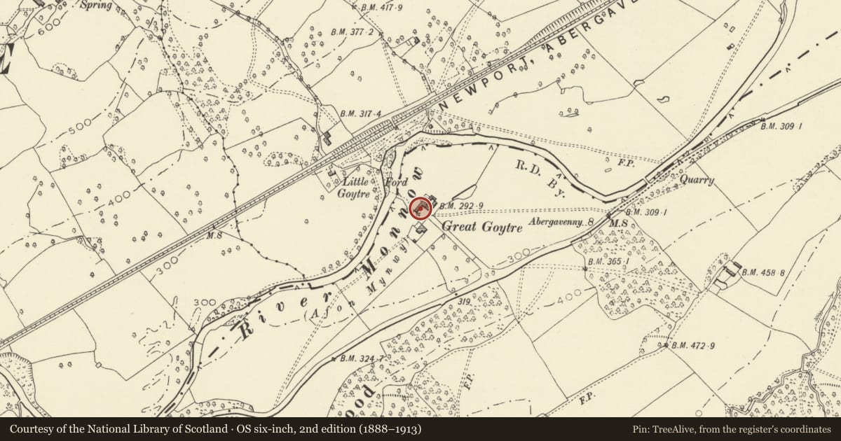
5 historical maps cover this location, the earliest the 1636 map "Cornubia : Devonia, Somersetus, Dorcestria, Wiltonia, Glocestria ..." (David Rumsey Map Collection, Stanford Libraries).
Historical maps covering this location
- 1636 · Cornubia : Devonia, Somersetus, Dorcestria, Wiltonia, Glocestria ... (David Rumsey Map Collection, Stanford Libraries)
- 1830 · V.3:11-15:XV.Britisches Reich. A. Kon: England. a. England ab sich: Shire:15-17, 33 (David Rumsey Map Collection, Stanford Libraries)
- 1895 · Sheet 11. Ordnance Survey of England and Wales. (David Rumsey Map Collection, Stanford Libraries)
- 1896 · 214 Talgarth (Hills) (David Rumsey Map Collection, Stanford Libraries)
- 1901 · Sheet 14. (David Rumsey Map Collection, Stanford Libraries)
Cadw's description
Location
Situated on flat land by River Monnow at the end of a farm track which runs NW off the A465, approximately 5 km W of Grosmont. The Barn lies some 70m N of the farmhouse at Great Goytre in an open farmyard.
History
C18 barn and stable block.
Exterior
Rubble stone with corrugated asbestos roof. C18 linear farm range; comprises large barn and lofted stables. Barn (to right) has opposing doorways to threshing floor with boarded doors and half doors. To left, ground floor has two slit ventilators and upper loft a square opening with voussoired stone arch and 7 closely spaced thin diamond mullions. To right, gable of C19 cowhouse cuts across facade of barn. Stable (to left) has centre boarded door with segmental arched voussoirs. Flanking doorway on each side are square window openings with similar arches, and 2-light windows with centre mullion and inside shutters. Originally these windows had intermediate iron stanchions, but only one survives (on window to left). W gable has upper doorway to pitching loft and C20 corrugated metal sheeting at gable head. Opposing E gable is all of stone with segmental arched pitching door in upper gable and two slit ventilators below.
Interior
Barn is 5 bays with raking queen strut trusses and two tiers of purlins. Each side of the threshing floor are lofted storage bays.
Reason for designation
Included as a C18 barn range which has group value with farmhouse and listed farm buildings at Great Goytre.
Nearby in the register
- Cowhouse, Granary and Cartshed at Great GoytreAgriculture and Subsistenceunder 1 mi
- Great Goytre FarmhouseNo class recordedunder 1 mi
- Goytre Wood Castle MoundMotteunder 1 mi
- Great MarlboroughNo class recorded1 mi
Other entries of the same register within about three miles of this one, by straight line.