Cof Cymru: National Historic Assets of Wales · Wales
Outbuilding at Allt-y-bella
Llantrisant Fawr, Monmouthshire, Wales
A Grade II listed building in Llangeview, Usk, Llantrisant Fawr, Monmouthshire, designated on 12 October 2000.
The record
- Designation
- Listed building, Grade II
- Broad class
- Agriculture and Subsistence
- Date of designation
- 12 October 2000
- Locality
- Llangeview
- Town
- Usk
- Community
- Llantrisant Fawr
- Unitary authority
- Monmouthshire
- Country
- Wales
- Coordinates
- 51.70072, -2.85375
- Cadw reference
- 24119
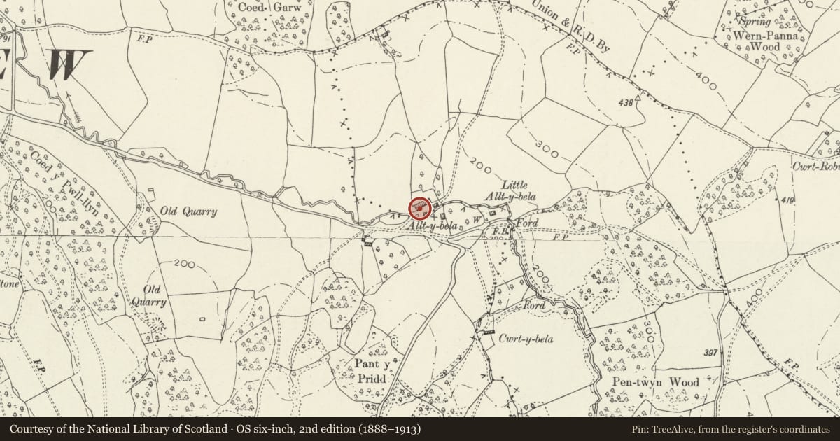
Slide toward Today to fade the historical sheet and see the modern map underneath.
David Rumsey Map Collection, Stanford LibrariesDavid Rumsey Map Collection, Stanford LibrariesDavid Rumsey Map Collection, Stanford LibrariesDavid Rumsey Map Collection, Stanford LibrariesDavid Rumsey Map Collection, Stanford Libraries
5 historical maps cover this location, the earliest the 1636 map "Cornubia : Devonia, Somersetus, Dorcestria, Wiltonia, Glocestria ..." (David Rumsey Map Collection, Stanford Libraries).
Historical maps covering this location
- 1636 · Cornubia : Devonia, Somersetus, Dorcestria, Wiltonia, Glocestria ... (David Rumsey Map Collection, Stanford Libraries)
- 1830 · V.3:11-15:XV.Britisches Reich. A. Kon: England. a. England ab sich: Shire:15-17, 33 (David Rumsey Map Collection, Stanford Libraries)
- 1895 · Sheet 11. Ordnance Survey of England and Wales. (David Rumsey Map Collection, Stanford Libraries)
- 1905 · 250 Chepstow (Hills) (David Rumsey Map Collection, Stanford Libraries)
- 1913 · Sheet 102. Newport. (David Rumsey Map Collection, Stanford Libraries)
Cadw's description
Location
Situated on S side of yard at Allt-y-bella.
History
Outbuilding, probably early C19 with gable-front to low open ground floor and large loft above. Lean-to on left may be added. Marked on 1843 Tithe Map.
Exterior
Outbuilding, rubble stone with slate roof. N gable front has broad whitewashed plastered gable (apparently red brick beneath plaster) over broad open ground floor with single central square rubble stone pier and continuous timber lintel. Upper floor has 3-light diamond-mullion window left of centre, and overhanging eaves with bargeboards. Right side wall has remnant of outside stone steps to loft door.
Lean-to to left with rubble stone end wall, and small 2-light window. Roof largely collapsed at time of survey. Two doors on side wall and window in rear end wall.
Interior
Ground floor has 7 large square beams and one beam each end.
Reason for designation
Included for group value with Allt-y-bella.
Nearby in the register
- Allt-y-bellaDomesticunder 1 mi
- The RectoryDomesticunder 1 mi
- The Farmhouse and The Dairy, Upper MaerdyDomesticunder 1 mi
- Coed-Cwnwr Moated SiteMoated Siteunder 1 mi
Other entries of the same register within about three miles of this one, by straight line.