Cof Cymru: National Historic Assets of Wales · Wales
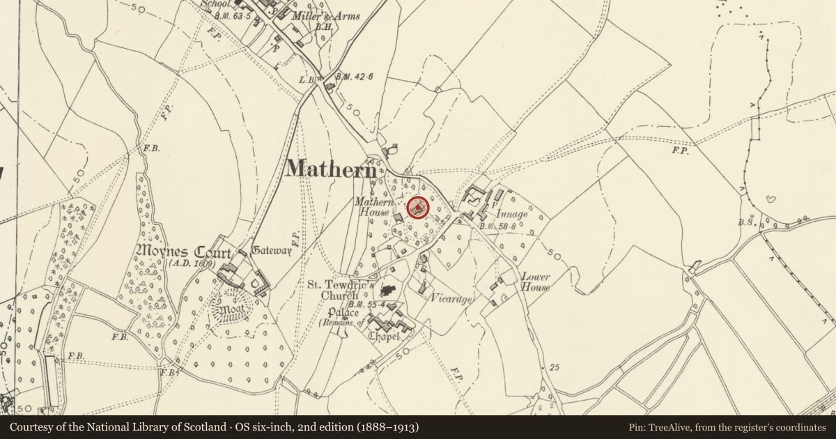
East Wing, Mathern House
Mathern, Monmouthshire, Wales
A Grade II listed building in Mathern, Chepstow, Monmouthshire, designated on 10 October 2000.
The record
- Designation
- Listed building, Grade II
- Broad class
- Domestic
- Date of designation
- 10 October 2000
- Locality
- Mathern
- Town
- Chepstow
- Community
- Mathern
- Unitary authority
- Monmouthshire
- Country
- Wales
- Coordinates
- 51.61630, -2.68912
- Cadw reference
- 24096
Slide toward Today to fade the historical sheet and see the modern map underneath.
David Rumsey Map Collection, Stanford LibrariesDavid Rumsey Map Collection, Stanford LibrariesDavid Rumsey Map Collection, Stanford LibrariesDavid Rumsey Map Collection, Stanford LibrariesDavid Rumsey Map Collection, Stanford Libraries
5 historical maps cover this location, the earliest the 1636 map "Cornubia : Devonia, Somersetus, Dorcestria, Wiltonia, Glocestria ..." (David Rumsey Map Collection, Stanford Libraries).
Historical maps covering this location
- 1636 · Cornubia : Devonia, Somersetus, Dorcestria, Wiltonia, Glocestria ... (David Rumsey Map Collection, Stanford Libraries)
- 1830 · V.3:11-15:XV.Britisches Reich. A. Kon: England. a. England ab sich: Shire:15-17, 33 (David Rumsey Map Collection, Stanford Libraries)
- 1895 · Sheet 11. Ordnance Survey of England and Wales. (David Rumsey Map Collection, Stanford Libraries)
- 1897 · 250 Chepstow (Outline) (David Rumsey Map Collection, Stanford Libraries)
- 1905 · 250 Chepstow (Hills) (David Rumsey Map Collection, Stanford Libraries)
Cadw's description
Location
In the centre of Mathern village about 200m north of the Church of St Tewdric.
History
This house is a mid C19 extension of Mathern House which is attached on the west (qv), seemingly the Dining Room, Kitchen and service wing. It looks as if it might be older, but it does not appear on the Mathern tithe map of 1839. It is now a separate house and has been completely modernised in the late C20.
Exterior
The house is constructed of local random rubble, rendered on the rear wall, and with a Welsh slate roof. It has two storeys and is L-shaped in plan, being an addition to the east gable of Mathern House. The garden front has a gable facing forward with two windows on the ground floor, cross-framed casements with leaded lattice lights, and there is a 3-light one in the gable above. Plain bargeboards to the gable, big kitchen stack on the return wall to the right. The left return has two 2-light windows, and there are two more at right angles to these and in line with the front of Mathern House. To the right is a single storey wing with the entrance door. The rear elevation has a modern lean-to across the ground floor with two windows and French casements; and two gabled half-dormers in the roof above which is hipped to the left.
Interior
Only the ground floor was seen at resurvey. It has been fully modernised and changed and only the main reception room is recognisable as the sometime Dining Room of Mathern House, while the dining room was probably the Kitchen.
Reason for designation
Included for its group value, both physical and historic, with the attached Mathern House.
Nearby in the register
- Mathern HouseDomesticunder 1 mi
- Front Wall and Entrance Gates of Mathern HouseDomesticunder 1 mi
- Barn and Granary at Innage FarmAgriculture and Subsistenceunder 1 mi
- Mathern LodgeDomesticunder 1 mi
Other entries of the same register within about three miles of this one, by straight line.