Cof Cymru: National Historic Assets of Wales · Wales
Fish Pool Dam
Devauden, Monmouthshire, Wales
A Grade II listed building in Pont-y-saeson, Chepstow, Devauden, Monmouthshire, designated on 29 September 2000.
The record
- Designation
- Listed building, Grade II
- Broad class
- Water Supply and Drainage
- Date of designation
- 29 September 2000
- Locality
- Pont-y-saeson
- Town
- Chepstow
- Community
- Devauden
- Unitary authority
- Monmouthshire
- Country
- Wales
- Coordinates
- 51.69754, -2.71787
- Cadw reference
- 24059
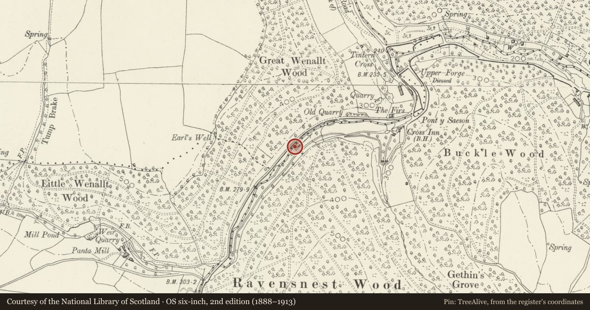
Slide toward Today to fade the historical sheet and see the modern map underneath.
David Rumsey Map Collection, Stanford LibrariesDavid Rumsey Map Collection, Stanford LibrariesDavid Rumsey Map Collection, Stanford LibrariesDavid Rumsey Map Collection, Stanford LibrariesDavid Rumsey Map Collection, Stanford Libraries
5 historical maps cover this location, the earliest the 1636 map "Cornubia : Devonia, Somersetus, Dorcestria, Wiltonia, Glocestria ..." (David Rumsey Map Collection, Stanford Libraries).
Historical maps covering this location
- 1636 · Cornubia : Devonia, Somersetus, Dorcestria, Wiltonia, Glocestria ... (David Rumsey Map Collection, Stanford Libraries)
- 1895 · Sheet 11. Ordnance Survey of England and Wales. (David Rumsey Map Collection, Stanford Libraries)
- 1897 · 250 Chepstow (Outline) (David Rumsey Map Collection, Stanford Libraries)
- 1905 · 250 Chepstow (Hills) (David Rumsey Map Collection, Stanford Libraries)
- 1913 · Sheet 102. Newport. (David Rumsey Map Collection, Stanford Libraries)
Cadw's description
Location
About 3000m west of Tintern Abbey beside the road to Devauden.
History
This dam was constructed to provide power for the Pont-y-saeson Forge which was about 500m below it. Little is known about this forge which may have begun functioning as early as 1675, but the dam is probably at least C18 in origin.
Exterior
The dam is constructed of rubble sandstone walling. The upstream side has eight low arches with elliptical heads for the sluices. The downstream side has the spillways from these with an over-spill or fish ladder to the right. The dam provides a 3.5m head of water in its current state. The dam is about 20m long and about 2.5m wide. The crest of the dam has been rebuilt in the late C20 as a part of its current role as a fishing lake.
Reason for designation
Included as a well preserved small mill dam dating possibly from the C18, and as a part of an important group of surviving relics of the metal industry in the Anghidy valley.
Nearby in the register
- Tintern Upper Wireworks (New Tongs Mill)Leatunder 1 mi
- Beaufort Pond DamWater Supply and Drainageunder 1 mi
- Furnace CottagesDomesticunder 1 mi
- Old Furnace Blast FurnaceBlast Furnaceunder 1 mi
Other entries of the same register within about three miles of this one, by straight line.