Cof Cymru: National Historic Assets of Wales · Wales
Tomb with Pyramid in Churchyard of Former Church of St Mary
Wye Valley, Monmouthshire, Wales
A Grade II listed building in Chapel Hill, Tintern, Wye Valley, Monmouthshire, designated on 29 September 2000.
The record
- Designation
- Listed building, Grade II
- Broad class
- Religious, Ritual and Funerary
- Date of designation
- 29 September 2000
- Locality
- Chapel Hill
- Town
- Tintern
- Community
- Wye Valley
- Unitary authority
- Monmouthshire
- Country
- Wales
- Coordinates
- 51.69637, -2.68072
- Cadw reference
- 24051
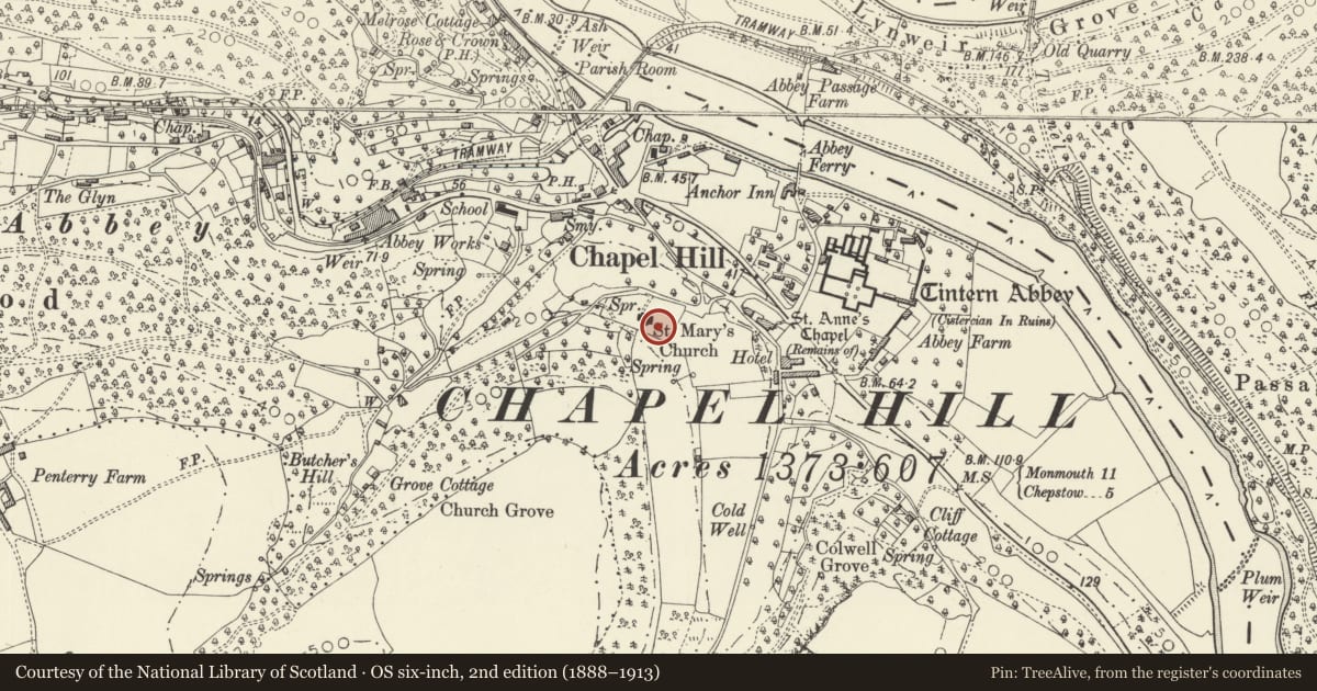
Slide toward Today to fade the historical sheet and see the modern map underneath.
David Rumsey Map Collection, Stanford LibrariesDavid Rumsey Map Collection, Stanford LibrariesDavid Rumsey Map Collection, Stanford LibrariesDavid Rumsey Map Collection, Stanford LibrariesDavid Rumsey Map Collection, Stanford Libraries
5 historical maps cover this location, the earliest the 1636 map "Cornubia : Devonia, Somersetus, Dorcestria, Wiltonia, Glocestria ..." (David Rumsey Map Collection, Stanford Libraries).
Historical maps covering this location
- 1636 · Cornubia : Devonia, Somersetus, Dorcestria, Wiltonia, Glocestria ... (David Rumsey Map Collection, Stanford Libraries)
- 1830 · V.3:11-15:XV.Britisches Reich. A. Kon: England. a. England ab sich: Shire:15-17, 33 (David Rumsey Map Collection, Stanford Libraries)
- 1895 · Sheet 11. Ordnance Survey of England and Wales. (David Rumsey Map Collection, Stanford Libraries)
- 1897 · 250 Chepstow (Outline) (David Rumsey Map Collection, Stanford Libraries)
- 1905 · 250 Chepstow (Hills) (David Rumsey Map Collection, Stanford Libraries)
Cadw's description
Location
About 30m from the east end of the Church of St Mary.
History
A fine tomb in the neo-classical manner dating from the late C18 or early C19.
Exterior
Tomb constructed of sandstone ashlar. Rectangular base with clasping corners, both the corners and the long sides have indented panels. Overhanging cornice. The table slab supports a large pyramid with a blunted point
Reason for designation
Included as a fine and rare late C18 or early C19 neo-classical tomb.
Nearby in the register
- Tomb of J S Brown in Churchyard of Former Church of St MaryReligious, Ritual and Funeraryunder 1 mi
- Tomb with Sarcophagus in Churchyard of Former Church of St MaryReligious, Ritual and Funeraryunder 1 mi
- Former Church of St MaryReligious, Ritual and Funeraryunder 1 mi
- St Mary's Church, Chapel HillChurchunder 1 mi
Other entries of the same register within about three miles of this one, by straight line.