Cof Cymru: National Historic Assets of Wales · Wales
Water Pump including surrounding revetment walls
Llantrisant, Rhondda Cynon Taff, Wales
A Grade II listed building in Llantrisant, Rhondda Cynon Taff, designated on 18 August 2000.
The record
- Designation
- Listed building, Grade II
- Broad class
- Water Supply and Drainage
- Date of designation
- 18 August 2000
- Locality
- Llantrisant
- Community
- Llantrisant
- Unitary authority
- Rhondda Cynon Taff
- Country
- Wales
- Coordinates
- 51.54341, -3.37988
- Cadw reference
- 23955
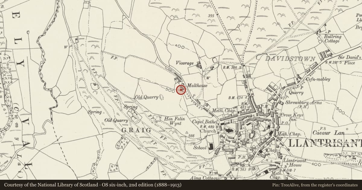
Slide toward Today to fade the historical sheet and see the modern map underneath.
David Rumsey Map Collection, Stanford LibrariesDavid Rumsey Map Collection, Stanford LibrariesDavid Rumsey Map Collection, Stanford LibrariesDavid Rumsey Map Collection, Stanford LibrariesDavid Rumsey Map Collection, Stanford Libraries
5 historical maps cover this location, the earliest the 1636 map "Cornubia : Devonia, Somersetus, Dorcestria, Wiltonia, Glocestria ..." (David Rumsey Map Collection, Stanford Libraries).
Historical maps covering this location
- 1636 · Cornubia : Devonia, Somersetus, Dorcestria, Wiltonia, Glocestria ... (David Rumsey Map Collection, Stanford Libraries)
- 1637 · The fourth table of England. Cornub. Devonia, Somerset etc. (David Rumsey Map Collection, Stanford Libraries)
- 1865 · England and Wales. England No. 6. (David Rumsey Map Collection, Stanford Libraries)
- 1895 · Sheet 11. Ordnance Survey of England and Wales. (David Rumsey Map Collection, Stanford Libraries)
- 1907 · 248 Pontypridd (Hills) (David Rumsey Map Collection, Stanford Libraries)
Cadw's description
Location
On the roadside, the ground revetted to the rear.
History
Victorian water pump in its original position and restored by the community council in 1993. The pump is one of 3 in the town and is the best preserved.
Exterior
Cast iron water pump enclosed by rubble stone walls and metal railings. Round-section stem with fluting and rings, above which is a shorter section of wider diameter. This is surmounted by an openwork dome with small round finial. Attached to the NE side, towards the top, is a long narrow curved handle. Fixed to the narrower part of the stem is a curved spout facing S, with a scroll on top of the curve. There is a maker's mark on the E side of the stem, hard to read, but possibly depicting a bear. The pump is mounted on a stone plinth. It is set within high rubble stone walls to the N and W, partly retaining the ground, and a short wall to the S. Steel railings elsewhere with arched gateway to roadside.
Reason for designation
Listed as a well preserved item of street furniture contributing character to the area.
Nearby in the register
- The MalthouseAgriculture and Subsistenceunder 1 mi
- Y Felin Wynt TowerIndustrialunder 1 mi
- Church of St Illtyd, St Gwynno and St DyfodwgReligious, Ritual and Funeraryunder 1 mi
- New InnCommercialunder 1 mi
Other entries of the same register within about three miles of this one, by straight line.