Cof Cymru: National Historic Assets of Wales · Wales
Boiler stack of former lead mine NW of Cefn-parc Farm
Pont-y-Clun, Rhondda Cynon Taff, Wales
A Grade II listed building in Mwyndy, Pontyclun, Rhondda Cynon Taff, designated on 15 August 2000.
The record
- Designation
- Listed building, Grade II
- Broad class
- Industrial
- Date of designation
- 15 August 2000
- Locality
- Mwyndy
- Town
- Pontyclun
- Community
- Pont-y-Clun
- Unitary authority
- Rhondda Cynon Taff
- Country
- Wales
- Coordinates
- 51.53045, -3.37330
- Cadw reference
- 23915
Slide toward Today to fade the historical sheet and see the modern map underneath.
David Rumsey Map Collection, Stanford LibrariesDavid Rumsey Map Collection, Stanford LibrariesDavid Rumsey Map Collection, Stanford LibrariesDavid Rumsey Map Collection, Stanford LibrariesDavid Rumsey Map Collection, Stanford Libraries
5 historical maps cover this location, the earliest the 1636 map "Cornubia : Devonia, Somersetus, Dorcestria, Wiltonia, Glocestria ..." (David Rumsey Map Collection, Stanford Libraries).
Historical maps covering this location
- 1636 · Cornubia : Devonia, Somersetus, Dorcestria, Wiltonia, Glocestria ... (David Rumsey Map Collection, Stanford Libraries)
- 1637 · The fourth table of England. Cornub. Devonia, Somerset etc. (David Rumsey Map Collection, Stanford Libraries)
- 1865 · England and Wales. England No. 6. (David Rumsey Map Collection, Stanford Libraries)
- 1895 · Sheet 11. Ordnance Survey of England and Wales. (David Rumsey Map Collection, Stanford Libraries)
- 1907 · 248 Pontypridd (Hills) (David Rumsey Map Collection, Stanford Libraries)
Cadw's description
Location
In a field NW of Cefn-parc Farm, and standing on a ridge overlooking Llantrisant to the N.
History
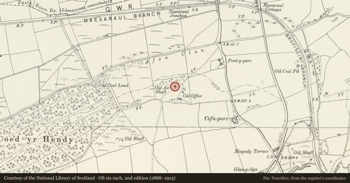
Probably built in the C18, and one of a number of C18 lead mines in the Vale of Glamorgan. The mine is shown as disused on the 1841 Llantrisant Tithe map, by which time all the other buildings on the site had been taken down. A later OS map marks the stack as an air shaft for a local colliery.
Exterior
A round rubble-stone stack approximately 3m diameter at the base and tapering to approximately 25m high. Projecting coping stones partly survive. The stack is constructed on a wider stone plinth, which has partly fallen away. A segmental-headed opening is on the W side at the base.
Reason for designation
Listed for industrial archaeological interest as a rare surviving building associated with lead-mining industry of the Vale of Glamorgan.
Nearby in the register
- Mwyndy HouseDomesticunder 1 mi
- Toll House CottageTransportunder 1 mi
- Llantrisant HouseDomesticunder 1 mi
- Wall with bee boles at TondrugwaerAgriculture and Subsistenceunder 1 mi
Other entries of the same register within about three miles of this one, by straight line.