Cof Cymru: National Historic Assets of Wales · Wales
Water lift pump at Rhyd-yr-onen
Bryn-Crug, Gwynedd, Wales
A Grade II listed building in Bryn Crug, Gwynedd, designated on 15 August 2000.
The record
- Designation
- Listed building, Grade II
- Broad class
- Water Supply and Drainage
- Date of designation
- 15 August 2000
- Locality
- Bryn Crug
- Community
- Bryn-Crug
- Unitary authority
- Gwynedd
- Country
- Wales
- Coordinates
- 52.59963, -4.04481
- Cadw reference
- 23907
Slide toward Today to fade the historical sheet and see the modern map underneath.
David Rumsey Map Collection, Stanford LibrariesDavid Rumsey Map Collection, Stanford LibrariesDavid Rumsey Map Collection, Stanford LibrariesDavid Rumsey Map Collection, Stanford LibrariesLlyfrgell Genedlaethol Cymru – The National Library of Wales
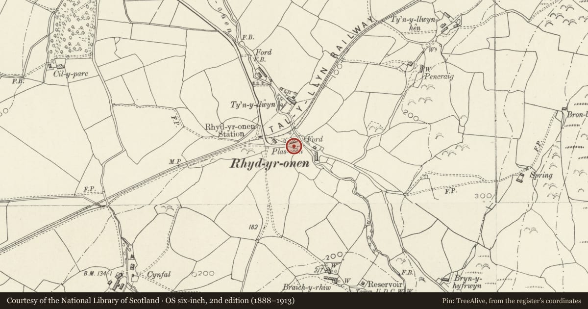
5 historical maps cover this location, the earliest the 1795 map "To Sir Watkin Williams-Wynn Bart ... the map of the six counties of North Wales is most humbly inscribed by his obedient humble servant" (Llyfrgell Genedlaethol Cymru – The National Library of Wales).
Historical maps covering this location
- 1795 · To Sir Watkin Williams-Wynn Bart ... the map of the six counties of North Wales is most… (Llyfrgell Genedlaethol Cymru – The National Library of Wales)
- 1883 · Watershed map England, Wales 3. (David Rumsey Map Collection, Stanford Libraries)
- 1896 · Sheet 7. Ordnance Survey of England and Wales. (David Rumsey Map Collection, Stanford Libraries)
- 1899 · 149 Barmouth (Hills) (David Rumsey Map Collection, Stanford Libraries)
- 1901 · Sheet 9 and 10. (David Rumsey Map Collection, Stanford Libraries)
Cadw's description
Location
The pump stands beside the K6 telephone kiosk and post box in the hamlet of Rhyd-yr-onen, opposte Y Barclud, one of a row of 5 small cottages.
History
Probably erected later in the C19 when piped water was first introuduced to the village.
Exterior
Cast iron lift pump, with a 10.16cm (4") diameter pipe with strengthening bands ascending to a widened and fluted top chamber, to which is attached a double curved arm and handle. The discharge pipe, at the head of the ascending pipe, has a scroll-shaped bucket hook. On the side of the chamber, a registration number and the manufacturer's badge on the shaft, surmounted by a lion crest, possibly for Norton Hamar, or the Lion Foundry of Kirkentilloch, Scotland, the manufacturer of the adjoining kiosk. The pump is steadied by two stay bars and a collar, and has been recently painted.
Reason for designation
Included as a well-preserved village pump, one of a group of such pumps in the community, an interesting example of a public amenity, unusual in a rural area.
Nearby in the register
- Castell Cynfal, Bryn CrugMotteunder 1 mi
- Water lift pump at Pen ParcWater Supply and Drainageunder 1 mi
- BronwylfaDomesticunder 1 mi
- Water lift pump on road to PenowernWater Supply and Drainageunder 1 mi
Other entries of the same register within about three miles of this one, by straight line.