Cof Cymru: National Historic Assets of Wales · Wales
Pont Llanybydder (Partly in Llanwenog Community)
Llanybydder, Carmarthenshire, Wales
A Grade II listed building in Llanybydder, Carmarthenshire, designated on 25 April 1997.
The record
- Designation
- Listed building, Grade II
- Broad class
- Transport
- Date of designation
- 25 April 1997
- Locality
- Llanybydder
- Community
- Llanybydder
- Unitary authority
- Carmarthenshire
- Country
- Wales
- Coordinates
- 52.07561, -4.16134
- Cadw reference
- 23883
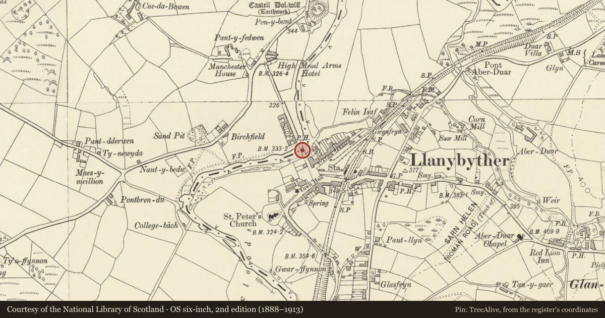
Slide toward Today to fade the historical sheet and see the modern map underneath.
David Rumsey Map Collection, Stanford LibrariesDavid Rumsey Map Collection, Stanford LibrariesDavid Rumsey Map Collection, Stanford LibrariesDavid Rumsey Map Collection, Stanford LibrariesDavid Rumsey Map Collection, Stanford Libraries
5 historical maps cover this location, the earliest the 1608 map "(13) Cambriae Typus." (David Rumsey Map Collection, Stanford Libraries).
Historical maps covering this location
- 1608 · (13) Cambriae Typus. (David Rumsey Map Collection, Stanford Libraries)
- 1830 · V.3:11-15:XV. Britisches Reich. A. Kon: England. b. Frstenthum Wales: Shire: 37-40 (David Rumsey Map Collection, Stanford Libraries)
- 1899 · 195 Lampeter (Hills) (David Rumsey Map Collection, Stanford Libraries)
- 1901 · Sheet 14. (David Rumsey Map Collection, Stanford Libraries)
- 1919 · Sheet 78. Lampeter. (David Rumsey Map Collection, Stanford Libraries)
Cadw's description
Location
Situated just W of Llanybydder, carrying B4337 across River Teifi.
History
Earlier C19 road bridge. In 1832 Herbert Evans of Highmead was paid £100 for his part in organising the rebuilding of the Cardiganshire side, and contractors were paid £70, which may relate to a complete rebuilding. In 1837 William Williams, Bridge Surveyor, was paid £2 for plans for repairs. It was damaged by flood in 1886 and repaired for £725 by Thomas George, County Surveyor for Carmarthenshire.
Exterior
Cut sandstone triple-arched bridge, slightly humped. Parapets with heavy tooled stone copings. Arches have flush voussoirs alternately of sandstone and slate, and there is a projecting stringcourse above, under parapet. Two cutwaters each side, triangular, broached back to flat piers, continued slightly narrower on parapet. Outer piers simply in three slightly narrowing steps.
Reason for designation
Listed as an exceptional well-designed stone bridge.
Nearby in the register
- Pont Llanybydder (Partly in Llanybydder Community)Transportunder 1 mi
- Dolgwm StoresCommercialunder 1 mi
- Church of St PeterReligious, Ritual and Funeraryunder 1 mi
- Cross Hands HotelCommercialunder 1 mi
Other entries of the same register within about three miles of this one, by straight line.