Cof Cymru: National Historic Assets of Wales · Wales
6 Gelli Houses
Glyncorrwg, Neath Port Talbot, Wales
A Grade II listed building in Gelli, Glyncorrwg, Neath Port Talbot, designated on 31 July 2000.
The record
- Designation
- Listed building, Grade II
- Broad class
- Domestic
- Date of designation
- 31 July 2000
- Locality
- Gelli
- Community
- Glyncorrwg
- Unitary authority
- Neath Port Talbot
- Country
- Wales
- Coordinates
- 51.65329, -3.63176
- Cadw reference
- 23859
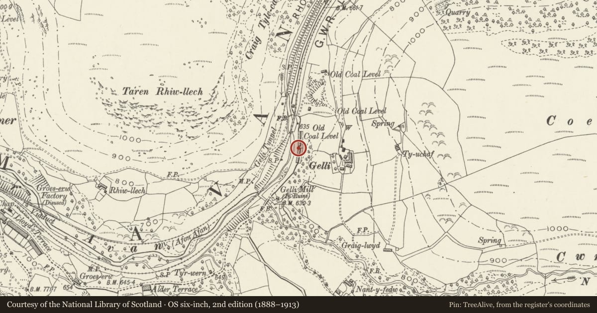
Slide toward Today to fade the historical sheet and see the modern map underneath.
David Rumsey Map Collection, Stanford LibrariesDavid Rumsey Map Collection, Stanford LibrariesDavid Rumsey Map Collection, Stanford LibrariesDavid Rumsey Map Collection, Stanford LibrariesDavid Rumsey Map Collection, Stanford Libraries
5 historical maps cover this location, the earliest the 1636 map "Cornubia : Devonia, Somersetus, Dorcestria, Wiltonia, Glocestria ..." (David Rumsey Map Collection, Stanford Libraries).
Historical maps covering this location
- 1636 · Cornubia : Devonia, Somersetus, Dorcestria, Wiltonia, Glocestria ... (David Rumsey Map Collection, Stanford Libraries)
- 1637 · The fourth table of England. Cornub. Devonia, Somerset etc. (David Rumsey Map Collection, Stanford Libraries)
- 1830 · V.3:11-15:XV. Britisches Reich. A. Kon: England. b. Frstenthum Wales: Shire: 37-40 (David Rumsey Map Collection, Stanford Libraries)
- 1865 · England and Wales. England No. 6. (David Rumsey Map Collection, Stanford Libraries)
- 1907 · 248 Pontypridd (Hills) (David Rumsey Map Collection, Stanford Libraries)
Cadw's description
Location
Approximately 1.1km E of Cymmer and set back from the A4107.
History
Erected in 1883 for colliers at nearby pits owned by the Glyncorrwg Coal Mining Company. The single-storey construction is unusual and the Gelli Houses represent one of the latest examples of the type. Of four-room construction with a lean-to pantry at the back, only two of the rooms were originally heated. The houses originally shared a communal bakehouse but this had been demolished by 1904.
Exterior
1-12 Gelli Houses
Two rows of 6 double-fronted houses are placed end-to-end but not quite parallel. The rubble-stone walls are now rendered, the roofs have been renewed and most of the brick stacks survive, some rendered. The windows and doors are replaced, mostly in original openings.
Rendered wall with doorways attached on N side and linking with 7 Gelli Houses.
Interior
Not inspected.
Reason for designation
Listed as a rare surviving row of single-storey colliers' cottages, representing a distinctive plan form used in the early mining cottages on the western side of the South Wales coalfield.
Nearby in the register
- 5 Gelli HousesDomesticunder 1 mi
- 7 Gelli HousesDomesticunder 1 mi
- 4 Gelli HousesDomesticunder 1 mi
- 8 Gelli HousesDomesticunder 1 mi
Other entries of the same register within about three miles of this one, by straight line.