Cof Cymru: National Historic Assets of Wales · Wales
Bryn Tudur
Llanegryn, Gwynedd, Wales
A Grade II listed building in Llanegryn, Tywyn, Gwynedd, designated on 26 July 2000.
The record
- Designation
- Listed building, Grade II
- Broad class
- Domestic
- Date of designation
- 26 July 2000
- Locality
- Llanegryn
- Town
- Tywyn
- Community
- Llanegryn
- Unitary authority
- Gwynedd
- Country
- Wales
- Coordinates
- 52.63256, -4.06297
- Cadw reference
- 23771
Slide toward Today to fade the historical sheet and see the modern map underneath.
David Rumsey Map Collection, Stanford LibrariesDavid Rumsey Map Collection, Stanford LibrariesDavid Rumsey Map Collection, Stanford LibrariesDavid Rumsey Map Collection, Stanford LibrariesLlyfrgell Genedlaethol Cymru – The National Library of Wales
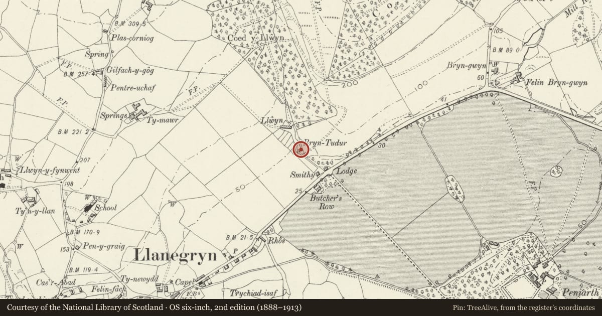
5 historical maps cover this location, the earliest the 1795 map "To Sir Watkin Williams-Wynn Bart ... the map of the six counties of North Wales is most humbly inscribed by his obedient humble servant" (Llyfrgell Genedlaethol Cymru – The National Library of Wales).
Historical maps covering this location
- 1795 · To Sir Watkin Williams-Wynn Bart ... the map of the six counties of North Wales is most… (Llyfrgell Genedlaethol Cymru – The National Library of Wales)
- 1883 · Watershed map England, Wales 3. (David Rumsey Map Collection, Stanford Libraries)
- 1896 · Sheet 7. Ordnance Survey of England and Wales. (David Rumsey Map Collection, Stanford Libraries)
- 1899 · 149 Barmouth (Hills) (David Rumsey Map Collection, Stanford Libraries)
- 1901 · Sheet 9 and 10. (David Rumsey Map Collection, Stanford Libraries)
Cadw's description
Location
The house stands on a trackway off the main Llanegryn to Abergynolwen Road, commencing opposite the gates to Peniarth.
History
Built by the Peniarth estate in c1860-80, probably for estate staff.
Exterior
Built in a modestly country-vernacular style, of a dark stone rubble with a slate roof. One storey and attic, 2 bays. The front elevation is symmetrical with the entrance in the right hand gable end, enclosed in a C20 porch. On the ground floor cast iron multipaned casement windows set in openings with cambered heads and flush keystone, and similar but shorter windows to the upper floor rising through the eaves and gabled, with a deep stone lintel of a paler coloured stone. Central rubble chimney stack.
Reason for designation
Included as a purpose-designed and built estate house retaining original character.
Nearby in the register
- LlwynDomesticunder 1 mi
- Gate piers and gate to PeniarthGardens, Parks and Urban Spacesunder 1 mi
- Maes y HafDomesticunder 1 mi
- Bryn meirionDomesticunder 1 mi
Other entries of the same register within about three miles of this one, by straight line.