Cof Cymru: National Historic Assets of Wales · Wales
Quarry Offices
Llanllyfni, Gwynedd, Wales
A Grade II listed building in Pen-yr-Orsedd, Caernarfon, Llanllyfni, Gwynedd, designated on 21 July 2000.
The record
- Designation
- Listed building, Grade II
- Broad class
- Industrial
- Date of designation
- 21 July 2000
- Locality
- Pen-yr-Orsedd
- Town
- Caernarfon
- Community
- Llanllyfni
- Unitary authority
- Gwynedd
- Country
- Wales
- Coordinates
- 53.06031, -4.22531
- Cadw reference
- 23731
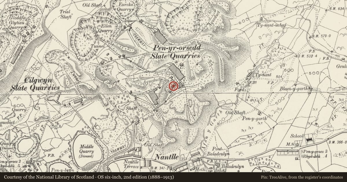
Slide toward Today to fade the historical sheet and see the modern map underneath.
David Rumsey Map Collection, Stanford LibrariesDavid Rumsey Map Collection, Stanford LibrariesDavid Rumsey Map Collection, Stanford LibrariesLlyfrgell Genedlaethol Cymru – The National Library of WalesDavid Rumsey Map Collection, Stanford Libraries
5 historical maps cover this location, the earliest the 1795 map "To Sir Watkin Williams-Wynn Bart ... the map of the six counties of North Wales is most humbly inscribed by his obedient humble servant" (Llyfrgell Genedlaethol Cymru – The National Library of Wales).
Historical maps covering this location
- 1795 · To Sir Watkin Williams-Wynn Bart ... the map of the six counties of North Wales is most… (Llyfrgell Genedlaethol Cymru – The National Library of Wales)
- 1883 · Watershed map England, Wales 3. (David Rumsey Map Collection, Stanford Libraries)
- 1896 · Sheet 7. Ordnance Survey of England and Wales. (David Rumsey Map Collection, Stanford Libraries)
- 1899 · 118 Nevin (Hills) (David Rumsey Map Collection, Stanford Libraries)
- 1901 · Sheet 9 and 10. (David Rumsey Map Collection, Stanford Libraries)
Cadw's description
Location
Located between the store building to the north and the barracks to the south-west on Level VI (Bonc yr Offis) of Pen-yr-Orsedd Slate Quarry.
History
The quarry offices were built in 2 stages, in c1863 and between 1899 and 1907. The quarry opened c1816 when it was worked by William Turner. In 1863 it was bought by W A Darbishire & Co., after which it underwent substantial modernisation, reflected in the use of both water and steam power. During the 1890s about 450 men worked here; it finally closed in 1997.
Exterior
Single-storey T-plan office building, the earlier range (cross-wing) to the west, aligned approximately north-south with the later range to the east, aligned roughly east-west. The later range has opposed doors front and back through which the men progressed to collect their wages. Coursed slate rubble construction, the earlier cross-wing with remains of render and probably later slate hanging, the later range with some red brick dressings; gable-ended slate roofs with brick stacks. 12-paned sash to front cross-wing and three 6-paned sashes in later range.
Interior
Original plaster finishes survive.
Reason for designation
Listed as a good example of quarry offices at the remarkably well-preserved slate quarry at Pen-yr-Orsedd.
Nearby in the register
- Barracks BuildingIndustrialunder 1 mi
- Quarry HospitalIndustrialunder 1 mi
- Store BuildingIndustrialunder 1 mi
- WorkshopsIndustrialunder 1 mi
Other entries of the same register within about three miles of this one, by straight line.