Cof Cymru: National Historic Assets of Wales · Wales
Brynarvon
Llanllyfni, Gwynedd, Wales
A Grade II listed building in Talysarn, Caernarfon, Llanllyfni, Gwynedd, designated on 21 July 2000.
The record
- Designation
- Listed building, Grade II
- Broad class
- Domestic
- Date of designation
- 21 July 2000
- Locality
- Talysarn
- Town
- Caernarfon
- Community
- Llanllyfni
- Unitary authority
- Gwynedd
- Country
- Wales
- Coordinates
- 53.05612, -4.25637
- Cadw reference
- 23709
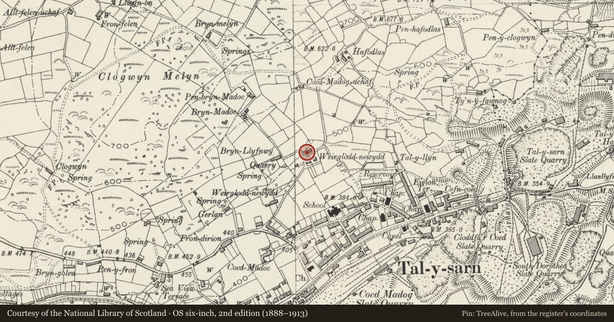
Slide toward Today to fade the historical sheet and see the modern map underneath.
David Rumsey Map Collection, Stanford LibrariesDavid Rumsey Map Collection, Stanford LibrariesDavid Rumsey Map Collection, Stanford LibrariesDavid Rumsey Map Collection, Stanford LibrariesLlyfrgell Genedlaethol Cymru – The National Library of Wales
5 historical maps cover this location, the earliest the 1795 map "To Sir Watkin Williams-Wynn Bart ... the map of the six counties of North Wales is most humbly inscribed by his obedient humble servant" (Llyfrgell Genedlaethol Cymru – The National Library of Wales).
Historical maps covering this location
- 1795 · To Sir Watkin Williams-Wynn Bart ... the map of the six counties of North Wales is most… (Llyfrgell Genedlaethol Cymru – The National Library of Wales)
- 1883 · Watershed map England, Wales 3. (David Rumsey Map Collection, Stanford Libraries)
- 1896 · Sheet 7. Ordnance Survey of England and Wales. (David Rumsey Map Collection, Stanford Libraries)
- 1899 · 118 Nevin (Hills) (David Rumsey Map Collection, Stanford Libraries)
- 1901 · Sheet 9 and 10. (David Rumsey Map Collection, Stanford Libraries)
Cadw's description
Location
Situated on track (Weirglodd-newydd) immediately above Talysarn.
History
Shown on the 1840 Tithe Map, this pair of early C19 cottages was probably built as quarryworkers' cottages for one of the several slate quarries opening in the area at this time.
Interior
Has matchboarded ceiling with lower parts of 2 A-frame trusses visible beneath and a short screen immediately to right of entrance in right room; C19 plank door leads to left room.
Reason for designation
Included as one of a pair of purpose-built and well-preserved quarryworkers' cottages, built in the local vernacular tradition and forming a distinctive component in this important upland encroachment landscape.
Nearby in the register
- Weirglodd-newyddDomesticunder 1 mi
- Seion Congregational ChurchReligious, Ritual and Funeraryunder 1 mi
- Capel Mawr, Sunday School and railed steps to chapel forecourtReligious, Ritual and Funeraryunder 1 mi
- Enclosed Hut Circle Settlement West of VotglasEnclosed hut circle settlementunder 1 mi
Other entries of the same register within about three miles of this one, by straight line.