Cof Cymru: National Historic Assets of Wales · Wales
Locomotive Shed
Llanllyfni, Gwynedd, Wales
A Grade II listed building in Pen-yr-Orsedd, Caernarfon, Llanllyfni, Gwynedd, designated on 21 July 2000.
The record
- Designation
- Listed building, Grade II
- Broad class
- Industrial
- Date of designation
- 21 July 2000
- Locality
- Pen-yr-Orsedd
- Town
- Caernarfon
- Community
- Llanllyfni
- Unitary authority
- Gwynedd
- Country
- Wales
- Coordinates
- 53.06413, -4.22422
- Cadw reference
- 23671
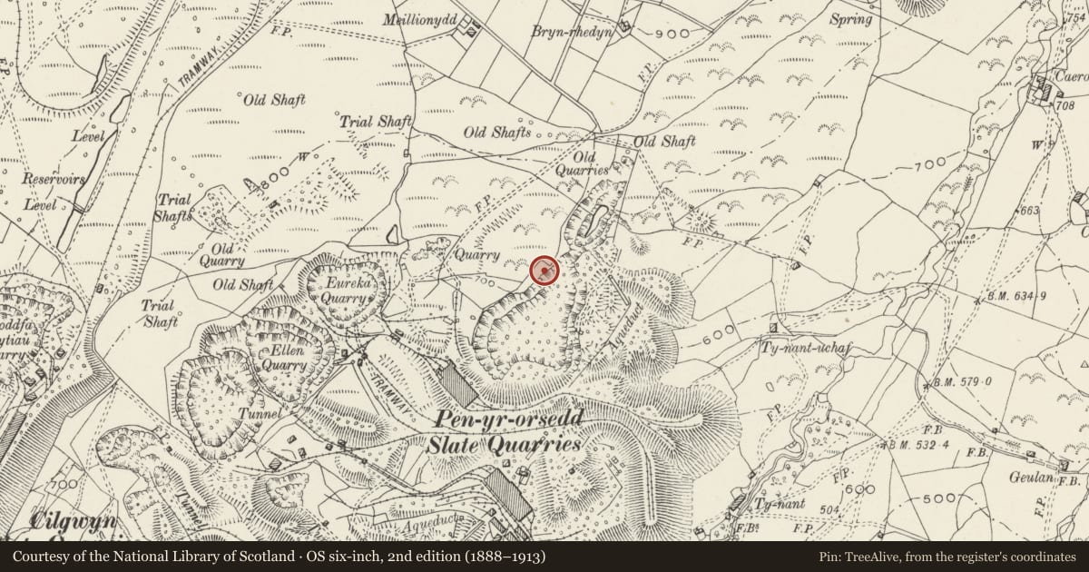
Slide toward Today to fade the historical sheet and see the modern map underneath.
David Rumsey Map Collection, Stanford LibrariesDavid Rumsey Map Collection, Stanford LibrariesDavid Rumsey Map Collection, Stanford LibrariesLlyfrgell Genedlaethol Cymru – The National Library of WalesDavid Rumsey Map Collection, Stanford Libraries
5 historical maps cover this location, the earliest the 1795 map "To Sir Watkin Williams-Wynn Bart ... the map of the six counties of North Wales is most humbly inscribed by his obedient humble servant" (Llyfrgell Genedlaethol Cymru – The National Library of Wales).
Historical maps covering this location
- 1795 · To Sir Watkin Williams-Wynn Bart ... the map of the six counties of North Wales is most… (Llyfrgell Genedlaethol Cymru – The National Library of Wales)
- 1883 · Watershed map England, Wales 3. (David Rumsey Map Collection, Stanford Libraries)
- 1896 · Sheet 7. Ordnance Survey of England and Wales. (David Rumsey Map Collection, Stanford Libraries)
- 1899 · 118 Nevin (Hills) (David Rumsey Map Collection, Stanford Libraries)
- 1901 · Sheet 9 and 10. (David Rumsey Map Collection, Stanford Libraries)
Cadw's description
Location
Located on Level VIII (Bonc Brig) of the Pen-yr-Orsedd Slate Quarry to the east of the modern steep access road from Y Fron.
History
Constructed after 1916 as part of expansion at the quarry. The quarry opened c1816 and in 1863 it was bought by W A Darbishire & Co. During the 1890s about 450 men worked here: it finally closed in 1997.
Exterior
Regularly coursed and dressed slate slabs; slate roof. Rectangular plan with roughly central catslide lean-to on east side. Gable end to north has wide entrance with steel lintel; short integral stack to south gable end.
Interior
A-frame roof trusses.
Reason for designation
Included as a well-preserved locomotive shed built as part of a programme of expansion at the quarry during the First World War, having strong group value with other structures on this level.
Nearby in the register
- Transformer HouseIndustrialunder 1 mi
- Engine and Compressor HouseIndustrialunder 1 mi
- Engine HouseIndustrialunder 1 mi
- Drying HouseIndustrialunder 1 mi
Other entries of the same register within about three miles of this one, by straight line.