Cof Cymru: National Historic Assets of Wales · Wales
Roberts Fruit and Veg
Denbigh, Denbighshire, Wales
A Grade II listed building in Denbigh - Town, Denbigh, Denbighshire, designated on 20 July 2000.
The record
- Designation
- Listed building, Grade II
- Broad class
- Commercial
- Date of designation
- 20 July 2000
- Locality
- Denbigh - Town
- Community
- Denbigh
- Unitary authority
- Denbighshire
- Country
- Wales
- Coordinates
- 53.18327, -3.42011
- Cadw reference
- 23598
Slide toward Today to fade the historical sheet and see the modern map underneath.
David Rumsey Map Collection, Stanford LibrariesLlyfrgell Genedlaethol Cymru – The National Library of WalesDavid Rumsey Map Collection, Stanford LibrariesDavid Rumsey Map Collection, Stanford LibrariesDavid Rumsey Map Collection, Stanford Libraries
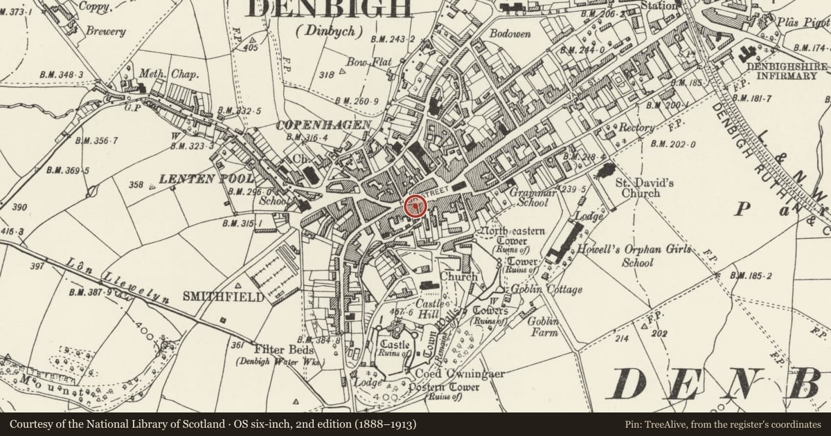
5 historical maps cover this location, the earliest the 1608 map "(13) Cambriae Typus." (David Rumsey Map Collection, Stanford Libraries).
Historical maps covering this location
- 1608 · (13) Cambriae Typus. (David Rumsey Map Collection, Stanford Libraries)
- 1795 · To Sir Watkin Williams-Wynn Bart ... the map of the six counties of North Wales is most… (Llyfrgell Genedlaethol Cymru – The National Library of Wales)
- 1830 · V.3:11-15:XV. Britisches Reich. A. Kon: England. b. Frstenthum Wales: Shire: 37-40 (David Rumsey Map Collection, Stanford Libraries)
- 1883 · Watershed map England, Wales 3. (David Rumsey Map Collection, Stanford Libraries)
- 1901 · Sheet 9 and 10. (David Rumsey Map Collection, Stanford Libraries)
Cadw's description
Location
On the street-line adjacent to the Old Vaults PH.
History
Third-quarter C19 house and shop, perhaps with earlier origins; modern shop front.
The building occupies an important burgage plot in the principal street of the town.
Exterior
Tall gabled building of 4 storeys. Of red/brown brick construction with slate roof; deep verges with decorative, pierced bargeboards and central spike finial. The ground floor shop front is modern; central entrance. The first floor has a canted wooden oriel bay with marginal glazing to plain sashes; lead roof. Two plain Victorian sashes to each of the second and third floors, with cambered heads and projecting stone sills.
Interior
The interior was not inspected at the time of survey.
Reason for designation
Listed for its special interest as a late C19 building retaining good original facade and occupying an important burgage plot in the principal street of the town.
Group value with other listed items in High Street.
Nearby in the register
- The Flower BasketCommercialunder 1 mi
- The Old Vaults PHCommercialunder 1 mi
- Boots PharmacyCommercialunder 1 mi
- The Star Shop (Halifax Building Society)Commercialunder 1 mi
Other entries of the same register within about three miles of this one, by straight line.