Cof Cymru: National Historic Assets of Wales · Wales
Former Manse at Capel Mawr
Denbigh, Denbighshire, Wales
A Grade II listed building in Denbigh - Town, Denbigh, Denbighshire, designated on 20 July 2000.
The record
- Designation
- Listed building, Grade II
- Broad class
- Religious, Ritual and Funerary
- Date of designation
- 20 July 2000
- Locality
- Denbigh - Town
- Community
- Denbigh
- Unitary authority
- Denbighshire
- Country
- Wales
- Coordinates
- 53.18494, -3.41925
- Cadw reference
- 23571
Slide toward Today to fade the historical sheet and see the modern map underneath.
David Rumsey Map Collection, Stanford LibrariesLlyfrgell Genedlaethol Cymru – The National Library of WalesDavid Rumsey Map Collection, Stanford LibrariesDavid Rumsey Map Collection, Stanford LibrariesDavid Rumsey Map Collection, Stanford Libraries
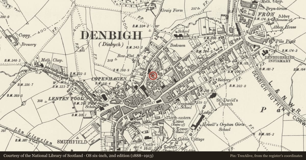
5 historical maps cover this location, the earliest the 1608 map "(13) Cambriae Typus." (David Rumsey Map Collection, Stanford Libraries).
Historical maps covering this location
- 1608 · (13) Cambriae Typus. (David Rumsey Map Collection, Stanford Libraries)
- 1795 · To Sir Watkin Williams-Wynn Bart ... the map of the six counties of North Wales is most… (Llyfrgell Genedlaethol Cymru – The National Library of Wales)
- 1830 · V.3:11-15:XV. Britisches Reich. A. Kon: England. b. Frstenthum Wales: Shire: 37-40 (David Rumsey Map Collection, Stanford Libraries)
- 1883 · Watershed map England, Wales 3. (David Rumsey Map Collection, Stanford Libraries)
- 1901 · Sheet 9 and 10. (David Rumsey Map Collection, Stanford Libraries)
Cadw's description
Location
Set back slightly from the road within, and to the R of, the chapel's railed forecourt, a little in advance of the adjacent chapel.
History
Manse built to serve Capel Mawr probably c1880 at which time the chapel itself was rebuilt.
Exterior
L-shaped manse of 2 storeys; of rubble construction, with facade of squared, quarry-dressed and roughly-coursed limestone with smooth dressings; slate roof with tiled ridge, deep verges and moulded bargeboards. The entrance is in the recessed right-hand section and has a slated canopy porch on supporting brackets; 6-panel door, the upper panels glazed. Above this is a plain sash. The advanced, gabled section to the L has two 6-pane, unhorned sashes with projecting sills and plain lintels. A rubble wall runs a short distance towards the street immediately to the R of the entrance, flush with the building's end gable. This joins the forecourt railings.
Interior
The interior was not inspected at the time of survey.
Reason for designation
Listed as forming part of the imposing late C19 chapel group at Capel Mawr.
Nearby in the register
- 23 Chapel StreetDomesticunder 1 mi
- 21 Chapel StreetDomesticunder 1 mi
- 19 Chapel StreetDomesticunder 1 mi
- Capel Mawr including associated School-room and forecourt railingsReligious, Ritual and Funeraryunder 1 mi
Other entries of the same register within about three miles of this one, by straight line.