Cof Cymru: National Historic Assets of Wales · Wales
Lime Kiln
Ilston, Swansea, Wales
A Grade II listed building in Lunnon, Swansea, Ilston, designated on 19 July 2000.
The record
- Designation
- Listed building, Grade II
- Broad class
- Industrial
- Date of designation
- 19 July 2000
- Locality
- Lunnon
- Town
- Swansea
- Community
- Ilston
- Unitary authority
- Swansea
- Country
- Wales
- Coordinates
- 51.58992, -4.10120
- Cadw reference
- 23543
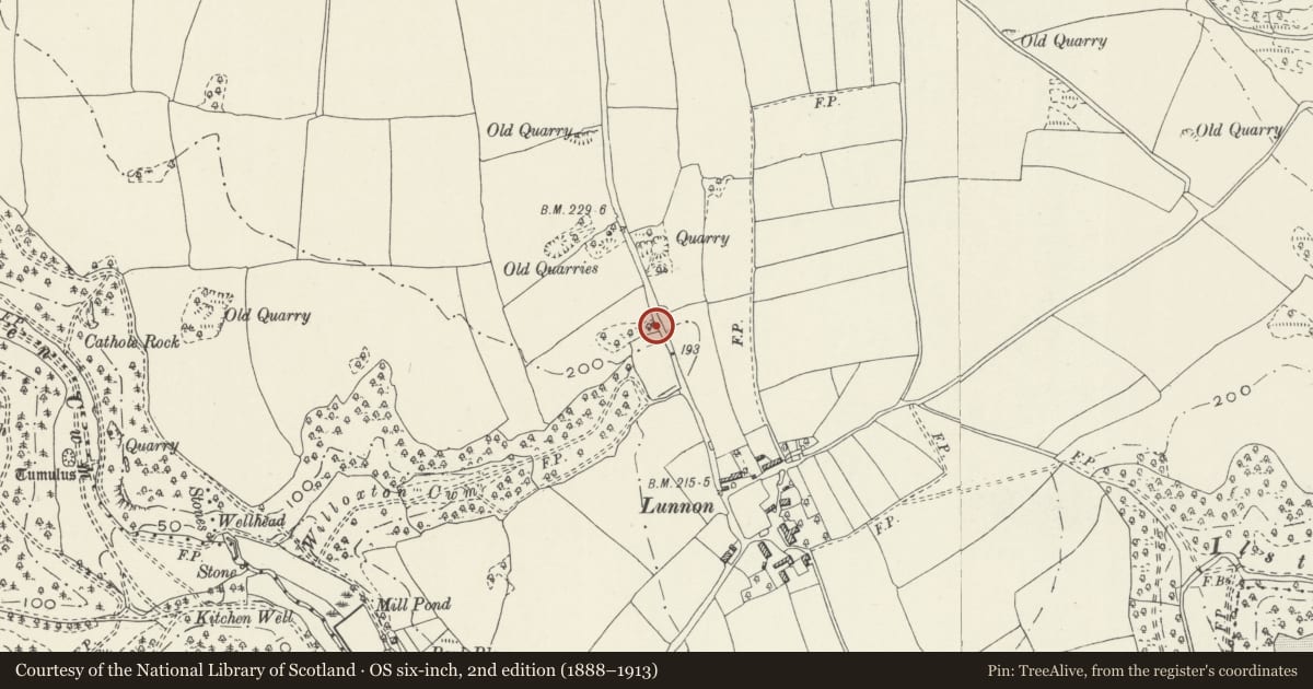
Slide toward Today to fade the historical sheet and see the modern map underneath.
David Rumsey Map Collection, Stanford LibrariesDavid Rumsey Map Collection, Stanford LibrariesDavid Rumsey Map Collection, Stanford LibrariesDavid Rumsey Map Collection, Stanford LibrariesDavid Rumsey Map Collection, Stanford Libraries
5 historical maps cover this location, the earliest the 1636 map "Cornubia : Devonia, Somersetus, Dorcestria, Wiltonia, Glocestria ..." (David Rumsey Map Collection, Stanford Libraries).
Historical maps covering this location
- 1636 · Cornubia : Devonia, Somersetus, Dorcestria, Wiltonia, Glocestria ... (David Rumsey Map Collection, Stanford Libraries)
- 1865 · England and Wales. England No. 6. (David Rumsey Map Collection, Stanford Libraries)
- 1891 · Sheet 10. Ordnance Survey of England and Wales. . (David Rumsey Map Collection, Stanford Libraries)
- 1897 · 247 Swansea (Hills) (David Rumsey Map Collection, Stanford Libraries)
- 1920 · Sheet 100. Llanelly. (David Rumsey Map Collection, Stanford Libraries)
Cadw's description
Location
At the roadside about 100 m north of the hamlet of Lunnon, on the road towards Pengwern Common.
History
This limekiln appears on the 1877 Ordnance Survey map but appears as 'old limekiln' on the map revision of 1913.
Exterior
A well preserved and conserved limekiln about 3m high consisting of local uncoursed axe-dressed limestone, with a bow-shaped front and the ground ramped up to its rear. There is one working recess, the sides of which are vertical, the face over the drawhole being corbelled out. The working recess is roofed by a stone arch of segmental shape and about 2m span, slightly tapering inwards. The floor of the working recess is paved in flagstones.
Steps have been formed at the north side to give access to the platform.
Interior
The lining of the kiln is in thin courses of sandstone and is intact and visible for the full height, and rises about ½m above the kiln platform level in places.
Reason for designation
A well-preserved limekiln of middling size, characteristic of the mid C19 local limeburning industry.
Nearby in the register
- Village PoundAgriculture and Subsistenceunder 1 mi
- Big House FarmhouseAgriculture and Subsistenceunder 1 mi
- Park Mill with Miller's House, Carpenters Shops and SmithyIndustrialunder 1 mi
- Parc le Breos Limekiln and QuarriesLimekilnunder 1 mi
Other entries of the same register within about three miles of this one, by straight line.