Cof Cymru: National Historic Assets of Wales · Wales
Group of Three Chest Tombs at the Church of St Sadwrn
Henllan, Denbighshire, Wales
A Grade II listed building in Henllan, Denbighshire, designated on 29 June 2000.
The record
- Designation
- Listed building, Grade II
- Broad class
- Religious, Ritual and Funerary
- Date of designation
- 29 June 2000
- Locality
- Henllan
- Community
- Henllan
- Unitary authority
- Denbighshire
- Country
- Wales
- Coordinates
- 53.20169, -3.46484
- Cadw reference
- 23519
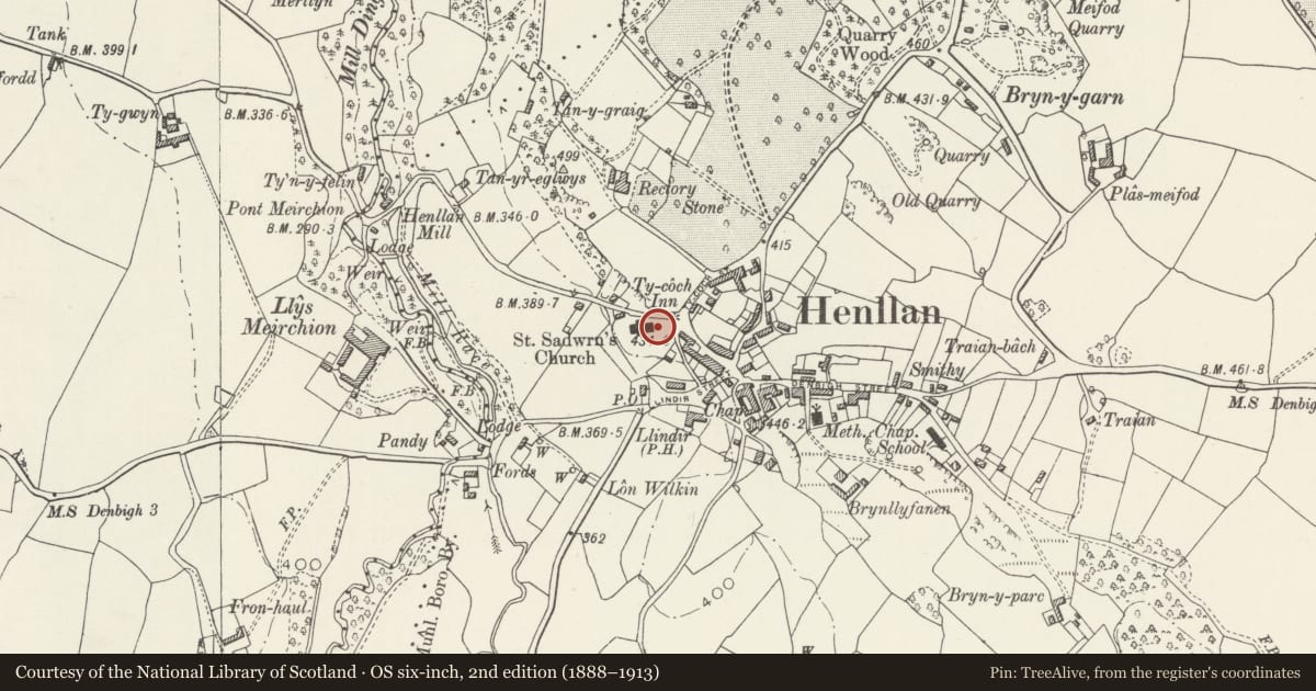
Slide toward Today to fade the historical sheet and see the modern map underneath.
David Rumsey Map Collection, Stanford LibrariesDavid Rumsey Map Collection, Stanford LibrariesLlyfrgell Genedlaethol Cymru – The National Library of WalesDavid Rumsey Map Collection, Stanford LibrariesDavid Rumsey Map Collection, Stanford Libraries
5 historical maps cover this location, the earliest the 1608 map "(13) Cambriae Typus." (David Rumsey Map Collection, Stanford Libraries).
Historical maps covering this location
- 1608 · (13) Cambriae Typus. (David Rumsey Map Collection, Stanford Libraries)
- 1795 · To Sir Watkin Williams-Wynn Bart ... the map of the six counties of North Wales is most… (Llyfrgell Genedlaethol Cymru – The National Library of Wales)
- 1830 · V.3:11-15:XV. Britisches Reich. A. Kon: England. b. Frstenthum Wales: Shire: 37-40 (David Rumsey Map Collection, Stanford Libraries)
- 1883 · Watershed map England, Wales 3. (David Rumsey Map Collection, Stanford Libraries)
- 1901 · Sheet 9 and 10. (David Rumsey Map Collection, Stanford Libraries)
Cadw's description
Location
Adjoining the E gable of the Church.
Exterior
Group of three C17 chest tombs. These are of sandstone and have heavy rectangular tombstones with Latin inscriptions, the outer ones with raised lettering. That to the L is the tomb of Hugh Peake of Perthewig, d.1601; that to the centre is to William Vaughan, d.1661, and that to the R is the tomb of Agnes Peake (wife of Hugh of Perthewig), d.1618. All 3 have secondary, mid-C18 inscriptions (incised).
Reason for designation
Listed as a fine and scarce series of C17 chest tombs.
Group value with other listed items at the Church of St Sadwrn.
Nearby in the register
- Group of Four Mausolea at the Church of St SadwrnReligious, Ritual and Funeraryunder 1 mi
- Parish Church of St Sadwrn including adjacent Cross ShaftReligious, Ritual and Funeraryunder 1 mi
- Detached Belfry Tower at the Church of St SadwrnReligious, Ritual and Funeraryunder 1 mi
- Churchyard Walls and Lychgate at the Church of St SadwrnReligious, Ritual and Funeraryunder 1 mi
Other entries of the same register within about three miles of this one, by straight line.