Cof Cymru: National Historic Assets of Wales · Wales
Cowhouse to east of Blaen-y-nant
Llandygai, Gwynedd, Wales
A Grade II listed building in Nant Francon, Bangor, Llandygai, Gwynedd, designated on 24 May 2000.
The record
- Designation
- Listed building, Grade II
- Broad class
- Agriculture and Subsistence
- Date of designation
- 24 May 2000
- Locality
- Nant Francon
- Town
- Bangor
- Community
- Llandygai
- Unitary authority
- Gwynedd
- Country
- Wales
- Coordinates
- 53.12720, -4.02774
- Cadw reference
- 23455
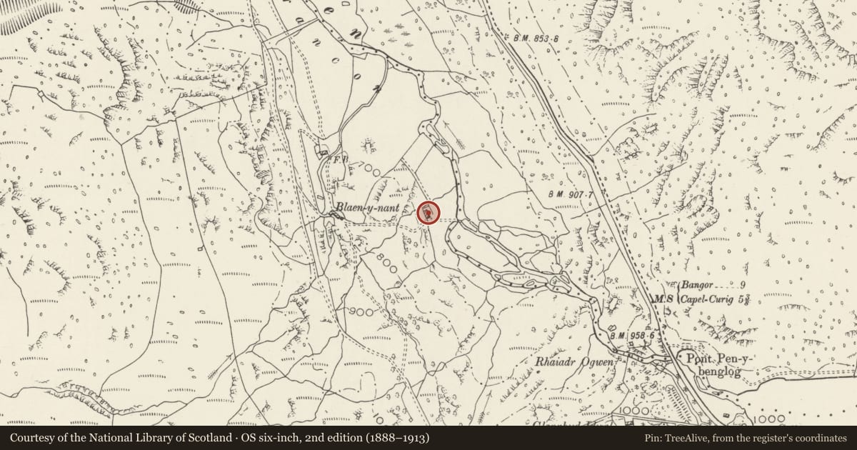
Slide toward Today to fade the historical sheet and see the modern map underneath.
David Rumsey Map Collection, Stanford LibrariesDavid Rumsey Map Collection, Stanford LibrariesDavid Rumsey Map Collection, Stanford LibrariesDavid Rumsey Map Collection, Stanford LibrariesDavid Rumsey Map Collection, Stanford Libraries
5 historical maps cover this location, the earliest the 1896 map "Sheet 7. Ordnance Survey of England and Wales." (David Rumsey Map Collection, Stanford Libraries).
Historical maps covering this location
- 1896 · Sheet 7. Ordnance Survey of England and Wales. (David Rumsey Map Collection, Stanford Libraries)
- 1899 · 106 Bangor (Hills) (David Rumsey Map Collection, Stanford Libraries)
- 1899 · 106 Bangor (Outline) (David Rumsey Map Collection, Stanford Libraries)
- 1901 · Sheet 9 and 10. (David Rumsey Map Collection, Stanford Libraries)
- 1919 · Sheet 41. Anglesey. (David Rumsey Map Collection, Stanford Libraries)
Cadw's description
Location
Located in isolated position approximately 180m east of the farmhouse at Blaen-y-nant on the western side of the Afon Ogwen in the Nant Ffrancon valley below the A 5; low rubblestone wall protects east side of the cowhouse.
History
Built in the mid-C19 as a field cowhouse, probably originally associated with the roughly contemporary farmhouse at Blaen-y-nant (not included on this list). The cowhouse is a good example of a once common regional farmbuilding type, the detached cowhouse standing on its own in fields.
Exterior
Rectangular plan, aligned roughly north-south. Roughly coursed rubblestone; slate roof with coped verges. Eastern (entrance) side has 3 evenly-spaced doors and small window to left; boarded hatch to hayloft in south gable end.
Interior
Interior not inspected at time of Survey.
Reason for designation
Listed as a well-preserved example of a mid-C19 field cowhouse, a characteristic farmbuilding type of the region and period, which forms a distinctive feature in the landscape.
Nearby in the register
- The Holyhead Road: the Ogwen PassRoadunder 1 mi
- Nant Ffrancon Anti-invasion DefencesAnti Invasion Defence Siteunder 1 mi
- Telford Milestone (34)Transportunder 1 mi
- Pont Pen-y-benglogTransportunder 1 mi
Other entries of the same register within about three miles of this one, by straight line.