Cof Cymru: National Historic Assets of Wales · Wales
Cowhouse/Stables at Dinas
Llandygai, Gwynedd, Wales
A Grade II listed building in Tregarth, Llandygai, Gwynedd, designated on 24 May 2000.
The record
- Designation
- Listed building, Grade II
- Broad class
- Agriculture and Subsistence
- Date of designation
- 24 May 2000
- Locality
- Tregarth
- Community
- Llandygai
- Unitary authority
- Gwynedd
- Country
- Wales
- Coordinates
- 53.19541, -4.08520
- Cadw reference
- 23387
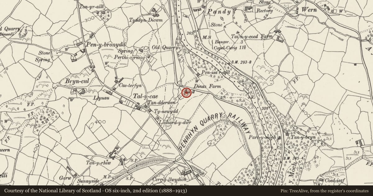
Slide toward Today to fade the historical sheet and see the modern map underneath.
David Rumsey Map Collection, Stanford LibrariesDavid Rumsey Map Collection, Stanford LibrariesDavid Rumsey Map Collection, Stanford LibrariesDavid Rumsey Map Collection, Stanford LibrariesDavid Rumsey Map Collection, Stanford Libraries
5 historical maps cover this location, the earliest the 1896 map "Sheet 7. Ordnance Survey of England and Wales." (David Rumsey Map Collection, Stanford Libraries).
Historical maps covering this location
- 1896 · Sheet 7. Ordnance Survey of England and Wales. (David Rumsey Map Collection, Stanford Libraries)
- 1899 · 106 Bangor (Hills) (David Rumsey Map Collection, Stanford Libraries)
- 1899 · 106 Bangor (Outline) (David Rumsey Map Collection, Stanford Libraries)
- 1901 · Sheet 9 and 10. (David Rumsey Map Collection, Stanford Libraries)
- 1919 · Sheet 41. Anglesey. (David Rumsey Map Collection, Stanford Libraries)
Cadw's description
Location
Located immediately to the east of Pen Dinas Farmhouse; cobbled yards between it and the farmhouse and between it and the barn to the east.
History
Contemporary with the farmhouse at Pen Dinas Farm, and an example of the Penrhyn Estate's programme of farm improvement, in this case dating from the mid-C19.
Exterior
Cowhouse/stables at right-angles to road. Constructed of roughly coursed rubblestone with hipped slate roof and lower range to west parallel with road, also under hipped slate roof. North end wall of main range has wide segmental-headed doorway with double doors to road and 2 eaves windows; low rubblestone wall to yard attached to north-east corner. Entrances in angle between ranges onto yard facing farmhouse.
Interior
Interior not inspected at time of Survey.
Reason for designation
Included as the mid-C19 cowhouse/stables of an essentially unaltered small estate farm of the simple 'vernacular revival' style particularly favoured by the Penrhyn Estate in the decades immediately after c1850; forms a good group with the adjoining farmhouse and hay barn.
Nearby in the register
- Hay Barn at DinasAgriculture and Subsistenceunder 1 mi
- Dinas FarmhouseDomesticunder 1 mi
- Telford Milestone (28)Transportunder 1 mi
- 5 Tal GaeDomesticunder 1 mi
Other entries of the same register within about three miles of this one, by straight line.