Cof Cymru: National Historic Assets of Wales · Wales
Former Stables at Plas y Coed
Llandygai, Gwynedd, Wales
A Grade II listed building in Penrhyn Park, Llandygai, Gwynedd, designated on 24 May 2000.
The record
- Designation
- Listed building, Grade II
- Broad class
- Agriculture and Subsistence
- Date of designation
- 24 May 2000
- Locality
- Penrhyn Park
- Community
- Llandygai
- Unitary authority
- Gwynedd
- Country
- Wales
- Coordinates
- 53.23058, -4.10838
- Cadw reference
- 23371
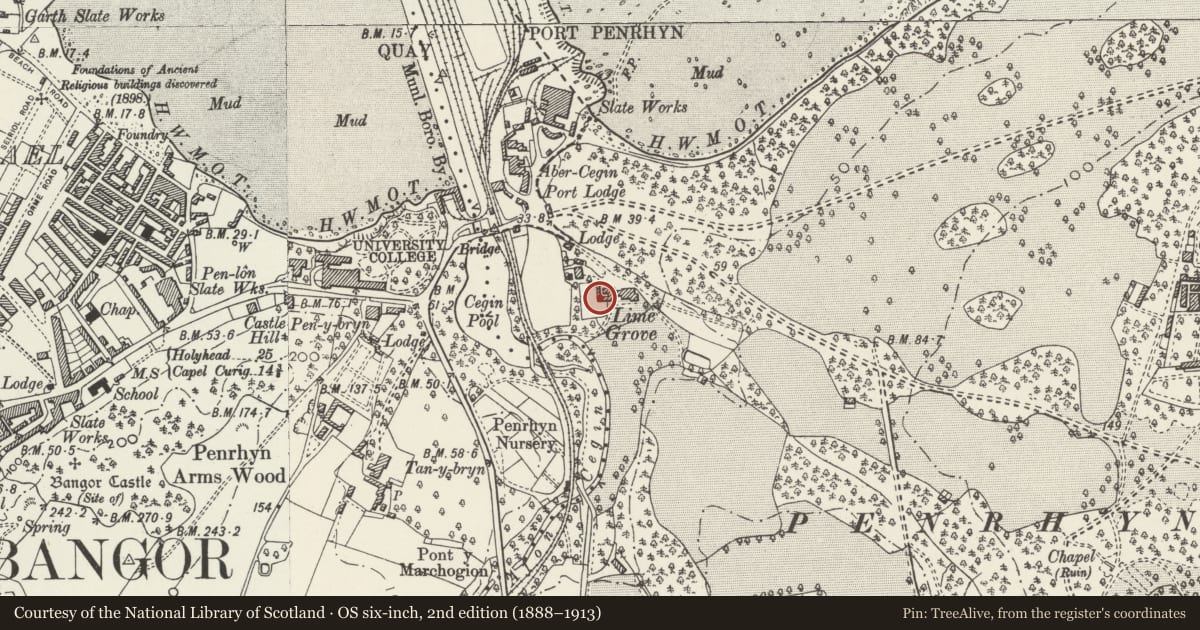
Slide toward Today to fade the historical sheet and see the modern map underneath.
David Rumsey Map Collection, Stanford LibrariesDavid Rumsey Map Collection, Stanford LibrariesDavid Rumsey Map Collection, Stanford LibrariesDavid Rumsey Map Collection, Stanford LibrariesDavid Rumsey Map Collection, Stanford Libraries
5 historical maps cover this location, the earliest the 1896 map "Sheet 7. Ordnance Survey of England and Wales." (David Rumsey Map Collection, Stanford Libraries).
Historical maps covering this location
- 1896 · Sheet 7. Ordnance Survey of England and Wales. (David Rumsey Map Collection, Stanford Libraries)
- 1899 · 106 Bangor (Outline) (David Rumsey Map Collection, Stanford Libraries)
- 1899 · 106 Bangor (Hills) (David Rumsey Map Collection, Stanford Libraries)
- 1901 · Sheet 9 and 10. (David Rumsey Map Collection, Stanford Libraries)
- 1919 · Sheet 41. Anglesey. (David Rumsey Map Collection, Stanford Libraries)
Cadw's description
Location
Attached to west end of house at Plas y Coed forming small U-shaped courtyard.
History
Stables built contemporaneously with the house at Plas y Coed. Range in front of courtyard on west side added in late C20.
Exterior
Single-storey ranges of building forming U-plan around small courtyard. Snecked rubblestone; hipped slate roof. Centre range has boarded opening to front with conical ventilator to left on ridge; similar ventilator to front of east range. West range has one doorway (to left), 2 windows with stone cill and integral lateral stack to east wall. Gate piers to inner front corners of east and west ranges, former truncated, latter retaining moulded stone cap. West range extended to north of original courtyard.
Interior
Interior not inspected at time of Survey.
Reason for designation
Included as an integral part of the late C19 house at Plas y Coed with which it has strong group value.
Nearby in the register
- Plas y CoedDomesticunder 1 mi
- Cegin Viaduct (Penrhyn Railroad)Viaductunder 1 mi
- Port LodgeDomesticunder 1 mi
- Parapet/Boundary Walls on Port Lodge approach to Penrhyn CastleGardens, Parks and Urban Spacesunder 1 mi
Other entries of the same register within about three miles of this one, by straight line.