Cof Cymru: National Historic Assets of Wales · Wales
Ty-bont, with Post Office and General Stores
Pennal, Gwynedd, Wales
A Grade II listed building in Pennal, Machynlleth, Gwynedd, designated on 25 May 2000.
The record
- Designation
- Listed building, Grade II
- Broad class
- Commercial
- Date of designation
- 25 May 2000
- Locality
- Pennal
- Town
- Machynlleth
- Community
- Pennal
- Unitary authority
- Gwynedd
- Country
- Wales
- Coordinates
- 52.58570, -3.92188
- Cadw reference
- 23337
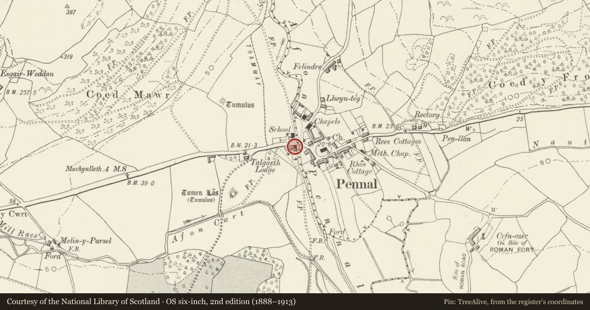
Slide toward Today to fade the historical sheet and see the modern map underneath.
David Rumsey Map Collection, Stanford LibrariesDavid Rumsey Map Collection, Stanford LibrariesDavid Rumsey Map Collection, Stanford LibrariesLlyfrgell Genedlaethol Cymru – The National Library of WalesDavid Rumsey Map Collection, Stanford Libraries
5 historical maps cover this location, the earliest the 1795 map "To Sir Watkin Williams-Wynn Bart ... the map of the six counties of North Wales is most humbly inscribed by his obedient humble servant" (Llyfrgell Genedlaethol Cymru – The National Library of Wales).
Historical maps covering this location
- 1795 · To Sir Watkin Williams-Wynn Bart ... the map of the six counties of North Wales is most… (Llyfrgell Genedlaethol Cymru – The National Library of Wales)
- 1830 · V.3:11-15:XV. Britisches Reich. A. Kon: England. b. Frstenthum Wales: Shire: 37-40 (David Rumsey Map Collection, Stanford Libraries)
- 1883 · Watershed map England, Wales 3. (David Rumsey Map Collection, Stanford Libraries)
- 1896 · Sheet 7. Ordnance Survey of England and Wales. (David Rumsey Map Collection, Stanford Libraries)
- 1901 · Sheet 9 and 10. (David Rumsey Map Collection, Stanford Libraries)
Cadw's description
Location
The building stands on the W bank of the river by the bridge, and on the S side of the main Machynlleth to Aberdovey road, at the centre of Pennal.
History
Built in the later C19 as a purpose-built shop and dwelling, and probably refronted in c1900.
Exterior
Built of rubble with a slate roof. A building of two storeys, double depth plan, the shop occupying the left half of the building. Shop front of c1900, symmetrical, with a recessed central entrance between plate glass windows and end pilasters, the heads bracketed out to carry the cornice. Black fascia, glazed, with gold lettering reading GROCER/DRAPER. The entrance is a wide partly glazed door and overlight. Below the windows are buff glazed tiles with a floral pattern. On the first floor, a single 12-pane sash window. The right half of the building contains the residence, the shop front continuing as a porch over the entrance to similar bracketed pilaster. Panelled reveals to a 4-panelled half-glazed door and overlight. A single uPVC window to the right on the ground floor and two on the first floor. Slate sills. The building extends to the rear with a single storey and attic outbuilding.
Interior
The interior of the shop has been modernised.
Reason for designation
Included as a good traditional type of village building retaining a fine late C19 shop front, of group value at the centre of the village of Pennal.
Nearby in the register
- Pont PennalTransportunder 1 mi
- Riverside HotelCommercialunder 1 mi
- Telephone Call-boxCommunicationsunder 1 mi
- Addoldy MC Pennal, including front yard and railings (Methodist Chapel)Religious, Ritual and Funeraryunder 1 mi
Other entries of the same register within about three miles of this one, by straight line.