Cof Cymru: National Historic Assets of Wales · Wales
Granary at Ty'n y Cellar
Margam, Neath Port Talbot, Wales
A Grade II listed building in Water Street, Port Talbot, Margam, Neath Port Talbot, designated on 25 April 2000.
The record
- Designation
- Listed building, Grade II
- Broad class
- Agriculture and Subsistence
- Date of designation
- 25 April 2000
- Locality
- Water Street
- Town
- Port Talbot
- Community
- Margam
- Unitary authority
- Neath Port Talbot
- Country
- Wales
- Coordinates
- 51.53724, -3.72614
- Cadw reference
- 23289
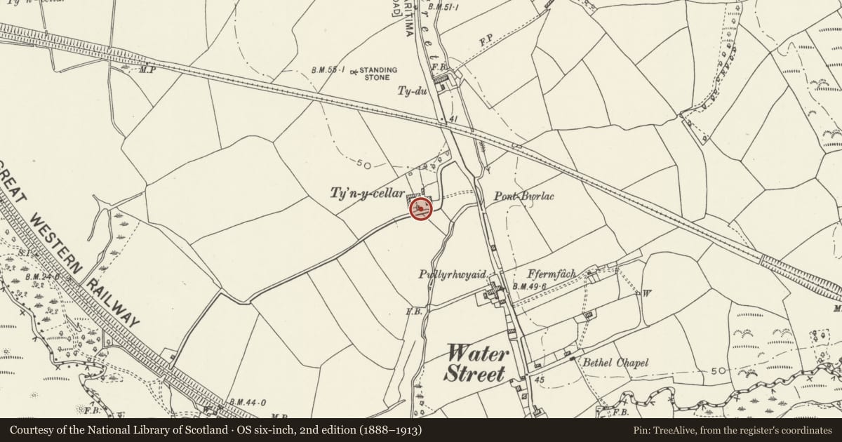
Slide toward Today to fade the historical sheet and see the modern map underneath.
David Rumsey Map Collection, Stanford LibrariesDavid Rumsey Map Collection, Stanford LibrariesDavid Rumsey Map Collection, Stanford LibrariesDavid Rumsey Map Collection, Stanford LibrariesNational Library of Scotland
5 historical maps cover this location, the earliest the 1636 map "Cornubia : Devonia, Somersetus, Dorcestria, Wiltonia, Glocestria ..." (David Rumsey Map Collection, Stanford Libraries).
Historical maps covering this location
- 1636 · Cornubia : Devonia, Somersetus, Dorcestria, Wiltonia, Glocestria ... (David Rumsey Map Collection, Stanford Libraries)
- 1637 · The fourth table of England. Cornub. Devonia, Somerset etc. (David Rumsey Map Collection, Stanford Libraries)
- 1865 · England and Wales. England No. 6. (David Rumsey Map Collection, Stanford Libraries)
- 1907 · 248 Pontypridd (Hills) (David Rumsey Map Collection, Stanford Libraries)
- 1930 · OS Popular Edition 1919-1947 (National Library of Scotland)
Cadw's description
Location
Part of the farm complex at Ty'n y Cellar. The S gable end of the range faces the lane which leads to Kenfig industrial estate. The house is to the E.
History
Constructed between 1876 and 1897 as part of a remodelling of Ty'n y Cellar farm.
Exterior
Two-storey 3-bay cart shed and granary of snecked rock-faced stone under a pan-tile roof. Orientated N-S, the front facing E. Three full-height openings to the lower storey under a continuous lintel. The R bay is divided off by a partition wall. The upper storey has 3 loft hatch openings under segmental voussoir heads, boarded below and glazed above. External stone steps rise up against the N gable end with a planked door under a stone voussoir head leading into the loft. No openings to S gable end or W wall.
Interior
The lower storey is open; no access to loft.
Reason for designation
Listed as an unaltered component of a planned Victorian farm. Group value with house and other farm buildings at Ty'n y Cellar.
Nearby in the register
- Cart Shed, Stable and Cow-House at Ty'n y CellarAgriculture and Subsistenceunder 1 mi
- Ty'n y Cellar and adjoining BarnDomesticunder 1 mi
- Former Cow-house at Ty'n y CellarAgriculture and Subsistenceunder 1 mi
- Ty'n-y-Cellar Standing StoneStanding Stoneunder 1 mi
Other entries of the same register within about three miles of this one, by straight line.