Cof Cymru: National Historic Assets of Wales · Wales
Milepost at Tollgate Park
Margam, Neath Port Talbot, Wales
A Grade II listed building in Tollgate Park, Port Talbot, Margam, Neath Port Talbot, designated on 25 April 2000.
The record
- Designation
- Listed building, Grade II
- Broad class
- Transport
- Date of designation
- 25 April 2000
- Locality
- Tollgate Park
- Town
- Port Talbot
- Community
- Margam
- Unitary authority
- Neath Port Talbot
- Country
- Wales
- Coordinates
- 51.57113, -3.75588
- Cadw reference
- 23284
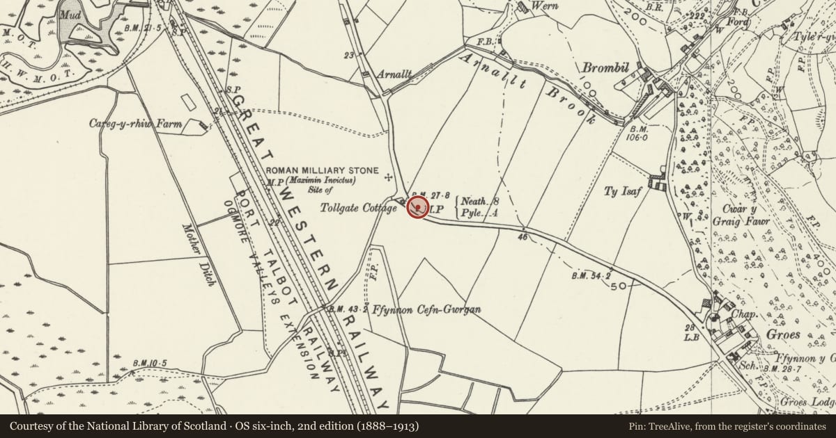
Slide toward Today to fade the historical sheet and see the modern map underneath.
David Rumsey Map Collection, Stanford LibrariesDavid Rumsey Map Collection, Stanford LibrariesDavid Rumsey Map Collection, Stanford LibrariesDavid Rumsey Map Collection, Stanford LibrariesNational Library of Scotland
5 historical maps cover this location, the earliest the 1636 map "Cornubia : Devonia, Somersetus, Dorcestria, Wiltonia, Glocestria ..." (David Rumsey Map Collection, Stanford Libraries).
Historical maps covering this location
- 1636 · Cornubia : Devonia, Somersetus, Dorcestria, Wiltonia, Glocestria ... (David Rumsey Map Collection, Stanford Libraries)
- 1637 · The fourth table of England. Cornub. Devonia, Somerset etc. (David Rumsey Map Collection, Stanford Libraries)
- 1865 · England and Wales. England No. 6. (David Rumsey Map Collection, Stanford Libraries)
- 1891 · Sheet 10. Ordnance Survey of England and Wales. . (David Rumsey Map Collection, Stanford Libraries)
- 1930 · OS Popular Edition 1919-1947 (National Library of Scotland)
Cadw's description
Location
Located immediately outside Tollgate Park against the boundary fence.
History
One of a group of mileposts in Gothic style, associated with the turnpiking of the A48. This milepost is not in its original position, and was moved from a roundabout on the site of Tollgate Park.
Exterior
Ornate cast iron milepost, painted white with black lettering and detail. Square base supporting a rear upright with pointed arched head with mouldings, imposts and keystone. In front, the base supports a low domed section with round-headed front face, above which are 2 tall faces with pointed arched heads each set at an angle of 45 degrees. The arches have raised mouldings.
Underneath the rear arch, the milepost reads 'Bridgend District'. The angled faces point in opposite directions, one reading 'To Pyle 4' and the other 'To Neath 8'. Underneath the round arch is the lettering 'London 187'. The square base has a raised border within which 'Margam Parish' is written in relief. A raised tablet at the bottom (unpainted) reads '1841'.
Reason for designation
Listed for its historic interest as a characteristic feature of turnpike roads, and in an unusually ornate Gothic style. Group value with other mileposts on this section of the A48.
Nearby in the register
- Beulah Calvinistic Methodist ChapelReligious, Ritual and Funeraryunder 1 mi
- Gates, Piers and Railings at Beulah ChapelReligious, Ritual and Funeraryunder 1 mi
- Vestry at Beulah ChapelReligious, Ritual and Funeraryunder 1 mi
- Chain Home Low Radar Station, MargamRadar Stationunder 1 mi
Other entries of the same register within about three miles of this one, by straight line.