Cof Cymru: National Historic Assets of Wales · Wales
Miller's House, Llanrhidian Lower Mill
Llanrhidian Lower, Swansea, Wales
A Grade II listed building in Llanrhidian village, Swansea, Llanrhidian Lower, designated on 20 April 2000.
The record
- Designation
- Listed building, Grade II
- Broad class
- Domestic
- Date of designation
- 20 April 2000
- Locality
- Llanrhidian village
- Town
- Swansea
- Community
- Llanrhidian Lower
- Unitary authority
- Swansea
- Country
- Wales
- Coordinates
- 51.61019, -4.17308
- Cadw reference
- 23226
Slide toward Today to fade the historical sheet and see the modern map underneath.
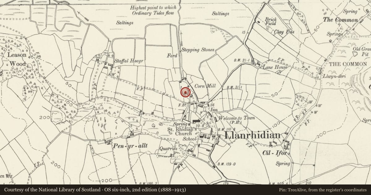
David Rumsey Map Collection, Stanford LibrariesDavid Rumsey Map Collection, Stanford LibrariesDavid Rumsey Map Collection, Stanford LibrariesDavid Rumsey Map Collection, Stanford LibrariesDavid Rumsey Map Collection, Stanford Libraries
5 historical maps cover this location, the earliest the 1636 map "Cornubia : Devonia, Somersetus, Dorcestria, Wiltonia, Glocestria ..." (David Rumsey Map Collection, Stanford Libraries).
Historical maps covering this location
- 1636 · Cornubia : Devonia, Somersetus, Dorcestria, Wiltonia, Glocestria ... (David Rumsey Map Collection, Stanford Libraries)
- 1865 · England and Wales. England No. 6. (David Rumsey Map Collection, Stanford Libraries)
- 1891 · Sheet 10. Ordnance Survey of England and Wales. . (David Rumsey Map Collection, Stanford Libraries)
- 1907 · 246 Worms Head (Hills) (David Rumsey Map Collection, Stanford Libraries)
- 1920 · Sheet 100. Llanelly. (David Rumsey Map Collection, Stanford Libraries)
Cadw's description
Location
At the north end of Llanrhidian village, to west of the millpond.
History
An early C19 miller's house, probably contemporary with the Lower Mill built in 1803.
Exterior
Two storey symmetrical-fronted house facing south. Uncoursed local limestone masonry with slate roof and tile ridge, rendered end-chimneys, low extension to rear. The house stands with its east gable a short distance from the mill pond. Three-window front elevation with central door. The upper windows are of sash type with six panes, with the eaves forming the heads. The lower windows are taller, also of sash type, with twelve panes and segmental brick arches. Replaced timber door beneath a similar segmental arch.
Reason for designation
An early C19 miller's house retaining its regional character, also listed for group value with the related mill and millpond.
Nearby in the register
- Retaining wall and pool of Llanrhidian Lower MillIndustrialunder 1 mi
- Llanrhidian Lower MillIndustrialunder 1 mi
- Parish Church of St Rhidian and St IlltydReligious, Ritual and Funeraryunder 1 mi
- Pillory in Llanrhidian Village formed from reputed ancient cross.Civilunder 1 mi
Other entries of the same register within about three miles of this one, by straight line.