Cof Cymru: National Historic Assets of Wales · Wales
Mile Marker
Llanfihangel-y-Pennant, Gwynedd, Wales
A Grade II listed building in Tal-y-llyn, Llanfihangel-y-Pennant, Gwynedd, designated on 10 April 2000.
The record
- Designation
- Listed building, Grade II
- Broad class
- Transport
- Date of designation
- 10 April 2000
- Locality
- Tal-y-llyn
- Community
- Llanfihangel-y-Pennant
- Unitary authority
- Gwynedd
- Country
- Wales
- Coordinates
- 52.66315, -3.92012
- Cadw reference
- 23193
Slide toward Today to fade the historical sheet and see the modern map underneath.
David Rumsey Map Collection, Stanford LibrariesDavid Rumsey Map Collection, Stanford LibrariesDavid Rumsey Map Collection, Stanford LibrariesLlyfrgell Genedlaethol Cymru – The National Library of WalesDavid Rumsey Map Collection, Stanford Libraries
5 historical maps cover this location, the earliest the 1795 map "To Sir Watkin Williams-Wynn Bart ... the map of the six counties of North Wales is most humbly inscribed by his obedient humble servant" (Llyfrgell Genedlaethol Cymru – The National Library of Wales).
Historical maps covering this location
- 1795 · To Sir Watkin Williams-Wynn Bart ... the map of the six counties of North Wales is most… (Llyfrgell Genedlaethol Cymru – The National Library of Wales)
- 1883 · Watershed map England, Wales 3. (David Rumsey Map Collection, Stanford Libraries)
- 1896 · Sheet 7. Ordnance Survey of England and Wales. (David Rumsey Map Collection, Stanford Libraries)
- 1899 · 149 Barmouth (Hills) (David Rumsey Map Collection, Stanford Libraries)
- 1901 · Sheet 9 and 10. (David Rumsey Map Collection, Stanford Libraries)
Cadw's description
Location
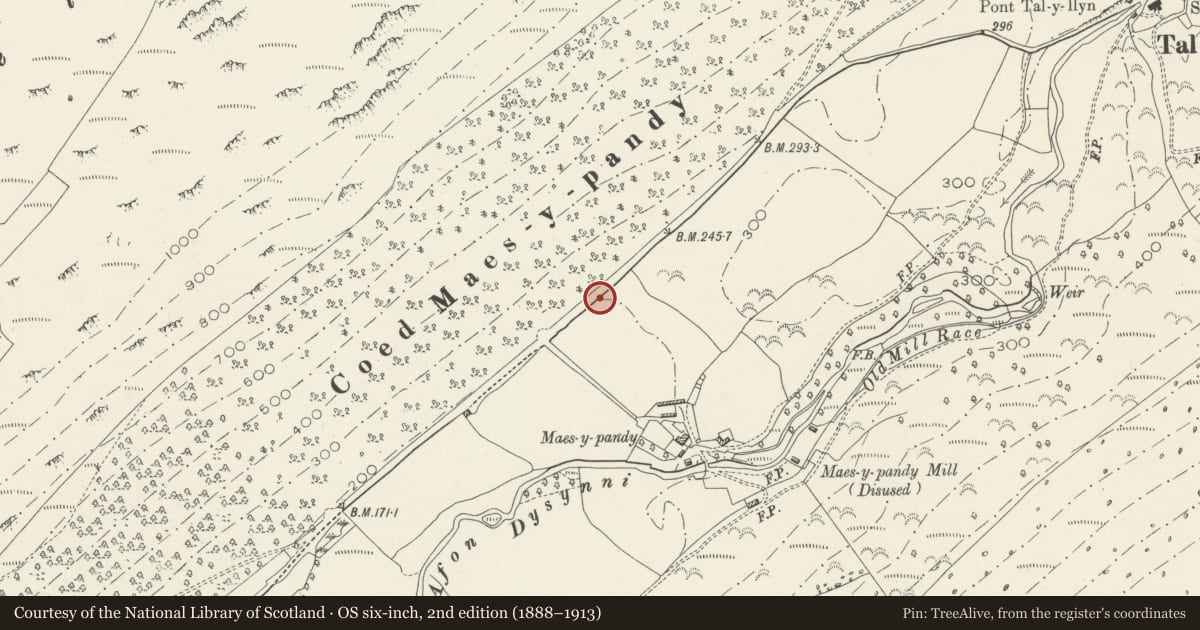
The mile marker is set in the verge NE of the farm road to Maes-y-Pandy farm.
History
The Merionethshire Turnpike Trust was first established in 1777, and had 5 districts, this route being in the Dolgellau & Mawddach area, which was absorbed into the larger Dolgelley Mawddwy and Towyn district in 1851, and was finally dissolved after 1875. The mile marker post was probably erected by the turnpike trust in c1827 when the route from Dolgellau to Towyn was remade .
Exterior
Made of cast iron, of triangular section rising from a moulded plinth to an enlarged top sloping back to an edge roll moulding. Raised cast lettering reading, on the left TOWYN / 9; on the right, DOLGELLEY / 11.
Reason for designation
Included as a good and well preserved example of the C19 cast iron mile markers of the type frequently used in the earlier decades of the C19; and one of the most complete series of such posts to survive.
Nearby in the register
- Bee boles at Maes-y-pandyAgriculture and Subsistenceunder 1 mi
- Maes-y-pandy FarmhouseDomesticunder 1 mi
- Yr ysgoldy at Maes-y-PandyEducationunder 1 mi
- Barn at Maes-y-pandyAgriculture and Subsistenceunder 1 mi
Other entries of the same register within about three miles of this one, by straight line.