Cof Cymru: National Historic Assets of Wales · Wales
Former Tredegar Arms Hotel and Lloyd's Bank (Yates's)
Stow Hill, Newport, Wales
A Grade II listed building in Stow Hill, Newport, designated on 31 March 2000.
The record
- Designation
- Listed building, Grade II
- Broad class
- Commercial
- Date of designation
- 31 March 2000
- Community
- Stow Hill
- Unitary authority
- Newport
- Country
- Wales
- Coordinates
- 51.58950, -2.99780
- Cadw reference
- 23138
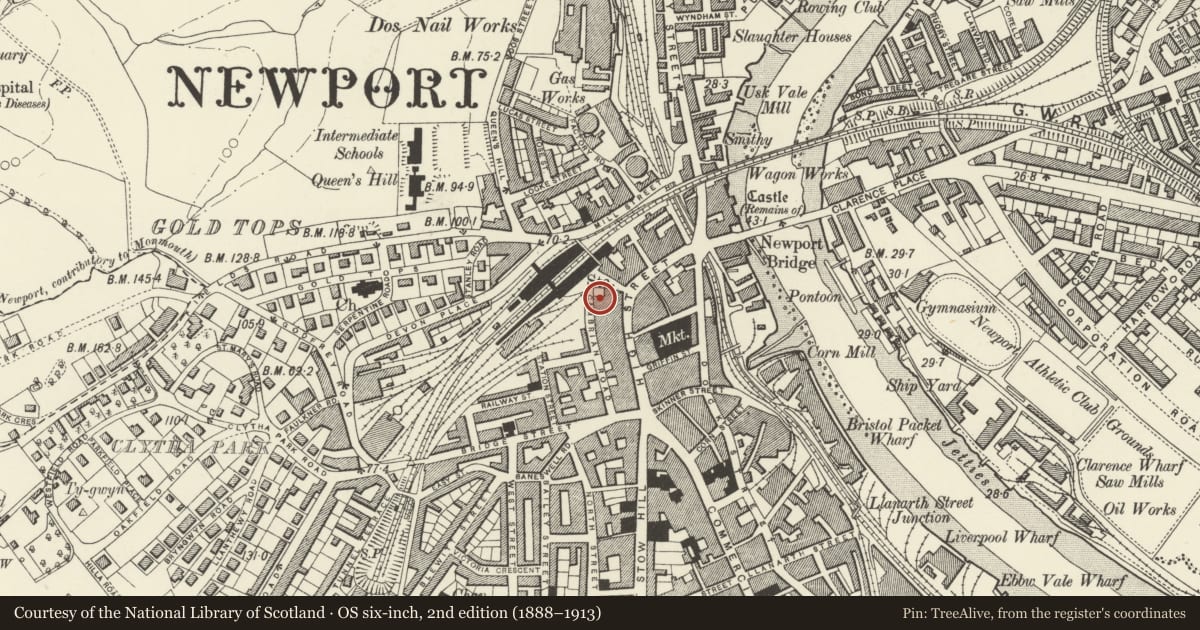
Slide toward Today to fade the historical sheet and see the modern map underneath.
David Rumsey Map Collection, Stanford LibrariesDavid Rumsey Map Collection, Stanford LibrariesDavid Rumsey Map Collection, Stanford LibrariesDavid Rumsey Map Collection, Stanford LibrariesDavid Rumsey Map Collection, Stanford Libraries
5 historical maps cover this location, the earliest the 1636 map "Cornubia : Devonia, Somersetus, Dorcestria, Wiltonia, Glocestria ..." (David Rumsey Map Collection, Stanford Libraries).
Historical maps covering this location
- 1636 · Cornubia : Devonia, Somersetus, Dorcestria, Wiltonia, Glocestria ... (David Rumsey Map Collection, Stanford Libraries)
- 1865 · England and Wales. England No. 6. (David Rumsey Map Collection, Stanford Libraries)
- 1895 · Sheet 11. Ordnance Survey of England and Wales. (David Rumsey Map Collection, Stanford Libraries)
- 1906 · 249 Newport (Hills) (David Rumsey Map Collection, Stanford Libraries)
- 1913 · Sheet 102. Newport. (David Rumsey Map Collection, Stanford Libraries)
Cadw's description
Location
On large convex site forming whole SW side of Station Approach. The block consists of 1-3 Station Approach , and 55 High Street.
History
Large commercial development, formerly Tredegar Arms Hotel; and bank. Dated 1926. By Griggs, Vaughan, & Percy R Fry, architects; John Jenkins Ltd, contractors.
Exterior
Interwar Classical style. Four storeys; bathstone (first floor channelled) with Portland stone ground floor. From L (High Street) end, a block of 5 windows turning into Station Approach. Alternating bays have pedimented window with balcony at 2nd floor level. Then block of 5 bays articulated by Ionic columns spanning 2nd and 3rd floors. Then bay with pedimentrd window at 2nd floor level as before. Then block of 5 bays with ionic columns as before but convex, turning into Cambrian Road. Finally, section of 5 windows, with end bays having pedimented 2nd floor windows as before. Ground floor with heavy blocking to openings with influence of ancient Near-East.
Reason for designation
Ambitious commercial block in interwar classical style, on important town centre site.
Nearby in the register
- Ye Olde Murenger House PHCommercialunder 1 mi
- 46-47 High StreetCommercialunder 1 mi
- Former Head Post OfficeCommunicationsunder 1 mi
- Newport ArcadeCommercialunder 1 mi
Other entries of the same register within about three miles of this one, by straight line.