Cof Cymru: National Historic Assets of Wales · Wales
HSBC (formerly Midland Bank)
Stow Hill, Newport, Wales
A Grade II listed building in Stow Hill, Newport, designated on 31 March 2000.
The record
- Designation
- Listed building, Grade II
- Broad class
- Commercial
- Date of designation
- 31 March 2000
- Community
- Stow Hill
- Unitary authority
- Newport
- Country
- Wales
- Coordinates
- 51.58783, -2.99701
- Cadw reference
- 23132
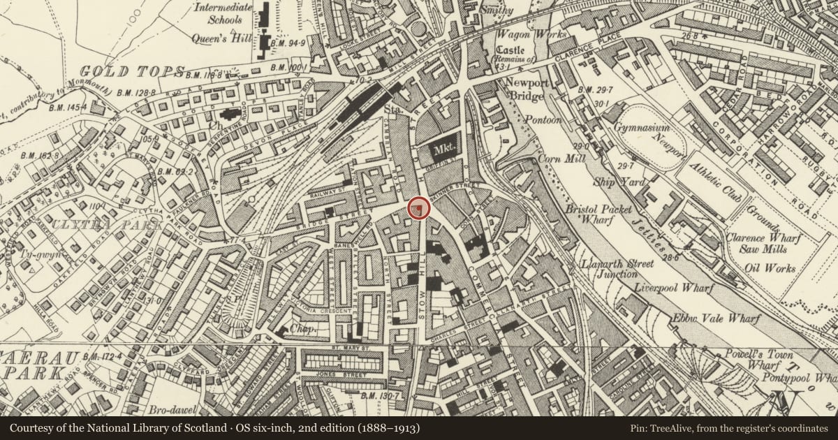
Slide toward Today to fade the historical sheet and see the modern map underneath.
David Rumsey Map Collection, Stanford LibrariesDavid Rumsey Map Collection, Stanford LibrariesDavid Rumsey Map Collection, Stanford LibrariesDavid Rumsey Map Collection, Stanford LibrariesDavid Rumsey Map Collection, Stanford Libraries
5 historical maps cover this location, the earliest the 1636 map "Cornubia : Devonia, Somersetus, Dorcestria, Wiltonia, Glocestria ..." (David Rumsey Map Collection, Stanford Libraries).
Historical maps covering this location
- 1636 · Cornubia : Devonia, Somersetus, Dorcestria, Wiltonia, Glocestria ... (David Rumsey Map Collection, Stanford Libraries)
- 1865 · England and Wales. England No. 6. (David Rumsey Map Collection, Stanford Libraries)
- 1895 · Sheet 11. Ordnance Survey of England and Wales. (David Rumsey Map Collection, Stanford Libraries)
- 1906 · 249 Newport (Hills) (David Rumsey Map Collection, Stanford Libraries)
- 1913 · Sheet 102. Newport. (David Rumsey Map Collection, Stanford Libraries)
Cadw's description
Location
On corner of Stow Hill and Bridge Street.
History
Late C19 bank.
Exterior
Bank in Northern European Renaissance style. Three storeys plus attic. Pale brown ashlar on grey plinth; slate roofs; stone chimneys. Two bays to Stow Hill (L), 5 to Bridge Street. Second floor has 3-light mullion and transom windows; first floor has similar windows with pediments; on ground floor, 3-light mullion and transom windows enclosed in arches with keystones. Attics alternate dormers with wooden gables and dormers in stone with flanking volutes and swan-necked pediments. Entrance in splayed corner with turret which has polygonal lantern supported on square base with clock, and pediment to each face. Two storey oriel window on upper floors; doorway with segmental pediment with cartouche.
In Bridge Street, a further lower block in red brick with extensive bathstone dressings. Three storeys, three windows, upper floors with central narrow window flanked by splayed bay windows; on ground floor, doorway to R, simple mullioned windows to L.
Reason for designation
Good late C19 bank on key site in town centre.
Nearby in the register
- Central Chambers (Former Gas Showrooms)Commercialunder 1 mi
- Pedestal & Statue of Sir Charles MorganCommemorativeunder 1 mi
- Lamb PHCommercialunder 1 mi
- National Westminster Bank (including Nos.2 & 4 Cambrian Road)Commercialunder 1 mi
Other entries of the same register within about three miles of this one, by straight line.