Cof Cymru: National Historic Assets of Wales · Wales
7-12 Burton Homes
Stow Hill, Newport, Wales
A Grade II listed building in Stow Hill, Newport, designated on 31 March 2000.
The record
- Designation
- Listed building, Grade II
- Broad class
- Domestic
- Date of designation
- 31 March 2000
- Community
- Stow Hill
- Unitary authority
- Newport
- Country
- Wales
- Coordinates
- 51.58039, -3.00325
- Cadw reference
- 23118
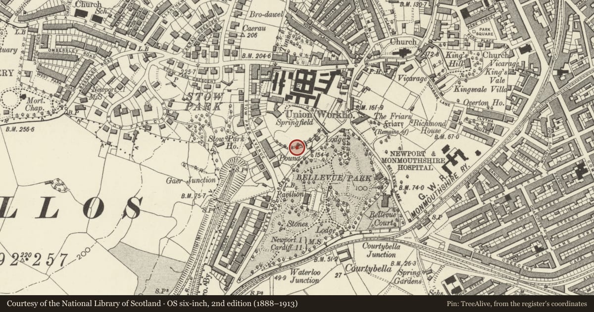
Slide toward Today to fade the historical sheet and see the modern map underneath.
David Rumsey Map Collection, Stanford LibrariesDavid Rumsey Map Collection, Stanford LibrariesDavid Rumsey Map Collection, Stanford LibrariesDavid Rumsey Map Collection, Stanford LibrariesDavid Rumsey Map Collection, Stanford Libraries
5 historical maps cover this location, the earliest the 1636 map "Cornubia : Devonia, Somersetus, Dorcestria, Wiltonia, Glocestria ..." (David Rumsey Map Collection, Stanford Libraries).
Historical maps covering this location
- 1636 · Cornubia : Devonia, Somersetus, Dorcestria, Wiltonia, Glocestria ... (David Rumsey Map Collection, Stanford Libraries)
- 1865 · England and Wales. England No. 6. (David Rumsey Map Collection, Stanford Libraries)
- 1895 · Sheet 11. Ordnance Survey of England and Wales. (David Rumsey Map Collection, Stanford Libraries)
- 1906 · 249 Newport (Hills) (David Rumsey Map Collection, Stanford Libraries)
- 1913 · Sheet 102. Newport. (David Rumsey Map Collection, Stanford Libraries)
Cadw's description
Location
Near W end of Friars Road, set back behind gardens; immediately to R of 1-6.
History
One of 2 identical sets of 6 almshouses built in 1908.
Exterior
Single-storey block of almshouses in red-brown rock-faced stone with bathstone dressings; plain tiled roofs; brick chimneys; mullion and transom windows with small-pane casement glazing. To each end, set forward, block with paired half-timbered gables, and tiled hood over pair of splayed bay windows, inner elevations have lean-to porch with roof following roof line of gable; porches half-timbered and glazed. Between end blocks, 4 houses each consisting of central steeply-gabled half-timbered porch with mullion and transom window to each side.
Reason for designation
Well-preserved and designed example of unusual building type; group value with adjacent set of almshouses.
Nearby in the register
- 1-6 Burton HomesDomesticunder 1 mi
- Pavilion and attached ConservatoriesGardens, Parks and Urban Spacesunder 1 mi
- Waterloo Road Gatepiers & Gates to Belle Vue ParkGardens, Parks and Urban Spacesunder 1 mi
- Upper Lodge at Belle Vue Park, including Attached Wall & GatepiersDomesticunder 1 mi
Other entries of the same register within about three miles of this one, by straight line.