Cof Cymru: National Historic Assets of Wales · Wales
Bridge over Tennant Canal E of Cwrt y Bettws Farm
Coedffranc, Neath Port Talbot, Wales
A Grade II listed building in Tennant Canal, Coedffranc, Neath Port Talbot, designated on 29 March 2000.
The record
- Designation
- Listed building, Grade II
- Broad class
- Transport
- Date of designation
- 29 March 2000
- Locality
- Tennant Canal
- Community
- Coedffranc
- Unitary authority
- Neath Port Talbot
- Country
- Wales
- Coordinates
- 51.64402, -3.84320
- Cadw reference
- 23073
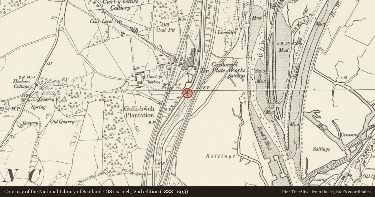
Slide toward Today to fade the historical sheet and see the modern map underneath.
David Rumsey Map Collection, Stanford LibrariesDavid Rumsey Map Collection, Stanford LibrariesDavid Rumsey Map Collection, Stanford LibrariesDavid Rumsey Map Collection, Stanford LibrariesDavid Rumsey Map Collection, Stanford Libraries
5 historical maps cover this location, the earliest the 1636 map "Cornubia : Devonia, Somersetus, Dorcestria, Wiltonia, Glocestria ..." (David Rumsey Map Collection, Stanford Libraries).
Historical maps covering this location
- 1636 · Cornubia : Devonia, Somersetus, Dorcestria, Wiltonia, Glocestria ... (David Rumsey Map Collection, Stanford Libraries)
- 1637 · The fourth table of England. Cornub. Devonia, Somerset etc. (David Rumsey Map Collection, Stanford Libraries)
- 1865 · England and Wales. England No. 6. (David Rumsey Map Collection, Stanford Libraries)
- 1891 · Sheet 10. Ordnance Survey of England and Wales. . (David Rumsey Map Collection, Stanford Libraries)
- 1897 · 247 Swansea (Hills) (David Rumsey Map Collection, Stanford Libraries)
Cadw's description
Location
Spanning the Tennant Canal E of Cwrt y Bettws Farm and beside the Tennant Canal pumping station.
History
The Tennant Canal was built 1820-4, engineered by William Kirkhouse. The head of the canal was at Aberdulais, where it joins the Neath Canal, and ended at Port Tennant on the E side of the River Tawe in Swansea. Traffic was carried on the canal until the 1930s. The bridge was built in the 3rd quarter of the C19 and first shown on the 1877 Ordnance Survey.
Exterior
A single-carriageway, single-span bridge of rubble stone with tooled voussoirs to the segmental arch. The abutments and integral parapet curve outwards. The parapet retains some copper slag copings on the N side but is mostly renewed. The parapet terminates in brick on the NE side, copper slag courses to the SE, and brick and slag to the NW. The hump-backed deck is laid with concrete.
Reason for designation
Listed for group value with other listed items associated with the Tennant Canal.
Nearby in the register
- Boiler stack of former Cardonnel Tinplate WorksIndustrialunder 1 mi
- Llandarcy Round CairnRound Cairnunder 1 mi
- Weir on E side of Tennant Canal at Red Jacket PillTransportunder 1 mi
- River Lock and attached bridges at Red Jacket PillTransportunder 1 mi
Other entries of the same register within about three miles of this one, by straight line.