Cof Cymru: National Historic Assets of Wales · Wales
Sychnant Presbyterian Church and vestry
St. Harmon, Powys, Wales
A Grade II listed building in Sychnant, Rhayader, St. Harmon, Powys, designated on 21 March 2000.
The record
- Designation
- Listed building, Grade II
- Broad class
- Religious, Ritual and Funerary
- Date of designation
- 21 March 2000
- Locality
- Sychnant
- Town
- Rhayader
- Community
- St. Harmon
- Unitary authority
- Powys
- Country
- Wales
- Coordinates
- 52.38525, -3.50882
- Cadw reference
- 23030
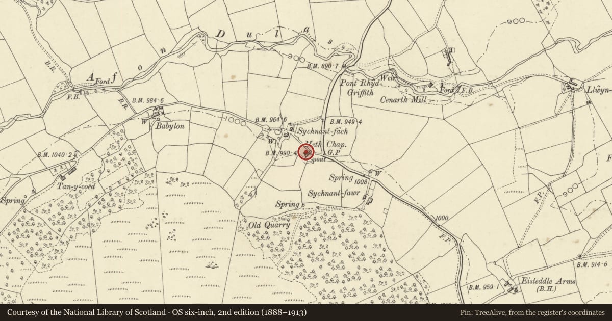
Slide toward Today to fade the historical sheet and see the modern map underneath.
David Rumsey Map Collection, Stanford LibrariesDavid Rumsey Map Collection, Stanford LibrariesDavid Rumsey Map Collection, Stanford LibrariesDavid Rumsey Map Collection, Stanford LibrariesDavid Rumsey Map Collection, Stanford Libraries
5 historical maps cover this location, the earliest the 1608 map "(13) Cambriae Typus." (David Rumsey Map Collection, Stanford Libraries).
Historical maps covering this location
- 1608 · (13) Cambriae Typus. (David Rumsey Map Collection, Stanford Libraries)
- 1637 · Particular description of Wales. Cambria seu Wallia (David Rumsey Map Collection, Stanford Libraries)
- 1883 · Watershed map England, Wales 3. (David Rumsey Map Collection, Stanford Libraries)
- 1898 · 179 Rhyader (Hills) (David Rumsey Map Collection, Stanford Libraries)
- 1901 · Sheet 14. (David Rumsey Map Collection, Stanford Libraries)
Cadw's description
Location
Situated facing NE some 30m W of a junction of a minor road and the B4518 approximately 3km N of Pant-y-dwr.
History
Calvinistic Methodist chapel and attached vestry in single range, dated 1825. The interior would suggest a date between 1820 and 1850. Renovated 1929, the renovations presumably including the rendering of the front.
Exterior
Long range of chapel and vestry, unpainted stucco with right end slate-hung. Slate eaves roof with red and yellow brick chimney at left end. Chapel occupies about two thirds of facade, to right, with two large 30-pane sashes and two doors, all in plain raised surrounds. Pilaster strips each side, inlaid with dry-dash.
Vestry to left has similar pilaster at angle, one small centre small-paned casement pair above ground floor door and larger casement pair. Raised surrounds. The end wall has small-paned casement pair each floor to left. Rear has two horned 16-pane windows lighting chapel, to left.
Interior
Simple interior with pale painted graining to box pews in 3 blocks. Pews are raked with ramped ends, panelled backs and panelled doors. Similar panelled grained 3-sided set fawr enclosure with 2 pews each side facing pulpit. Side pews have high panelled back as draught screen against doors. Pulpit also painted grained and panelled has canted corners and simple moulded cornice. Door on right side. Plastered two-bay three-sided ceiling with central truss also plastered over.beam.
Reason for designation
Included as a well-preserved early C19 chapel with fine interior including painted box pews and original box-pulpit, the latter a rare survival.
Nearby in the register
- Farm building at Sychnant FachNo class recordedunder 1 mi
- Sychnant FachNo class recordedunder 1 mi
- Standing Stone & Round Barrow SE of HenriwRound Barrowunder 1 mi
- Lower FedwNo class recorded1 mi
Other entries of the same register within about three miles of this one, by straight line.