Cof Cymru: National Historic Assets of Wales · Wales
The Vine Tree P.H.
Monmouth, Monmouthshire, Wales
A Grade II listed building in Monmouth, Monmouthshire, designated on 18 November 1970.
The record
- Designation
- Listed building, Grade II
- Broad class
- Commercial
- Date of designation
- 18 November 1970
- Locality
- Monmouth
- Town
- Monmouth
- Community
- Monmouth
- Unitary authority
- Monmouthshire
- Country
- Wales
- Coordinates
- 51.81079, -2.71794
- Cadw reference
- 2299
Slide toward Today to fade the historical sheet and see the modern map underneath.
David Rumsey Map Collection, Stanford LibrariesDavid Rumsey Map Collection, Stanford LibrariesDavid Rumsey Map Collection, Stanford LibrariesDavid Rumsey Map Collection, Stanford LibrariesDavid Rumsey Map Collection, Stanford Libraries
5 historical maps cover this location, the earliest the 1636 map "Cornubia : Devonia, Somersetus, Dorcestria, Wiltonia, Glocestria ..." (David Rumsey Map Collection, Stanford Libraries).
Historical maps covering this location
- 1636 · Cornubia : Devonia, Somersetus, Dorcestria, Wiltonia, Glocestria ... (David Rumsey Map Collection, Stanford Libraries)
- 1830 · V.3:11-15:XV.Britisches Reich. A. Kon: England. a. England ab sich: Shire:15-17, 33 (David Rumsey Map Collection, Stanford Libraries)
- 1895 · Sheet 11. Ordnance Survey of England and Wales. (David Rumsey Map Collection, Stanford Libraries)
- 1896 · 233 Monmouth (Hills) (David Rumsey Map Collection, Stanford Libraries)
- 1901 · Sheet 14. (David Rumsey Map Collection, Stanford Libraries)
Cadw's description
Location
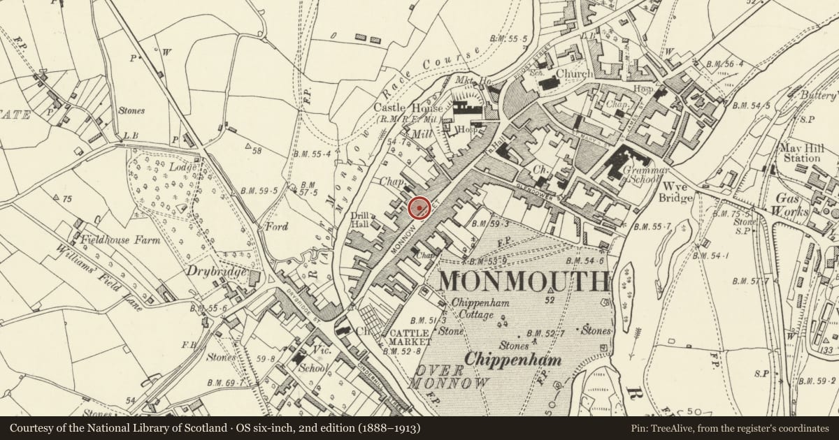
On Monmouth's principal commercial street which leads out of the town square going south-west to Monnow Bridge.
History
Built in two ranges, parallel with the street. The rear part of the building is of probably late C16 date and is box-framed construction, with crucks reported, but if so they must be upper crucks. The front part is apparently C18, probably heightened in c1800. The whole has been refurbished and added to in the late C20 which has confused some of the evidence.
Exterior
Roughcast render with pebbledash now painted white, Welsh slate roof. Double depth central entry plan. Three storeys, four windows. The centre door is narrow and panelled with a small pedimented hood. Canted bay on right side with sash windows, and on left side three replacement 6 over 6 sashes. Windows above are 6 over 6 pane sashes at the first floor, and at the second floor smaller windows with 2 + 2 pane casements. There is a wide gap between the windows in the centre of the facade. Low pitch roof with stack at either gable.
The rear elevation is obscured by later additions and no historic features can be seen.
Interior
The interior of the rear range is timber framed and is said to incorporate crucks, though none were seen at resurvey. The ground floor is box-framed and appears to date from c1600. There is also said to be some C18 panelling.
Reason for designation
Included for its special architectural interest as a multi-period building of definite character in the Monmouth town centre and as one of Monmouth's historic inns.
Nearby in the register
- 55 Monnow StreetCommercialunder 1 mi
- 53 Monnow StreetCommercialunder 1 mi
- 65 Monnow StreetDomesticunder 1 mi
- 67 Monnow StreetDomesticunder 1 mi
Other entries of the same register within about three miles of this one, by straight line.