Cof Cymru: National Historic Assets of Wales · Wales
Stable block at Plas Hendy
Llanarth, Monmouthshire, Wales
A Grade II listed building in Bryngwyn, Raglan, Llanarth, Monmouthshire, designated on 15 March 2000.
The record
- Designation
- Listed building, Grade II
- Broad class
- Transport
- Date of designation
- 15 March 2000
- Locality
- Bryngwyn
- Town
- Raglan
- Community
- Llanarth
- Unitary authority
- Monmouthshire
- Country
- Wales
- Coordinates
- 51.78189, -2.88513
- Cadw reference
- 22988
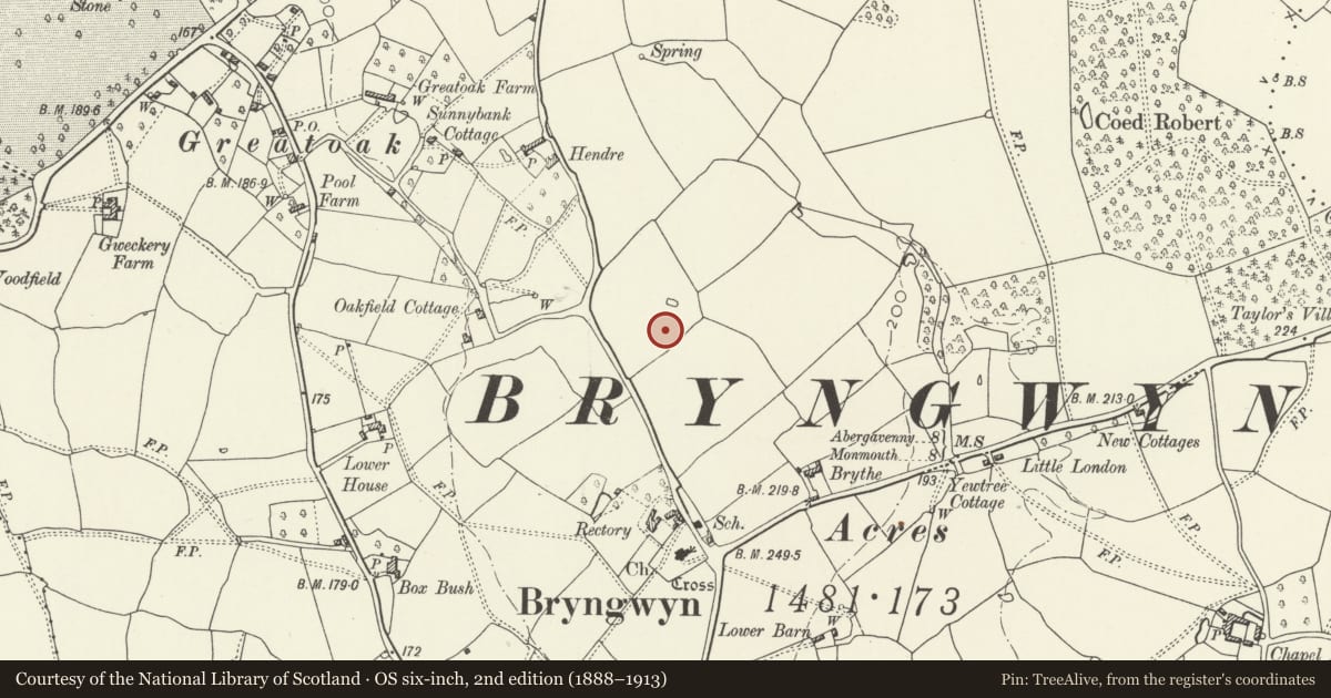
Slide toward Today to fade the historical sheet and see the modern map underneath.
David Rumsey Map Collection, Stanford LibrariesDavid Rumsey Map Collection, Stanford LibrariesDavid Rumsey Map Collection, Stanford LibrariesDavid Rumsey Map Collection, Stanford LibrariesDavid Rumsey Map Collection, Stanford Libraries
5 historical maps cover this location, the earliest the 1608 map "(13) Cambriae Typus." (David Rumsey Map Collection, Stanford Libraries).
Historical maps covering this location
- 1608 · (13) Cambriae Typus. (David Rumsey Map Collection, Stanford Libraries)
- 1636 · Cornubia : Devonia, Somersetus, Dorcestria, Wiltonia, Glocestria ... (David Rumsey Map Collection, Stanford Libraries)
- 1830 · V.3:11-15:XV.Britisches Reich. A. Kon: England. a. England ab sich: Shire:15-17, 33 (David Rumsey Map Collection, Stanford Libraries)
- 1895 · Sheet 11. Ordnance Survey of England and Wales. (David Rumsey Map Collection, Stanford Libraries)
- 1913 · Sheet 102. Newport. (David Rumsey Map Collection, Stanford Libraries)
Cadw's description
Location
Situated to N of Plas Hendy, facing S over rear yard.
History
Stable block to Plas Hendy built 1903-5 for two orphan grandchildren of the rector of Bryngwyn, the Rev. William Crawley (1802-96).
Exterior
Stable and coach-house range, red brick with red tiled hipped roof, centre cross gable and hipped dormer at W end, the ridge continuous with main ridge. one storey and loft. Centre broad opening with overhanging timber-framed gable and loft door. moulded bressumer, cambered collar-beam over door. Small domed cupola on ridge with octagonal open-arched sides, leaded dome and weather-vane. Coach-house to left has brick chimney on ridge and 3 large boarded doors with timber posts between and door with overlight to right. Right side stable has window, door and window. Behind is rubble stone tool-shed range. Rear gable to main range has outside steps to loft door.
Interior
Stable interior with complete stable fittings, 2 stalls, 2 loose-boxes, cast-iron gate-posts.
Reason for designation
Included as a well-designed early C20 coach-house and stable range. Group value with house.
Nearby in the register
- Plas HendyDomesticunder 1 mi
- Rectory Farmhouse and the Old RectoryDomesticunder 1 mi
- Church of Saint PeterReligious, Ritual and Funeraryunder 1 mi
- Churchyard cross at Bryngwyn churchReligious, Ritual and Funeraryunder 1 mi
Other entries of the same register within about three miles of this one, by straight line.