Cof Cymru: National Historic Assets of Wales · Wales
Churchyard cross in Llanvapley churchyard
Gobion Fawr, Monmouthshire, Wales
A Grade II listed building in Llanvapley, Abergavenny, Gobion Fawr, Monmouthshire, designated on 15 March 2000.
The record
- Designation
- Listed building, Grade II
- Broad class
- Religious, Ritual and Funerary
- Date of designation
- 15 March 2000
- Locality
- Llanvapley
- Town
- Abergavenny
- Community
- Gobion Fawr
- Unitary authority
- Monmouthshire
- Country
- Wales
- Coordinates
- 51.82170, -2.92008
- Cadw reference
- 22978
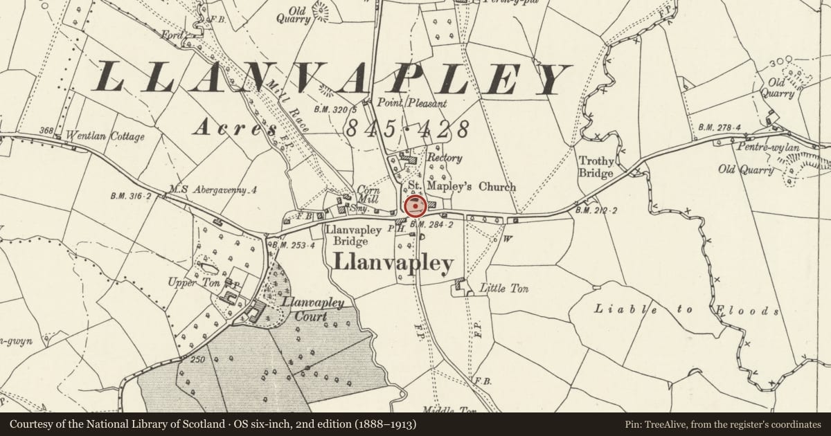
Slide toward Today to fade the historical sheet and see the modern map underneath.
David Rumsey Map Collection, Stanford LibrariesDavid Rumsey Map Collection, Stanford LibrariesDavid Rumsey Map Collection, Stanford LibrariesDavid Rumsey Map Collection, Stanford LibrariesDavid Rumsey Map Collection, Stanford Libraries
5 historical maps cover this location, the earliest the 1636 map "Cornubia : Devonia, Somersetus, Dorcestria, Wiltonia, Glocestria ..." (David Rumsey Map Collection, Stanford Libraries).
Historical maps covering this location
- 1636 · Cornubia : Devonia, Somersetus, Dorcestria, Wiltonia, Glocestria ... (David Rumsey Map Collection, Stanford Libraries)
- 1830 · V.3:11-15:XV.Britisches Reich. A. Kon: England. a. England ab sich: Shire:15-17, 33 (David Rumsey Map Collection, Stanford Libraries)
- 1895 · Sheet 11. Ordnance Survey of England and Wales. (David Rumsey Map Collection, Stanford Libraries)
- 1898 · 232 Abergavenny (Outline) (David Rumsey Map Collection, Stanford Libraries)
- 1901 · Sheet 14. (David Rumsey Map Collection, Stanford Libraries)
Cadw's description
Location
Situated in churchyard S of chancel of Church of St Mapley/ Mabli.
History
Late medieval steps and base of churchyard cross.
Exterior
Steps and base of churchyard cross. Four large steps, the lowest ones with coved moulding to front of coping stones, the others of solid squared blocks. Monolith square cross-base, the angles broached to octagonal with a ridged rounded moulding, the ridge and curved sides of the broach and the angles of the octagon delineated with an incised bead moulding.
Reason for designation
Included as a substantial remnant of a medieval churchyard cross, of group value with the church.
Nearby in the register
- St. Mabli's Churchyard Cross, LlanvapleyCross baseunder 1 mi
- Church of Saint Mapley/ MabliReligious, Ritual and Funeraryunder 1 mi
- The Old RectoryDomesticunder 1 mi
- Middle TonDomesticunder 1 mi
Other entries of the same register within about three miles of this one, by straight line.