Cof Cymru: National Historic Assets of Wales · Wales
Outbuildings at Pandy Newydd
Llanllechid, Gwynedd, Wales
A Grade II listed building in Tregarth, Llanllechid, Gwynedd, designated on 9 March 2000.
The record
- Designation
- Listed building, Grade II
- Broad class
- Domestic
- Date of designation
- 9 March 2000
- Locality
- Tregarth
- Community
- Llanllechid
- Unitary authority
- Gwynedd
- Country
- Wales
- Coordinates
- 53.19896, -4.08076
- Cadw reference
- 22973
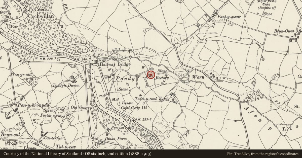
Slide toward Today to fade the historical sheet and see the modern map underneath.
David Rumsey Map Collection, Stanford LibrariesDavid Rumsey Map Collection, Stanford LibrariesDavid Rumsey Map Collection, Stanford LibrariesDavid Rumsey Map Collection, Stanford LibrariesDavid Rumsey Map Collection, Stanford Libraries
5 historical maps cover this location, the earliest the 1896 map "Sheet 7. Ordnance Survey of England and Wales." (David Rumsey Map Collection, Stanford Libraries).
Historical maps covering this location
- 1896 · Sheet 7. Ordnance Survey of England and Wales. (David Rumsey Map Collection, Stanford Libraries)
- 1899 · 106 Bangor (Hills) (David Rumsey Map Collection, Stanford Libraries)
- 1899 · 106 Bangor (Outline) (David Rumsey Map Collection, Stanford Libraries)
- 1901 · Sheet 9 and 10. (David Rumsey Map Collection, Stanford Libraries)
- 1919 · Sheet 41. Anglesey. (David Rumsey Map Collection, Stanford Libraries)
Cadw's description
Location
Situated directly to the east of Pandy Newydd.
History
Built contemporaneously with Pandy Newydd, the outbuildings comprise a small laundry, bakehouse and stable.
Exterior
Small L-shaped range of outbuildings with further small detached building (stable) immediately to east. Regularly coursed and dressed rubblestone blocks; slate roofs, gable ended with coped verges and kneelers to higher section, hipped to lower parts. Higher range has boarded door to upper floor of north gable end and window with stone cill and lintel to west wall; integral end stack on south with brick shaft. Further window with stone cill and lintel in west wall of lower range attached to south gable end; entrance through boarded door at rear.
Interior
Contains cast-iron wash boiler and bread oven.
Reason for designation
Included as an unaltered set of outbuildings contemporary with and having strong group value with Pandy Newydd; illustrative of the ancillary buildings necessary to maintain a Victorian rural rectory.
Nearby in the register
- Pandy NewyddDomesticunder 1 mi
- Telford Milestone (28)Transportunder 1 mi
- Halfway Bridge (partly in Llandygai community)Transportunder 1 mi
- Halfway Bridge (partly in Llanllechid community)Transportunder 1 mi
Other entries of the same register within about three miles of this one, by straight line.