Cof Cymru: National Historic Assets of Wales · Wales
L-shaped Cowhouse Range at Plas-uchaf
Llanllechid, Gwynedd, Wales
A Grade II listed building in Plas-uchaf, Llanllechid, Gwynedd, designated on 9 March 2000.
The record
- Designation
- Listed building, Grade II
- Broad class
- Agriculture and Subsistence
- Date of designation
- 9 March 2000
- Locality
- Plas-uchaf
- Community
- Llanllechid
- Unitary authority
- Gwynedd
- Country
- Wales
- Coordinates
- 53.20825, -4.06619
- Cadw reference
- 22949
Slide toward Today to fade the historical sheet and see the modern map underneath.
David Rumsey Map Collection, Stanford LibrariesDavid Rumsey Map Collection, Stanford LibrariesDavid Rumsey Map Collection, Stanford LibrariesDavid Rumsey Map Collection, Stanford LibrariesDavid Rumsey Map Collection, Stanford Libraries
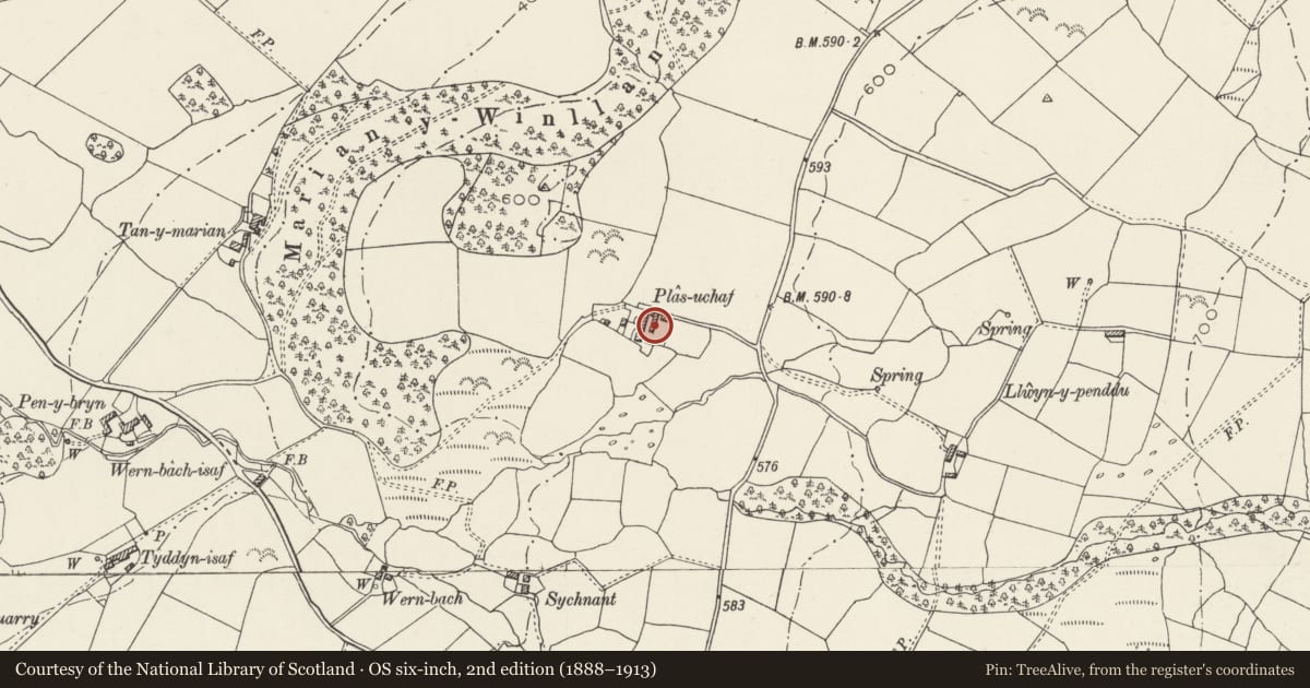
5 historical maps cover this location, the earliest the 1896 map "Sheet 7. Ordnance Survey of England and Wales." (David Rumsey Map Collection, Stanford Libraries).
Historical maps covering this location
- 1896 · Sheet 7. Ordnance Survey of England and Wales. (David Rumsey Map Collection, Stanford Libraries)
- 1899 · 106 Bangor (Outline) (David Rumsey Map Collection, Stanford Libraries)
- 1899 · 106 Bangor (Hills) (David Rumsey Map Collection, Stanford Libraries)
- 1901 · Sheet 9 and 10. (David Rumsey Map Collection, Stanford Libraries)
- 1919 · Sheet 41. Anglesey. (David Rumsey Map Collection, Stanford Libraries)
Cadw's description
Location
Located immediately to the east of the cart shelter and pigsties at Plas-uchaf looking onto yard defined by these buildings and rubblestone wall to track.
History
Contemporary with the cottages and other farmbuildings at Plas-uchaf.
Exterior
Long range aligned north-south with shorter range projecting at right-angles to west at north end. Roughly coursed rubblestone with large slate lintels to majority of openings; hipped slate roofs with ridge ventilators, main range broken by cross-gable towards south end. Main range has window flanked by doorways to left of gable, which has 2 wide openings on ground floor with loft opening above; further doorway on right of gable. Short range has stable door to front end wall and 2 ventilator windows flanking door to left return facing track.
Interior
Interior not accessible at time of Survey.
Reason for designation
Included as an integral part of the well-preserved mid-C19 farmstead group at Plas-uchaf.
Nearby in the register
- Cart Shelter and Pigsties at Plas-uchafAgriculture and Subsistenceunder 1 mi
- Small Cowhouse Range at Plas-uchafAgriculture and Subsistenceunder 1 mi
- Plas-uchafDomesticunder 1 mi
- Tan-y-marianDomesticunder 1 mi
Other entries of the same register within about three miles of this one, by straight line.