Cof Cymru: National Historic Assets of Wales · Wales
Turnpike House
Llanllechid, Gwynedd, Wales
A Grade II listed building in Tan-y-lon, Bangor, Llanllechid, Gwynedd, designated on 9 March 2000.
The record
- Designation
- Listed building, Grade II
- Broad class
- Domestic
- Date of designation
- 9 March 2000
- Locality
- Tan-y-lon
- Town
- Bangor
- Community
- Llanllechid
- Unitary authority
- Gwynedd
- Country
- Wales
- Coordinates
- 53.21888, -4.06955
- Cadw reference
- 22937
Slide toward Today to fade the historical sheet and see the modern map underneath.
David Rumsey Map Collection, Stanford LibrariesDavid Rumsey Map Collection, Stanford LibrariesDavid Rumsey Map Collection, Stanford LibrariesDavid Rumsey Map Collection, Stanford LibrariesDavid Rumsey Map Collection, Stanford Libraries
5 historical maps cover this location, the earliest the 1896 map "Sheet 7. Ordnance Survey of England and Wales." (David Rumsey Map Collection, Stanford Libraries).
Historical maps covering this location
- 1896 · Sheet 7. Ordnance Survey of England and Wales. (David Rumsey Map Collection, Stanford Libraries)
- 1899 · 106 Bangor (Outline) (David Rumsey Map Collection, Stanford Libraries)
- 1899 · 106 Bangor (Hills) (David Rumsey Map Collection, Stanford Libraries)
- 1901 · Sheet 9 and 10. (David Rumsey Map Collection, Stanford Libraries)
- 1919 · Sheet 41. Anglesey. (David Rumsey Map Collection, Stanford Libraries)
Cadw's description
Location
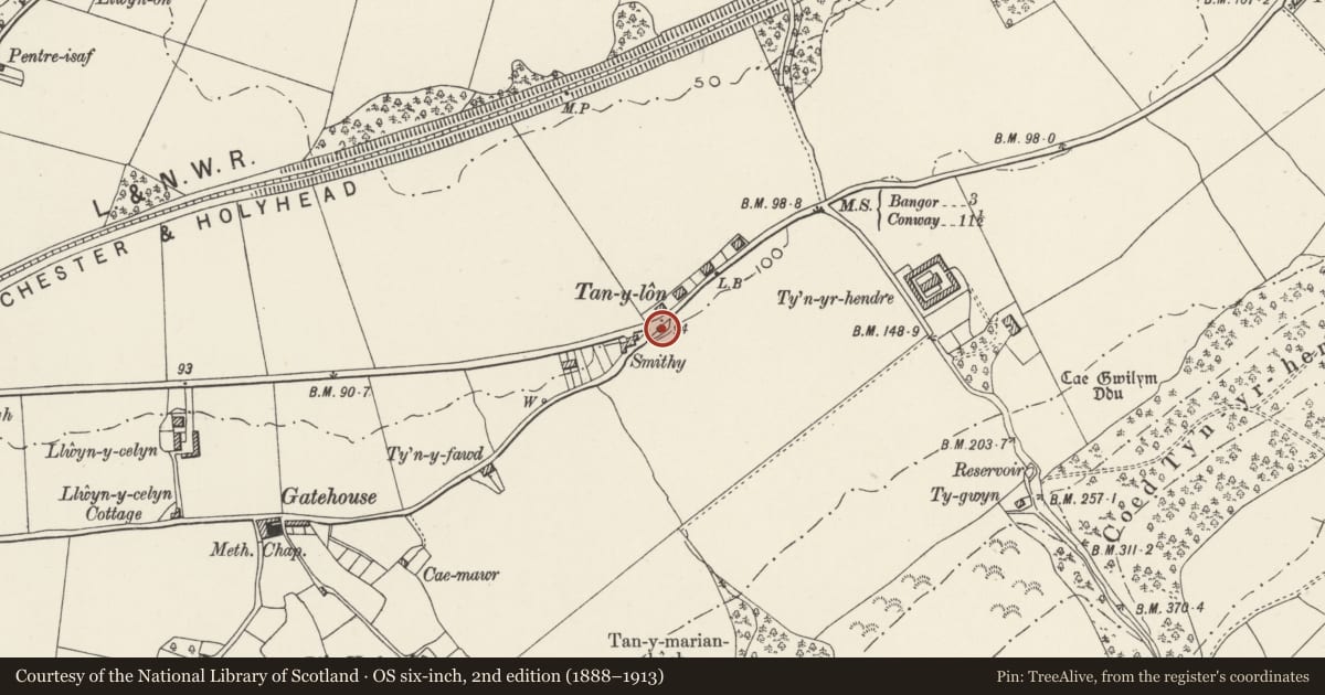
Located right on road in Tan-y-lon at junction between the old Bangor to Conwy road and the road which runs roughly parallel with it between Tan-y-lon and Eglwys St Cross.
History
Constructed as a toll house on the Bangor to Conway road, which was turnpiked as part of the route between Chester and Holyhead in the 1820s.
Exterior
Single-storey pentagonal building with splayed end to road. Painted regularly coursed rubblestone blocks; graded slate roof. Splayed end has C20 windows in original openings with slate cills to sides and blind panel to centre for former toll board; roughcast ridge stack near splayed end. Entrance in left return through C20 glazed door; C20 flat-roofed addition also on this side. Painted board to eaves on splayed end with pointing hand reads "LLANLLECHID 2 1/2".
Interior
Interior not accessible at time of Survey.
Reason for designation
Included, notwithstanding late C20 windows and extension, as an essentially well-preserved toll keeper's cottage on the former turnpike road.
Nearby in the register
- Tan-y-lonDomesticunder 1 mi
- Tan-y-lonDomesticunder 1 mi
- Farmbuildings at Ty'n-yr-hendreAgriculture and Subsistenceunder 1 mi
- Shelter Shed/Pigsties at Ty'n-yr-hendreAgriculture and Subsistenceunder 1 mi
Other entries of the same register within about three miles of this one, by straight line.