Cof Cymru: National Historic Assets of Wales · Wales
Dovecote at Bertholey
Llantrisant Fawr, Monmouthshire, Wales
A Grade II listed building in Bertholey, Usk, Llantrisant Fawr, Monmouthshire, designated on 25 February 2000.
The record
- Designation
- Listed building, Grade II
- Broad class
- Agriculture and Subsistence
- Date of designation
- 25 February 2000
- Locality
- Bertholey
- Town
- Usk
- Community
- Llantrisant Fawr
- Unitary authority
- Monmouthshire
- Country
- Wales
- Coordinates
- 51.64644, -2.87126
- Cadw reference
- 22920
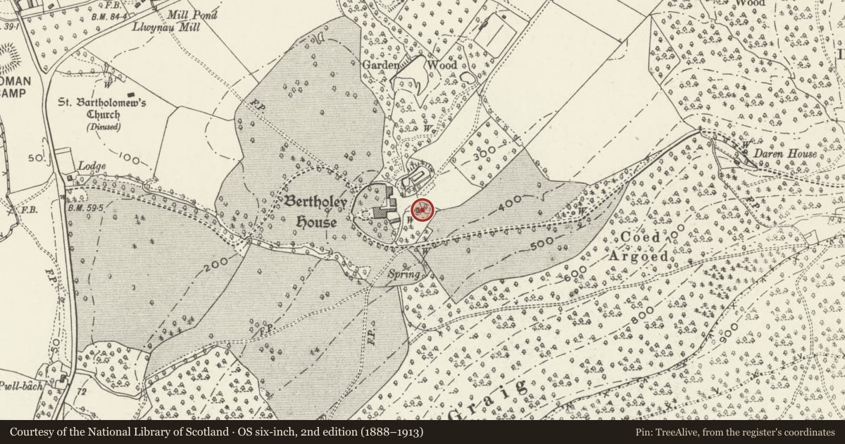
Slide toward Today to fade the historical sheet and see the modern map underneath.
David Rumsey Map Collection, Stanford LibrariesDavid Rumsey Map Collection, Stanford LibrariesDavid Rumsey Map Collection, Stanford LibrariesDavid Rumsey Map Collection, Stanford LibrariesDavid Rumsey Map Collection, Stanford Libraries
5 historical maps cover this location, the earliest the 1636 map "Cornubia : Devonia, Somersetus, Dorcestria, Wiltonia, Glocestria ..." (David Rumsey Map Collection, Stanford Libraries).
Historical maps covering this location
- 1636 · Cornubia : Devonia, Somersetus, Dorcestria, Wiltonia, Glocestria ... (David Rumsey Map Collection, Stanford Libraries)
- 1830 · V.3:11-15:XV.Britisches Reich. A. Kon: England. a. England ab sich: Shire:15-17, 33 (David Rumsey Map Collection, Stanford Libraries)
- 1895 · Sheet 11. Ordnance Survey of England and Wales. (David Rumsey Map Collection, Stanford Libraries)
- 1905 · 250 Chepstow (Hills) (David Rumsey Map Collection, Stanford Libraries)
- 1913 · Sheet 102. Newport. (David Rumsey Map Collection, Stanford Libraries)
Cadw's description
Location
Situated to E of courtyard formed by the outbuildings at Bertholey.
History
Earlier C19 dovecote, possibly built c1830 when Bertholey was rebuilt for Colthurst Bateman. Presumably a building of several functions as only the upper part of the main block was for doves, ground floor and perhaps the single storey wings may have been hen or turkey houses; it has been suggested that one or more of the wings may have been staff living quarters. The building was formerly of cruciform plan with taller central block and wings to north, south, east and west, but N wing is lost and E & S wings semi-ruinous.
Exterior
Dovecote and outbuildings, rubble stone with slate roofs. Two-storey centre block with single-storey wings. Centre has deeply overhanging verge with bargeboards over arched opening with timber tiered entries to nesting boxes. Ground floor door. Surviving wings have doors in end gables with brick heads.
Reason for designation
Included as an example of a relatively rare building type, and for group value with the other buildings listed at Bertholey.
Nearby in the register
- Stable/Cartshed block at Bertholey, including attached wall and lean-to to westAgriculture and Subsistenceunder 1 mi
- Outbuilding block to N of BertholeyAgriculture and Subsistenceunder 1 mi
- Former Farmhouse Range at BertholeyDomesticunder 1 mi
- LlwynauDomesticunder 1 mi
Other entries of the same register within about three miles of this one, by straight line.