Cof Cymru: National Historic Assets of Wales · Wales
Nant Rhaeadr
Aber, Gwynedd, Wales
A Grade II listed building in Nant, Llanfairfechan, Aber, Gwynedd, designated on 7 March 2000.
The record
- Designation
- Listed building, Grade II
- Broad class
- Domestic
- Date of designation
- 7 March 2000
- Locality
- Nant
- Town
- Llanfairfechan
- Community
- Aber
- Unitary authority
- Gwynedd
- Country
- Wales
- Coordinates
- 53.22114, -3.99981
- Cadw reference
- 22903
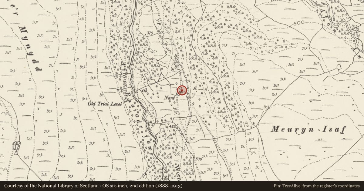
Slide toward Today to fade the historical sheet and see the modern map underneath.
David Rumsey Map Collection, Stanford LibrariesDavid Rumsey Map Collection, Stanford LibrariesDavid Rumsey Map Collection, Stanford LibrariesDavid Rumsey Map Collection, Stanford LibrariesDavid Rumsey Map Collection, Stanford Libraries
5 historical maps cover this location, the earliest the 1883 map "Watershed map England, Wales 3." (David Rumsey Map Collection, Stanford Libraries).
Historical maps covering this location
- 1883 · Watershed map England, Wales 3. (David Rumsey Map Collection, Stanford Libraries)
- 1896 · Sheet 7. Ordnance Survey of England and Wales. (David Rumsey Map Collection, Stanford Libraries)
- 1899 · 106 Bangor (Outline) (David Rumsey Map Collection, Stanford Libraries)
- 1899 · 106 Bangor (Hills) (David Rumsey Map Collection, Stanford Libraries)
- 1901 · Sheet 9 and 10. (David Rumsey Map Collection, Stanford Libraries)
Cadw's description
Location
Situated in remote elevated position on east side of Llwybr y Nant, the rough track leading from Bont Newydd to Aber Falls; dense woodland immediately to east.
History
Early C19 smallholder's cottage on very marginal land; in the later C19 as increasing numbers of tourists ascended the path to Aber Falls its occupants supplemented their livelihoods by selling tea and home-made lemonade to thirsty visitors. After a period of neglect, the cottage has been repaired by the Countryside Council for Wales.
Exterior
Single-storey 2-room plan, aligned roughly east-west, with full loft over. Roughly coursed rubblestone; slate roof with coped verges. Front has C20 4-pane horned sashes in original C19 openings with slate cills on either side of offset boarded door, all openings under slate lintels; rebuilt integral end stacks. C20 4-paned sash in right gable end lights crog-lofft and C20 rooflight is offset to left. Small 4-paned sash to back wall on right; lean-to on right gable end has boarded door to front and sash window to right wall. All windows have C20 timber shutters.
Interior
Larger room on left has open fireplace and exposed ceiling joists (floor boards of loft visible); straight-flight staircase with plain carved newel to turn at foot has stick balusters. Smaller room on right also with exposed ceiling joists and floor boards of loft visible has small fireplace with stone lintel; red and black quarry tile floors in both rooms and boarded door connects the two.
Reason for designation
Included, despite extensive late C20 repair, as a well-preserved early C19 smallholder's cottage on very marginal upland, characteristic of the settlement pattern of the region; important also for its connection with the expanding Victorian tourist trade centred on Aber Falls.
Nearby in the register
- Hut circle East of Afon Rhaeadr FawrUnenclosed hut circleunder 1 mi
- Meuryn Isaf CairnRound Cairnunder 1 mi
- Bont-NewyddBridgeunder 1 mi
- Bont NewyddTransportunder 1 mi
Other entries of the same register within about three miles of this one, by straight line.