Cof Cymru: National Historic Assets of Wales · Wales
Cwm Pelenna ventilation stack
Pelenna, Neath Port Talbot, Wales
A Grade II listed building in Cwm Blaenpelenna, Pelenna, Neath Port Talbot, designated on 6 March 2000.
The record
- Designation
- Listed building, Grade II
- Broad class
- Industrial
- Date of designation
- 6 March 2000
- Locality
- Cwm Blaenpelenna
- Community
- Pelenna
- Unitary authority
- Neath Port Talbot
- Country
- Wales
- Coordinates
- 51.66113, -3.71194
- Cadw reference
- 22888
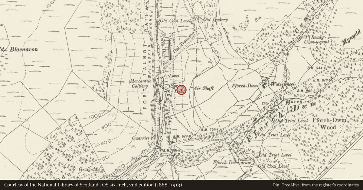
Slide toward Today to fade the historical sheet and see the modern map underneath.
David Rumsey Map Collection, Stanford LibrariesDavid Rumsey Map Collection, Stanford LibrariesDavid Rumsey Map Collection, Stanford LibrariesDavid Rumsey Map Collection, Stanford LibrariesDavid Rumsey Map Collection, Stanford Libraries
5 historical maps cover this location, the earliest the 1636 map "Cornubia : Devonia, Somersetus, Dorcestria, Wiltonia, Glocestria ..." (David Rumsey Map Collection, Stanford Libraries).
Historical maps covering this location
- 1636 · Cornubia : Devonia, Somersetus, Dorcestria, Wiltonia, Glocestria ... (David Rumsey Map Collection, Stanford Libraries)
- 1637 · The fourth table of England. Cornub. Devonia, Somerset etc. (David Rumsey Map Collection, Stanford Libraries)
- 1830 · V.3:11-15:XV. Britisches Reich. A. Kon: England. b. Frstenthum Wales: Shire: 37-40 (David Rumsey Map Collection, Stanford Libraries)
- 1865 · England and Wales. England No. 6. (David Rumsey Map Collection, Stanford Libraries)
- 1907 · 248 Pontypridd (Hills) (David Rumsey Map Collection, Stanford Libraries)
Cadw's description
Location
On open hillside approximately 1.6km ENE of Tonmawr, and sited on high ground on the E side of an unclassified road to Fforch dwm.
History
Built in the 1830s as a ventilation stack with hillside flue for a local coal level. Structures below the flue belong to a later C19 colliery.
Exterior
A truncated square rubble stone ventilation stack with rounded angles, standing on a square base. The stack stands approximately 5m high. On the downhill (W) side of the base is a round arch at the upper end of a stone flue visible in the hillside below.
Reason for designation
Listed for its industrial archaeological interest as a rare survival associated with the developing South Wales coal industry of the early C19.
Scheduled Ancient Monument Gm 458 (NEP).
Nearby in the register
- Cwm Pelenna Colliery Ventilation FurnaceCollieryunder 1 mi
- Scotch FaldAgriculture and Subsistenceunder 1 mi
- Cynon Corn-Drying KilnCorn Drying Kiln2 mi
- Blaen-Cwmbach CampMarching Camp2 mi
Other entries of the same register within about three miles of this one, by straight line.