Cof Cymru: National Historic Assets of Wales · Wales
Barn attached to Church with Roadside Range
Llangennith, Llanmadoc and Cheriton, Swansea, Wales
A Grade II listed building in Llangennith village, Swansea, Llangennith, Llanmadoc and Cheriton, designated on 3 March 2000.
The record
- Designation
- Listed building, Grade II
- Broad class
- Agriculture and Subsistence
- Date of designation
- 3 March 2000
- Locality
- Llangennith village
- Town
- Swansea
- Community
- Llangennith, Llanmadoc and Cheriton
- Unitary authority
- Swansea
- Country
- Wales
- Coordinates
- 51.59946, -4.27060
- Cadw reference
- 22879
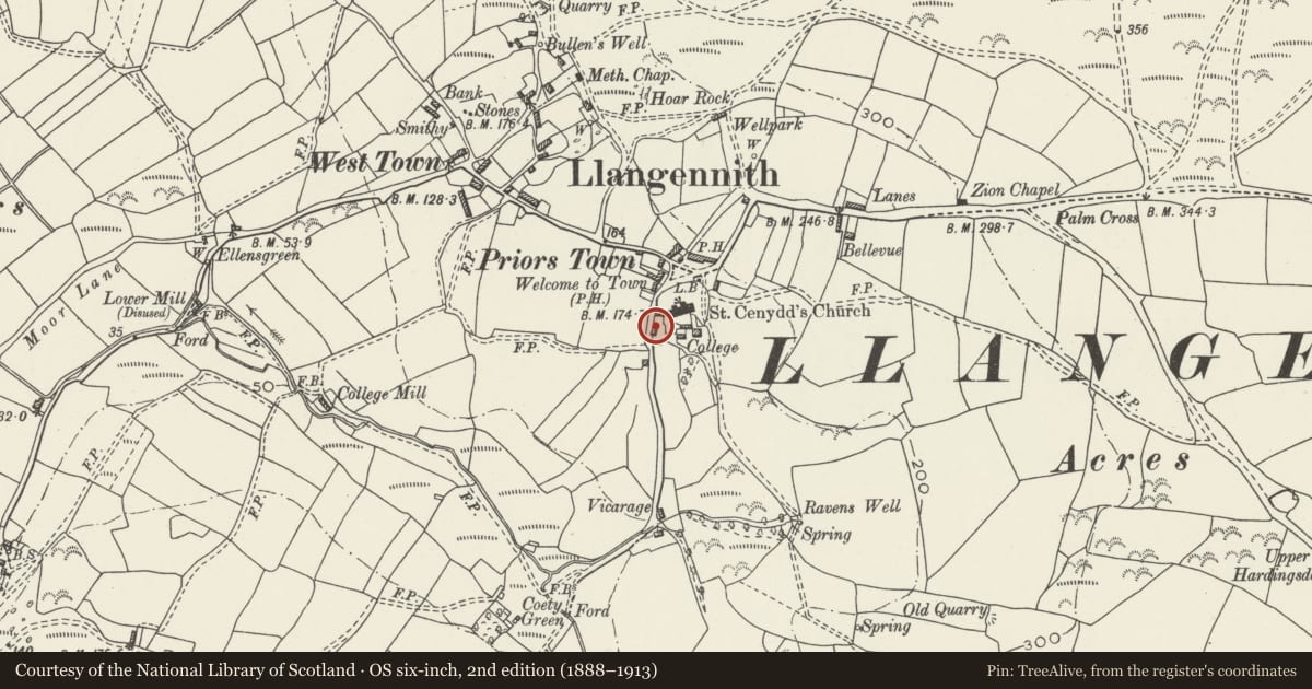
Slide toward Today to fade the historical sheet and see the modern map underneath.
David Rumsey Map Collection, Stanford LibrariesDavid Rumsey Map Collection, Stanford LibrariesDavid Rumsey Map Collection, Stanford LibrariesDavid Rumsey Map Collection, Stanford LibrariesDavid Rumsey Map Collection, Stanford Libraries
5 historical maps cover this location, the earliest the 1636 map "Cornubia : Devonia, Somersetus, Dorcestria, Wiltonia, Glocestria ..." (David Rumsey Map Collection, Stanford Libraries).
Historical maps covering this location
- 1636 · Cornubia : Devonia, Somersetus, Dorcestria, Wiltonia, Glocestria ... (David Rumsey Map Collection, Stanford Libraries)
- 1865 · England and Wales. England No. 6. (David Rumsey Map Collection, Stanford Libraries)
- 1891 · Sheet 10. Ordnance Survey of England and Wales. . (David Rumsey Map Collection, Stanford Libraries)
- 1907 · 246 Worms Head (Hills) (David Rumsey Map Collection, Stanford Libraries)
- 1920 · Sheet 100. Llanelly. (David Rumsey Map Collection, Stanford Libraries)
Cadw's description
Location
Attached to St Cenydd's Church at the west of the nave.
History
Traditionally known as 'the parson's barn'. The barn is probably C18 or earlier, but lacking in datable features; it was probably for the storage of tithes. The lower building fronting the street attached to the corner of the barn is at least partly built up from a low roadside wall in the C19, part earlier.
The barn and other college buildings were part of the Rectorial Glebe, owned by All Souls College, Oxford, until sold with the church to Major Penrice in 1838; in 1844 they were in the tenancy of Mary Jenkin. The Major's nephew sold them off as farm property in 1883 when the church was given to the parishioners.
Exterior
A barn extending west from the nave of the church in identical local conglomerate sandstone masonry. Slate roof with tile ridge; three rooflights inserted in south slope. Door openings to the south. One small window to the north. Lower range extends south from the end of the barn, at the side of a small farmyard. The latter range has blank walls to the street in identical masonry.
Reason for designation
Listed as a barn in an exceptional position attached to the west end of the church, and for group value with St Cenydd's church.
Nearby in the register
- Church of St CenyddReligious, Ritual and Funeraryunder 1 mi
- St Cennydd's Church Cross-shaftCross shaftunder 1 mi
- St Cenydd's LychgateReligious, Ritual and Funeraryunder 1 mi
- Well opposite St Cenydd's ChurchReligious, Ritual and Funeraryunder 1 mi
Other entries of the same register within about three miles of this one, by straight line.