Cof Cymru: National Historic Assets of Wales · Wales
Limekiln in Bovehill Wood
Llangennith, Llanmadoc and Cheriton, Swansea, Wales
A Grade II listed building in Landimore, Swansea, Llangennith, Llanmadoc and Cheriton, designated on 3 March 2000.
The record
- Designation
- Listed building, Grade II
- Broad class
- Industrial
- Date of designation
- 3 March 2000
- Locality
- Landimore
- Town
- Swansea
- Community
- Llangennith, Llanmadoc and Cheriton
- Unitary authority
- Swansea
- Country
- Wales
- Coordinates
- 51.61839, -4.21795
- Cadw reference
- 22878
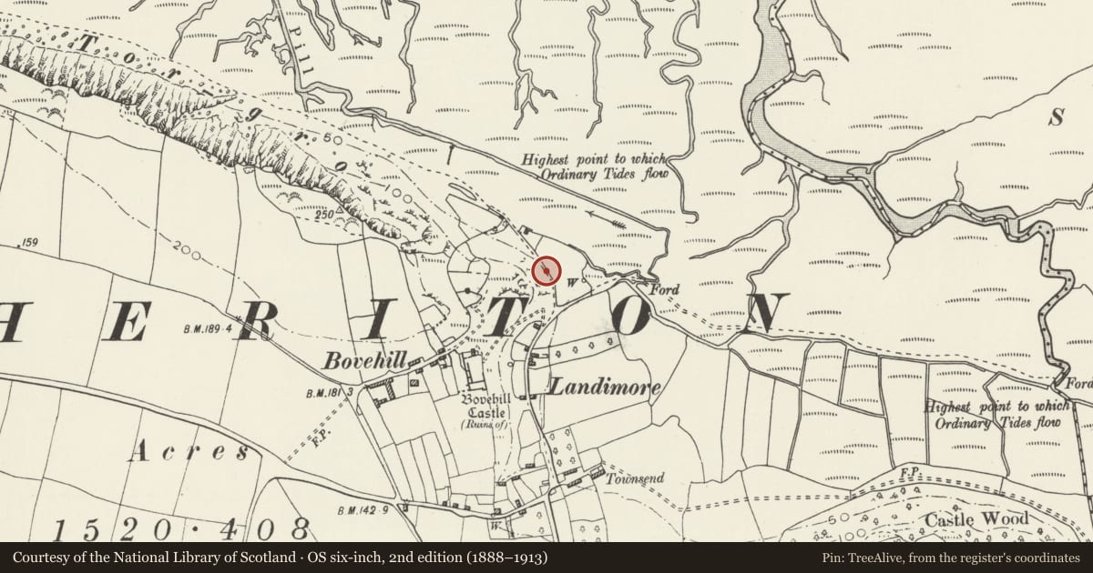
Slide toward Today to fade the historical sheet and see the modern map underneath.
David Rumsey Map Collection, Stanford LibrariesDavid Rumsey Map Collection, Stanford LibrariesDavid Rumsey Map Collection, Stanford LibrariesDavid Rumsey Map Collection, Stanford LibrariesDavid Rumsey Map Collection, Stanford Libraries
5 historical maps cover this location, the earliest the 1636 map "Cornubia : Devonia, Somersetus, Dorcestria, Wiltonia, Glocestria ..." (David Rumsey Map Collection, Stanford Libraries).
Historical maps covering this location
- 1636 · Cornubia : Devonia, Somersetus, Dorcestria, Wiltonia, Glocestria ... (David Rumsey Map Collection, Stanford Libraries)
- 1865 · England and Wales. England No. 6. (David Rumsey Map Collection, Stanford Libraries)
- 1891 · Sheet 10. Ordnance Survey of England and Wales. . (David Rumsey Map Collection, Stanford Libraries)
- 1907 · 246 Worms Head (Hills) (David Rumsey Map Collection, Stanford Libraries)
- 1920 · Sheet 100. Llanelly. (David Rumsey Map Collection, Stanford Libraries)
Cadw's description
Location
At roadside to north of hamlet of Landimore
History
A limekiln probably built after 1846 and in production by 1878; disused by 1913.
Exterior
A limekiln built in local rubble limestone, about 4 m high. There are two working recesses, each about two metres wide, with vertical sides but deeply corbelled over the working holes. An iron beam surves over the left working hole. At the right side of the right working recess is a hollow in the wall, perhaps a candle recess. The kiln stands against a bank with a short length of bank revetment to left and to right.
Reason for designation
Included for historic interest as a well preserved small C19 rural limekiln.
Nearby in the register
- Bovehill CastleManorunder 1 mi
- Telephone Call-box near Townsend (01792 390179)Communicationsunder 1 mi
- Packhorse Bridge over Burry PillTransportunder 1 mi
- North Hill Tor CampPromontory Fort- coastalunder 1 mi
Other entries of the same register within about three miles of this one, by straight line.